

Rain Ending; Snow Showers Wednesday
An all new edition of the ABC 33/40 Weather Xtreme video is available in the player on the right sidebar of the blog. You can subscribe to the Weather Xtreme video on iTunes by clicking here.
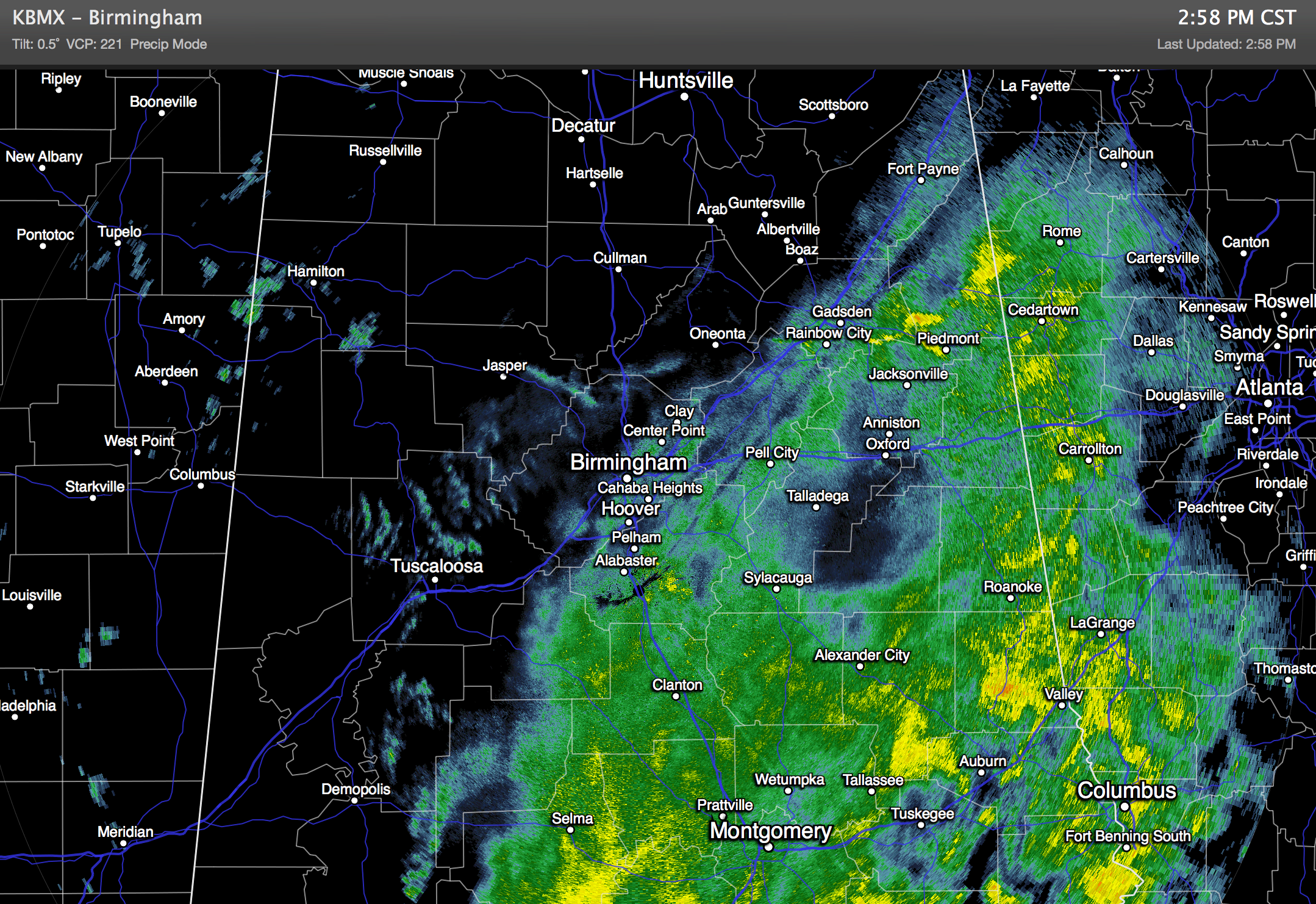
IMPROVING WEATHER: A radar check at mid-afternoon shows that the rain is generally over north of I-59, and the rest of the rain will exit the state this evening.
The sky will clear tonight, and tomorrow promises to be a beautiful day with a good supply of sunshine and a high between 57 and 60 degrees.
COLD AIR RETURNS WEDNESDAY; SOME SNOW? An Alberta Clipper type system will push much colder air down into Alabama on Wednesday, and the primary forecast challenge involves the chance of snow showers or flurries as the cold air rushes in.
The 12Z model set is clearly more aggressive with the clipper and potential for some snow. We have mentioned the chance of flurries all along, but we will have to consider the potential for heavier snow showers based on this new data.
We will probably see a little light rain initially late tomorrow night, but the precipitation will change to light snow Wednesday as thickness values plunge. Two favorable things going for snow showers…
*Very steep lapse rates due to very cold air aloft associated with the upper trough. This could create some convective snow showers; much like rain showers on a summer afternoon. They will be scattered, but some of them could bring a brief burst of heavier snow.
*The snow growth region, where temperatures are generally -10C to -20C in the atmosphere, feature lots of moisture.
BOTTOM LINE: We will mention a chance of light rain late tomorrow night, and then a chance of snow showers during the day Wednesday. Most places won’t see any significant accumulation, but where heavier snow showers form there could be a dusting. Best chance of accumulation will be across high terrain of Northeast Alabama, especially over 1,000 feet, where 1/2 to 1 inch is possible in a few spots.
Temperatures will be above freezing, mostly in the mid to upper 30s, when most of the snow showers fall, so travel issues for now are not expected. We will keep an eye on model trends.
Otherwise, Wednesday will be breezy and cold with a high only in the 38 to 42 degree range.
THURSDAY/FRIDAY: After a low in the low 20s early Thursday, we warm into the low 50s Thursday afternoon with a sunny sky. Then, another clipper brings more cold air Friday. We struggle to get out of the 30s Friday afternoon with a brisk northwest wind.
THE ALABAMA WEEKEND: Sunshine in full supply Saturday and Sunday. But, mornings will be cold. Lows early Saturday will range from 17 to 23 degrees, and the low early Sunday will be in the 20s. The high Saturday will be in the mid to upper 40s, followed by low 50s Sunday.
LONG RANGE: The weather looks very changeable over the latter half of January, with a number of quick hitting cold shots. See the Weather Xtreme video for the maps, graphics, and details.
WEATHER BRAINS: Don’t forget you can listen to our weekly 90 minute netcast anytime on the web, or on iTunes. This is the show all about weather featuring many familiar voices, including our meteorologists here at ABC 33/40. We will produce this week’s show at 8:30p tonight; you can watch it live on “James Spann 24/7”, our cable weather channel, or on the web here.
CONNECT: You can find me on all of the major social networks…
Facebook
Twitter
Google Plus
Instagram
I had a great time today visiting with the kids at Fruithurst Elementary School in Cleburne County; be looking for them on the Pepsi KIDCAM today at 5:00 on ABC 33/40 News! The next Weather Xtreme video will be posted here by 7:00 a.m. tomorrow….
Category: Alabama's Weather
About the Author (Author Profile)
James Spann is one of the most recognized and trusted television meteorologists in the industry. He holds the AMS CCM designation and television seals from the AMS and NWA. He is a past winner of the Broadcast Meteorologist of the Year from both professional organizations.Subscribe
If you enjoyed this article, subscribe to receive more just like it.


