

Slow Clearing, a Range in Temperatures
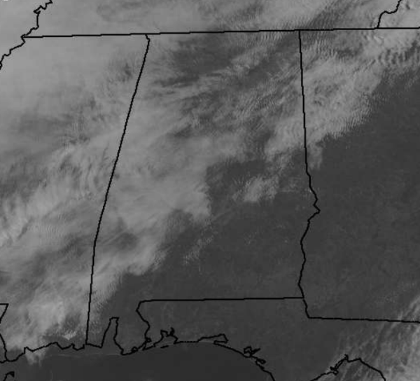
The clouds are slowly clearing out of the state. Our last look at a satellite image for today shows clear skies over southeastern Alabama. There is a mix of sun and clouds for the northern two-thirds of the state, and we are beginning to see more breaks in the clouds over the northern part of the state. It has been a slow go for the clearing, but we are seeing it continue this afternoon. We will see the clouds continue to thin out the rest of today and through the overnight as the shortwave responsible for the wintry precip and cloud cover pulls out of the area. By tomorrow, we should see mostly sunny conditions for Alabama.
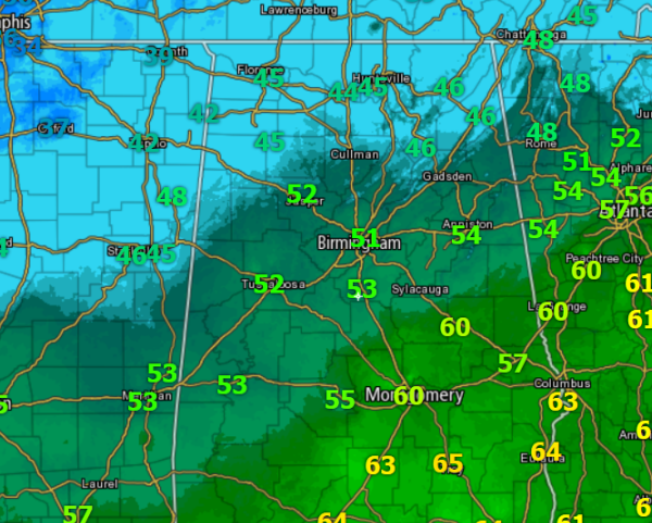
As we look at surface observations, we can tell where the clouds have moved out and where there are hanging on. A wide range in temperatures across the state with widespread 60s over our southeastern counties. Along the Interstate 20 corridor, we have made it into the 50s. To the north, where the clouds have been thicker today, we continue to see 40s. As more sun begins to shine down in these areas, there are still a couple hours of warming that will be possible. Those 40s could possibly be replaced by 50s the next few hours. After the weather overnight and this morning, it has turned into a fairly nice Saturday afternoon for much of Central Alabama.
Category: Alabama's Weather
About the Author (Author Profile)
Macon, Georgia Television Chief Meteorologist, Birmingham native, and long time Contributor on AlabamaWX. Stormchaser. I did not choose Weather, it chose Me. College Football Fanatic. @Ryan_StinnetSubscribe
If you enjoyed this article, subscribe to receive more just like it.


