Alabama 811 | Know What's Below.

Blog Archives

Rising Heat Levels; Strong Storms Sunday

Rising Heat Levels; Strong Storms Sunday

| July 10, 2020 @ 5:51 am

HOT, HUMID SUMMER WEATHER: Look for a high in the low 90s today, and mid 90s tomorrow as heat levels continue to rise across Alabama. The sky will be partly sunny both days, and while showers and thunderstorms are possible, they will be few and far between. Then, on Sunday, a surface boundary will slice into the hot, humid, unstable air, and will set the stage for strong, possibly severe thunderstorms.

Read More

Showers/Storms Becoming A Bit More Scattered Tomorrow/Friday

Showers/Storms Becoming A Bit More Scattered Tomorrow/Friday

| July 8, 2020 @ 3:16 pm

RADAR CHECK: In the tropical air over Alabama we have a number of showers and thunderstorms this afternoon, some producing heavy amounts of rain. Showers over the Tennessee Valley of North Alabama are moving very little, while the rain bands over the central counties are moving eastward. They will persist into the night.

Read More

Very Humid; Numerous Showers/Storms Today

Very Humid; Numerous Showers/Storms Today

| July 8, 2020 @ 5:39 am

AN OCEAN OF HUMIDITY: Very moist, tropical air will remain over the Deep South today, and we expect scattered to numerous showers and thunderstorms. In fact, showers have already formed early this morning across parts of North/Central Alabama. And, like recent days, the showers will be very efficient rain producers. We will have more clouds than sun, and the high today will be in the mid 80s for most communities. The average high for July 8 at Birmingham is 91.

Read More

Occasional Tropical Showers Through Tomorrow

Occasional Tropical Showers Through Tomorrow

| July 7, 2020 @ 3:14 pm

VERY HUMID DAY: A blanket of moist air continues to cover Alabama today, and we have a number of showers and thunderstorms on radar at mid-afternoon. Like yesterday, they are very effective rain producers thanks to the tropical airmass in place; motion today is to the south/southeast. Nothing severe, and not much lightning. The showers will persist well into the night as a broad upper trough remains over the region.

Read More

Moisture Laden, Tropical Air Continues Over Alabama

Moisture Laden, Tropical Air Continues Over Alabama

| July 7, 2020 @ 5:34 am

MORE SHOWERS LATER TODAY: The radar is quiet early this morning, but we expect scattered to numerous showers and thunderstorms to form across Alabama this afternoon and tonight in the tropical airmass that covers the state. Odds of any one spot getting wet this afternoon is around 70 percent, and the showers and storms will be very efficient rain producers due to the high precipitable water values. Look for more clouds than sun today with a high in the mid to upper 80s.

Read More

Showers/Storms Becoming More Numerous Through Mid-Week

Showers/Storms Becoming More Numerous Through Mid-Week

| July 6, 2020 @ 5:49 am

UNSETTLED WEATHER THROUGH WEDNESDAY: Moisture levels will rise across Alabama today, and with a weak upper low moving into the state, we expect scattered to numerous showers and thunderstorms by afternoon. It still won’t rain everywhere, but most communities should see a decent shower by the evening hours. Otherwise, the day will be warm and humid with a mix of sun and clouds along with a high in the mid 80s. The average high today at Birmingham is 91.

Read More

Hot, Humid Weekend With Scattered Storms

Hot, Humid Weekend With Scattered Storms

| July 3, 2020 @ 3:11 pm

**No Weather Xtreme video this afternoon; we are on a holiday schedule** RADAR CHECK: We have your classic case of random, scattered showers and thunderstorms across Alabama on this early July afternoon. Storm are moving slowly to the southwest, and some are producing very heavy rain, gusty winds, and lots of lightning. Away from the […]

Read More

Hot, Humid Weekend Ahead With A Few Scattered Storms

Hot, Humid Weekend Ahead With A Few Scattered Storms

| July 3, 2020 @ 5:33 am

HOT, HUIMD SUMMER WEATHER: The weather looks pretty routine for the holiday weekend across Alabama with hot, humid days, a partly sunny sky, and the risk of a “pop up” type thunderstorm during the afternoon and evening hours, generally between 1:00 and 9:00 p.m. Odds of any one spot getting wet today are only 10-20 percent, around 30 percent tomorrow, and 40 percent Sunday. The afternoon storms will be random and scattered, no way of knowing in advance exactly when and where they pop up.

Read More

Hot, Humid Days With A Few Storms

Hot, Humid Days With A Few Storms

| July 2, 2020 @ 3:12 pm

RADAR CHECK: As expected, showers and storms are fewer in number across Alabama this afternoon. In fact, much of the state is enjoying a mostly sunny sky with temperatures generally between 86 and 89 degrees at mid-afternoon. There are a few isolated showers over the eastern half of the state… those will end once the sun goes down.

Read More

Storms Around Later Today, But Fewer In Number

Storms Around Later Today, But Fewer In Number

| July 2, 2020 @ 5:38 am

TYPICAL JULY WEATHER: Overall atmospheric moisture levels have decreased a tad across Alabama today, so when scattered showers and storms begin to form this afternoon they should be fewer in number. Heavier thunderstorms are expected to be over the far southwest part of the state, where SPC maintains a “marginal risk” (level 1/5) of severe thunderstorms for this afternoon and early tonight.

Read More

Humid Air Persists; Scattered Showers/Storms Remain In The Forecast

Humid Air Persists; Scattered Showers/Storms Remain In The Forecast

| July 1, 2020 @ 3:26 pm

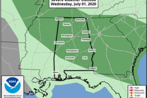
MUGGY AFTERNOON: An MCS (Mesoscale Convective System) rolled through Alabama this morning in a northwest flow aloft producing heavy rain and gusty winds. Radar suggests parts of Northwest Alabama received over 5 inches of rain earlier today, and a few flash flood warnings were required. The radar is fairly quiet over North/Central Alabama at mid-afternoon with heavier storms over the southern third of the state. SPC has removed the severe weather threat for most of the state thanks to the stabilization process after the morning rain.

Read More

A Couple Of Rounds Of Storms Likely Today

A Couple Of Rounds Of Storms Likely Today

| July 1, 2020 @ 5:44 am

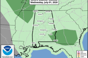
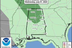
RADAR CHECK: A batch of rain and thunderstorms is moving through Northwest Alabama early this morning; the storms are not severe, but are noisy with lots of lightning and heavy rain. This activity will diminish later, but more storms will likely develop by mid to late afternoon, and those could pack a punch. SPC has roughly the northern half of the state in a “marginal risk” (level 1/5) of severe thunderstorms today.

Read More

Sun, Heat, Storms Through The Weekend

Sun, Heat, Storms Through The Weekend

| June 30, 2020 @ 3:18 pm

RADAR CHECK: Most of the thunderstorms over Alabama at mid-afternoon are over the eastern half of the state, and some of those are very strong with gusty winds and small hail. They are moving along at a pretty good clip, so no flooding issues have been reported so far. Away from those storms, the sky is partly sunny with temperatures in the 87-90 degree range.

Read More

Humid Summer Days; Scattered Showers And Storms Again Today

Humid Summer Days; Scattered Showers And Storms Again Today

| June 30, 2020 @ 5:45 am

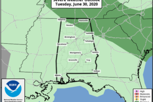
HUMID MORNING: it is a muggy late June morning across Alabama with dew points in the 70s for most communities. We note a few sprinkles over West Alabama, but the better chance of showers and thunderstorms will come later today as the air heats up and becomes unstable. SPC has a “marginal risk” (level 1/5) of severe thunderstorms defined for the northeast counties of the state this afternoon; heavier storms will be capable of strong straight line winds and some hail.

Read More