Alabama 811 | Know What's Below.

Blog Archives

Strong Storms Possible Late This Afternoon And Tonight

Strong Storms Possible Late This Afternoon And Tonight

| September 6, 2023 @ 5:41 am

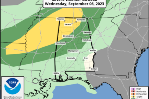
ACTIVE STORMS LATER TODAY: We have a few showers over Northeast Alabama early this morning, but the weather is dry elsewhere with temperatures in the 68-73 degree range at daybreak. A disturbance will bring potential for active thunderstorms in here later today; SPC has defined a “slight risk” (level 2/5) of severe thunderstorms for areas north of a line from Reform to Hanceville to Scottsboro.

Read More

Idalia Makes Landfall Tomorrow Morning; Drier Air For Alabama Thursday/Friday

Idalia Makes Landfall Tomorrow Morning; Drier Air For Alabama Thursday/Friday

| August 29, 2023 @ 3:01 pm

RADAR CHECK: Scattered showers and storms continue to develop across Alabama this afternoon; they are most numerous over the southeast counties of the state. Storms are producing heavy rain and lots of lightning as they move slowly northward. We will maintain the chance of a few showers and storms tonight in the very humid air across Alabama.

Read More

Showers/Storms Possible Across Alabama Again Today; Eyes On Idalia

Showers/Storms Possible Across Alabama Again Today; Eyes On Idalia

| August 29, 2023 @ 5:54 am

OCEAN OF HUMIDITY: Most of Alabama is dry early this morning, but we expect showers and storms to form again later today in the very humid air over Alabama. The chance of any one spot getting wet today is 40/50 percent, and like yesterday the storms will be very efficient rain producers. The sky will be occasionally cloudy, and the high will be in the mid to upper 80s over the northern counties, with low 90s to the south.

Read More

A Few Strong Storms Around Through Tomorrow; Eyes On Idalia

A Few Strong Storms Around Through Tomorrow; Eyes On Idalia

| August 28, 2023 @ 3:00 pm

RADAR CHECK: The more numerous showers and thunderstorms across Alabama are over the eastern half of the state this afternoon; stronger storms are capable of producing strong straight line winds (microbursts) as they move slowly to the east/northeast. As expected, temperatures are down today with most places in the 80s… the exception is Mobile and the southwest corner of the state where they are near 100 degrees again this afternoon.

Read More

Heat Levels Down; Rain Chances Up

Heat Levels Down; Rain Chances Up

| August 28, 2023 @ 5:51 am

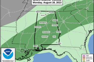
RADAR CHECK: A number of showers and storms are in progress across Alabama early this morning.. .a sign the upper ridge continues weaken over the region. This will lead to lower heat levels today along with higher rain chances. We note SPC has much of Alabama in a “marginal risk” (level 1/5) of severe thunderstorms today.

Read More

Hot, Humid Weekend Ahead; A Few Storms

Hot, Humid Weekend Ahead; A Few Storms

| August 11, 2023 @ 3:03 pm

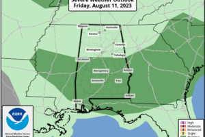
RADAR CHECK: Showers and strong storms are in progress over parts of East and South Alabama this afternoon where a severe thunderstorm watch is in effect until 7 CT. Heavier storms will produce strong winds and some hail over the next few hours. Showers are more isolated over the western half of Alabama, and the southwest counties are dry and very hot with temperatures in the mid to upper 90s.

Read More

A Few More Scattered Storms Later Today

A Few More Scattered Storms Later Today

| August 11, 2023 @ 5:32 am

RADAR CHECK: Noisy thunderstorms continue over parts of East and Central Alabama this morning around sunrise with heavy rain and gusty winds… some small hail is possible as well. Otherwise, it is a very muggy morning with temperatures in the 75-83 degree range.

Read More

A Few Storms Possible Tonight/Tomorrow

A Few Storms Possible Tonight/Tomorrow

| August 10, 2023 @ 3:03 pm

CALM AFTERNOON: All of Alabama is rain-free this afternoon with temperatures ranging from the low 80s over the northern counties to the low 90s near the Gulf Coast. The air was totally worked over by storms last night and early this morning, when some spots received 1-2 inches of rain.

Read More

Summer Storms Rumbling Over North Alabama This Morning

Summer Storms Rumbling Over North Alabama This Morning

| August 10, 2023 @ 5:41 am

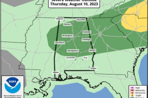
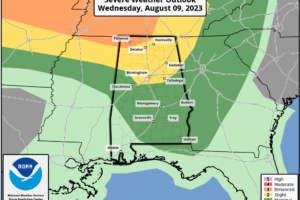
RADAR CHECK: At sunrise showers and thunderstorms are active over the northern half of the state. All are under severe limits, but they are producing heavy rain, gusty winds, and lots of lightning. SPC has defined a “marginal risk” (level 1/5) of severe thunderstorms for roughly the northern 2/3 of Alabama today.

Read More

Strong Storms Moving Through NW Alabama

Strong Storms Moving Through NW Alabama

| August 9, 2023 @ 2:55 pm

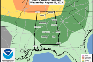
ACTIVE NIGHT FOR NORTH ALABAMA: A severe thunderstorm watch is in effect for roughly the northern quarter of Alabama through 8:00 p.m. A line of severe storms is moving through the Shoals as I write this around 2:45p CT, and as the storms continue moving through the Tennessee Valley they will be capable of producing strong/damaging winds.

Read More

More Strong Summer Storms Later Today/Tonight

More Strong Summer Storms Later Today/Tonight

| August 9, 2023 @ 5:50 am

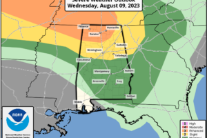
MORE STORMS POSSIBLE: Alabama’s weather is rain-free at sunrise, but showers and storms will likely form later this afternoon and tonight. It won’t rain everywhere, but where storms form they will be potentially strong to severe. SPC has defined an “enhanced risk” (level 3/5) of severe thunderstorms for the northwest corner of the state, including Florence and the Shoals.

Read More

Active Summer Thunderstorm Pattern Continues

Active Summer Thunderstorm Pattern Continues

| August 8, 2023 @ 3:09 pm

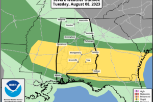
THIS AFTERNOON: While North Alabama is enjoying rain cooler air with temperatures in the 70s, severe thunderstorms are moving through the southeast corner of the state with strong winds. Multiple counties there are under severe thunderstorm warnings… all of the storms should be in Georgia by 4p CT. Most of the state will be dry tonight with lows in the 60s and 70s.

Read More

More Strong Storms Fire Up Later Today

More Strong Storms Fire Up Later Today

| August 8, 2023 @ 5:39 am

MORE SUMMER STORMS: On the maps this morning we have a surface boundary (we don’t call them “cold fronts” this time of the year) lined up near I-20. North of the front, temperatures are in the 60s… but to the south it is very humid with 70s and low 80s just before daybreak. No rain on radar across Alabama, but we note strong storms over Arkansas, and those will ride along the boundary and move in here later this morning.

Read More

More Strong/Severe Storms Likely Later Today

More Strong/Severe Storms Likely Later Today

| August 7, 2023 @ 5:37 am

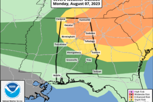
ANOTHER ACTIVE DAY AHEAD: Alabama is rain-free at sunrise, but another round of strong to severe thunderstorms is likely later today and tonight. SPC has defined an “enhanced risk” (level 3/5) of severe thunderstorms for much of Northeast Alabama, for Birmingham and points north and east. A “slight risk” (level 2/5) extends down to Tuscaloosa, Montgomery, and Eufaula, and a “marginal risk” (level 1/5) covers much of the rest of South Alabama.

Read More