Alabama 811 | Know What's Below.

Archive for July 18th, 2015

Big Storms in Birmingham Metro

Big Storms in Birmingham Metro

| July 18, 2015 @ 4:13 pm

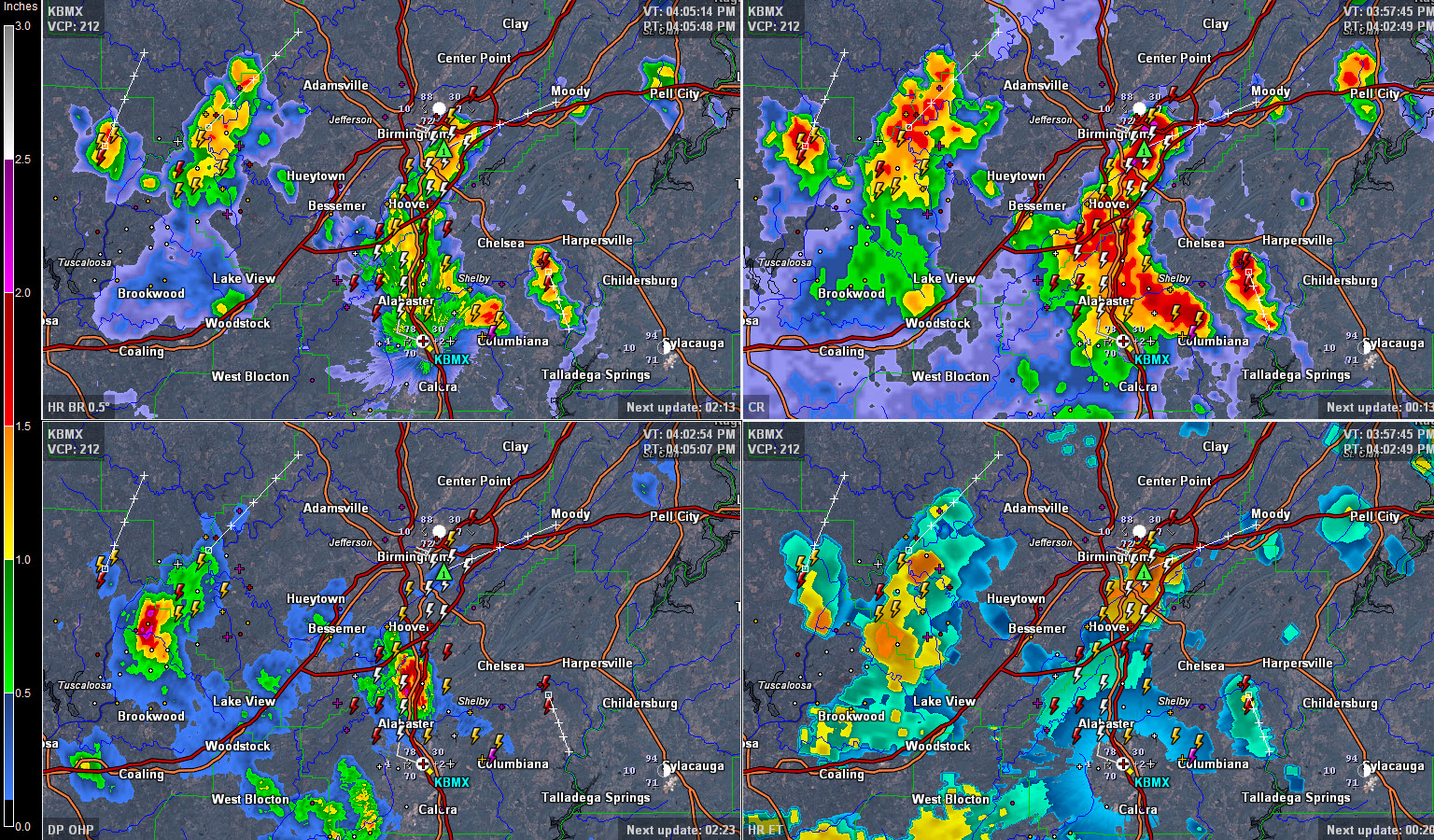
Storms have blown up in the past few minutes over southern Birmingham from Homewood to Mountain Brook. This image show base reflectivity (precip near the ground) in top left, composite reflectivity (good indicator of where is is about to storm heavily) in the top right, cloud heights in bottomr right and one hour rainfall amounts […]

Read More

Hot Saturday Afternoon

Hot Saturday Afternoon

| July 18, 2015 @ 2:55 pm

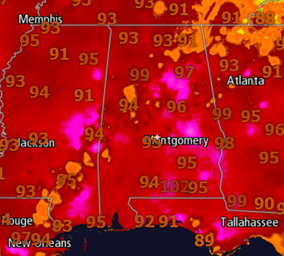
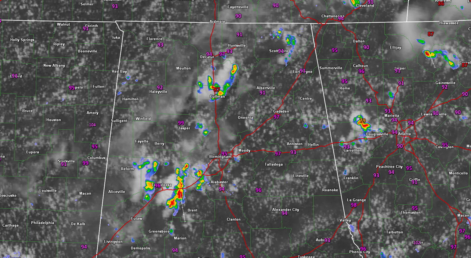
The hottest weekend so far this year is underway across the state of Alabama. Looking at the maps this afternoon, we are seeing temperatures well into the 90s across the state. We do note a few of cooler spots in orange as there are a few storms ongoing this afternoon. A look at the satellite […]

Read More

Strong Storms Between Tuscaloosa/Birmingham

Strong Storms Between Tuscaloosa/Birmingham

| July 18, 2015 @ 2:22 pm

Ryan is working on the afternoon forecast discussion and should be along with a post soon, but I thought I would provide a radar check here at 2:30. Showers and storms have continued to grow between Tuscaloosa and Birmingham and are pretty heavy now between Brookwood, Coaling and Duncanville. Others extend up to near Tannehill […]

Read More

Hot, Hot, Hot

Hot, Hot, Hot

| July 18, 2015 @ 7:46 am

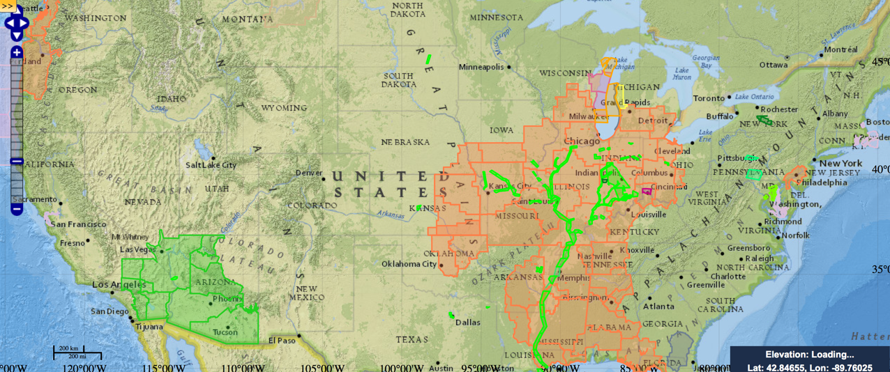
Brian Peters is out this weekend, so I will be sitting in with my first attempt ever at a Weather Xtreme video. Please be kind, it’s harder than James and Brian make it look! The National Weather Service Hazard Advisory Map looks like someone spilled orange paint on it this morning, with Heat Advisories stretching […]

Read More