Rain & Some Thunder Today; Drying Out Tomorrow for a Couple of Days
Rain moves in later today with some thunder possible. We’ll dry out by Sunday afternoon and stay dry until late on Tuesday, before we could see a risk of strong storms.
We’ll stay cool and dry through the weekend and for the start of the holiday week. For now, the daylight hours on Thanksgiving Day looks to be dry, but “Black Friday” shopping will require an umbrella.
The good news is that skies are continuing to clear across the area from northwest to southeast as we have reached the afternoon hours, but much of the area south of the I-59 corridor remains mostly cloudy. North of that, skies are mostly sunny.
It continues to be cold and mostly cloudy across Central Alabama at this mid-afternoon update. For now, radar looks to be clear of any showers, but a sprinkle or two may be occurring somewhere north of I-20 and east of I-65.
Enjoy the sunshine on Sunday, because it will be the last time we’ll get to see a good amount of it through the forecast period. Get ready for the big cool down everyone has been talking about.
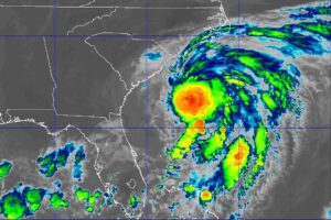
As of 12:30 pm, the main bulk of rain associated with Tropical Storm Nicole continues to stay off to our east and southeast, but I wouldn’t be surprised if a few light raindrops or drizzle is falling south of I-20 and east of I-65.
Tropical storm conditions will continue along the east coast of Florida, Georgia, and South Carolina within the warning areas today.
Maximum sustained winds are near 75 mph (120 km/h) with higher gusts. Little change in strength is expected until Nicole makes landfall along the Florida east coast.
5 pm CST observations from a NOAA Hurricane Hunter aircraft indicate that Nicole has strengthened in to a hurricane. The maximum winds are estimated to be 75 mph (120 km/h) with higher gusts.
On the forecast track, the center of Nicole will move near or over the Abacos and Grand Bahama in the northwestern Bahamas today and move onshore the east coast of Florida within the hurricane warning area tonight.
Nicole is likely to become a hurricane soon but, given the marginal dynamic and thermodynamic environment, significant strengthening seems unlikely.
Nicole is moving toward the west near 10 mph (17 km/h). A west-southwest motion is expected through early Wednesday. A westward to west-northwest motion is forecast to begin later on Wednesday, followed by a turn toward the northwest and north-northwest on Thursday and Thursday night.
Maximum sustained winds are near 50 mph with higher gusts. Strengthening is expected during the next 36 to 48 hours, and Nicole is forecast to be near or at hurricane strength by Wednesday and Wednesday night while it is moving near the northwestern Bahamas and approaching the east coast of Florida.
Nicole forecast to strengthen Tuesday night and Wednesday. Hurricane warning issued for portions of the northwestern Bahamas.