

Enhanced Risk Now Includes Birmingham and Much of North AL
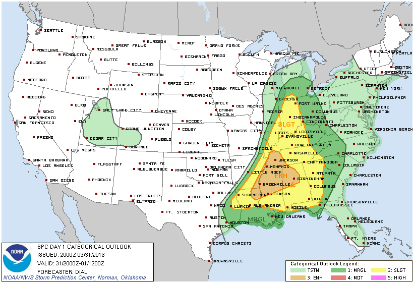
The Storm Prediction Center out of Norman, Oklahoma, has updated the severe risks for the remainder of the day. The ENHANCED RISK for severe weather now encompases much of north-central Alabama, northern Mississippi, and western Tennessee.
Severe thunderstorms with the greatest threat for tornadoes and large hail will be centered over northern Mississippi and Alabama this afternoon and evening. Major cities affected in in this new outlook include Birmingham, Hoover, Tuscaloosa, Jackson MS, and Memphis TN.
The slight risk now expands from the Gulf Coast of Alabama and the panhandle of Florida, up north through Indiana and the extreme southern part of Michigan.
Category: Alabama's Weather, Severe Weather
About the Author (Author Profile)
Bill Murray is the President of The Weather Factory. He is the site's official weather historian and a weekend forecaster. He also anchors the site's severe weather coverage. Bill Murray is the proud holder of National Weather Association Digital Seal #0001 @wxhistorianSubscribe
If you enjoyed this article, subscribe to receive more just like it.


