

Severe Thunderstorm Warning for Pickens and Lamar
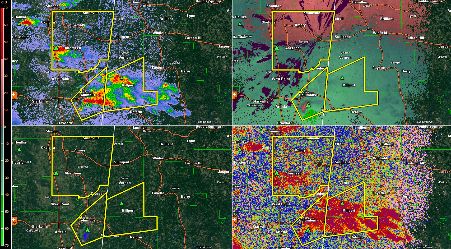
That is a dangerous storm south of Columbus MS.
It has large hail (2” possible) and decent rotation.
It will be moving gradually into an area of enhanced low level helicity.
A tornado could form at any time.
This storm will move across US-82 northwest of Macedonia and cross into southern Lamar County. It will threaten Millport and Vernon.
The storm southwest of Aberdeen will impact Marion County before 7 p.m. as well.
THE NATIONAL WEATHER SERVICE IN BIRMINGHAM HAS ISSUED A
* SEVERE THUNDERSTORM WARNING FOR…
NORTHERN PICKENS COUNTY IN WEST CENTRAL ALABAMA…
SOUTHERN LAMAR COUNTY IN WEST CENTRAL ALABAMA…
* UNTIL 715 PM CDT
* AT 612 PM CDT…A SEVERE THUNDERSTORM WAS LOCATED OVER COLUMBUS…
MOVING EAST AT 25 MPH.
HAZARD…GOLF BALL SIZE HAIL AND 60 MPH WIND GUSTS.
SOURCE…RADAR INDICATED.
IMPACT…PEOPLE AND ANIMALS OUTDOORS WILL BE INJURED. EXPECT HAIL
DAMAGE TO ROOFS…SIDING…WINDOWS…AND VEHICLES. EXPECT
WIND DAMAGE TO ROOFS…SIDING…AND TREES.
* LOCATIONS IMPACTED INCLUDE…
MILLPORT…KENNEDY…ETHELSVILLE…ASHCRAFT CORNER…FOREST…MELBORNE…
SHAW…CODY…STAR AND HIGHTOGY.
Category: Alabama's Weather, Severe Weather
About the Author (Author Profile)
Subscribe
If you enjoyed this article, subscribe to receive more just like it.


