

Thursday Midday Nowcast For Alabama
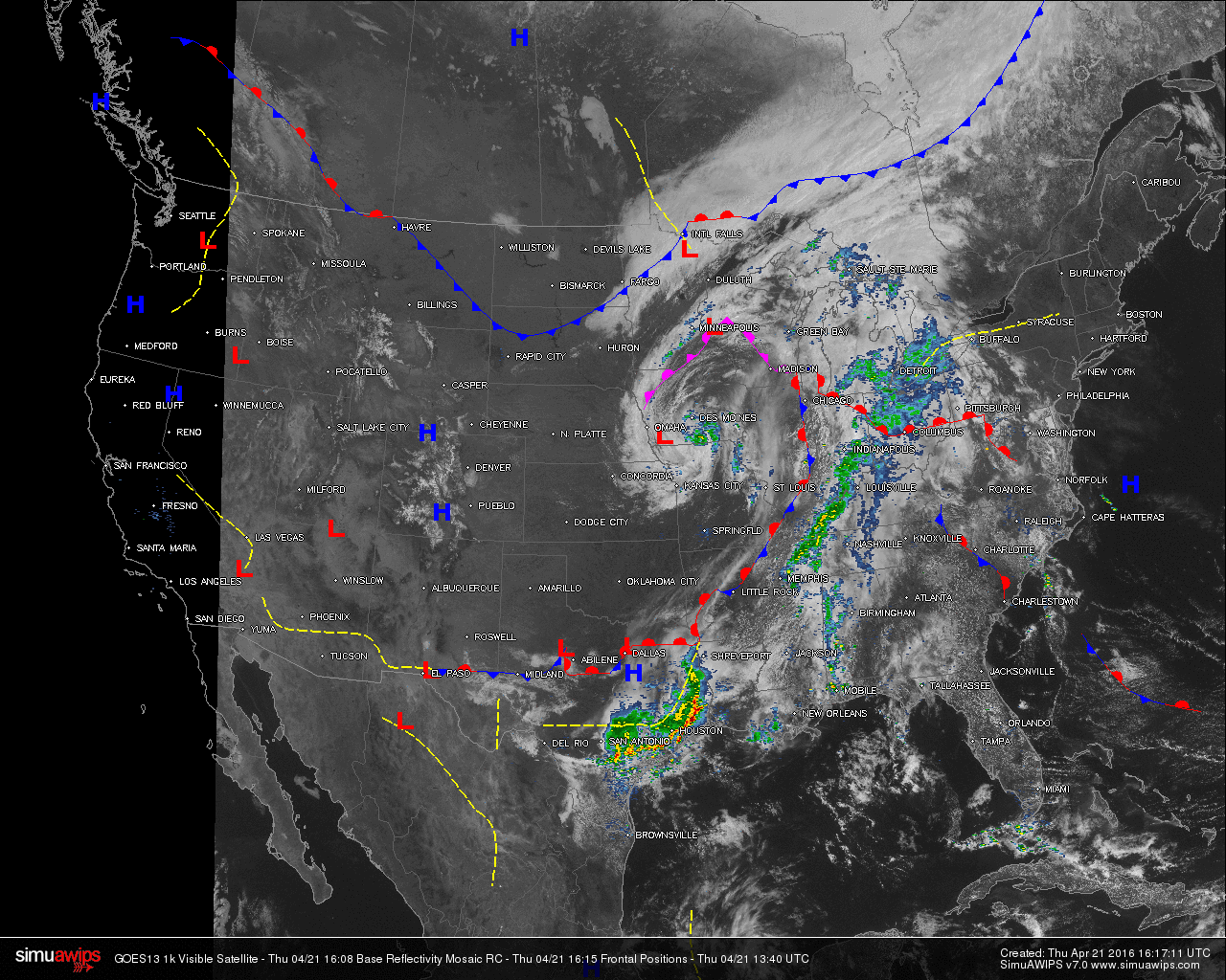
Mostly cloudy skies across much of the state, with rain falling at and just east of the Mississippi-Alabama State line. Most of the heavier storms are still located in eastern Texas, and just ahead of a stationary front lined up from western Tennessee and Kentucky, up through southeastern Indiana, much of Ohio, and up into southern Michigan. At the time of this post, there were no active severe weather warnings.
AT 11:00 AM: Much of north and west Alabama are under mostly cloudy to cloudy skies. Much of southeast Alabama have partly cloudy to mostly clear skies, and that is allowing those communities to warm quicker. Rain is currently falling over much of the extreme western counties of the state. Much of that is light rain, but a few heavier showers are falling in Hale, Marengo, and Dallas counties. Temperatures at 11:00 AM for a few select cities across the state:
Birmingham: Cloudy 71
Tuscaloosa: Light Rain 69
Gadsden: Partly Sunny 73
Anniston: Mostly Sunny 76
Huntsville: Cloudy 70
Montgomery: Sunny 77
Auburn: Mostly Sunny 75
Mobile: Heavy Rain 71
TODAY & TONIGHT: With the trough, associated with an upper level low, that was part of the “omega block” pattern beginning to lift to the northeast, showers will return to the state. The rainfall will not be too widespread or heavy, but a few thunderstorms could form. No severe weather is expected, and rainfall amounts should be less than 1/2 inch. Afternoon highs should reach the upper 70s to right above 80, with generally cloudy skies (the sun could peek through at times).
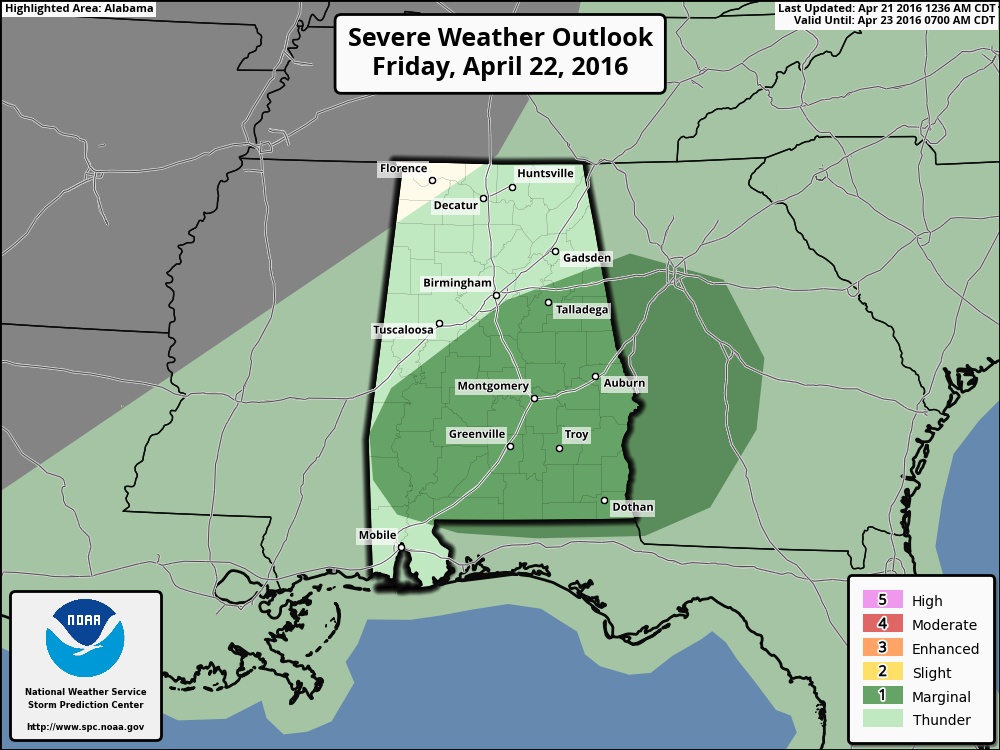
TOMORROW: Skies will remain mostly cloudy throughout the day with showers and thunderstorms possible. Storms should be pretty scattered, and a good part of the day will be dry. Where storms do form, they could be strong, with small hail and gusty winds as the main threat. The SPC has areas of the state south of a line from Demopolis to Hoover to Anniston under a “marginal risk” for severe weather. Afternoon highs should reach the upper 70s to right above 80. Good news is that drier air will start to move in and showers will end from the northwest to the southeast during the afternoon.
THE WEEKEND: Almost could say perfect weather for the weekend, as sunny skies and warm temperatures will be the main story. Highs on Saturday will be near 80, with lower 80s expected for Sunday.
HONDA INDY GRAND PRIX OF ALABAMA: A few widely scattered showers or storms are possible at the Barber Motorsports Park tomorrow, but a decent part of the day will be dry and I think they get some racing in. Then, perfect weather Saturday and Sunday with sunny warm days. Highs for the weekend will be at or just over 80 degrees. Get ticket information here.
Category: Alabama's Weather
About the Author (Author Profile)
Scott Martin is an operational meteorologist, professional graphic artist, musician, husband, and father. Not only is Scott a member of the National Weather Association, but he is also the Central Alabama Chapter of the NWA president. Scott is also the co-founder of Racecast Weather, which provides forecasts for many racing series across the USA. He also supplies forecasts for the BassMaster Elite Series events including the BassMaster Classic.Subscribe
If you enjoyed this article, subscribe to receive more just like it.


