

Wednesday Midday Nowcast For North/Central Alabama
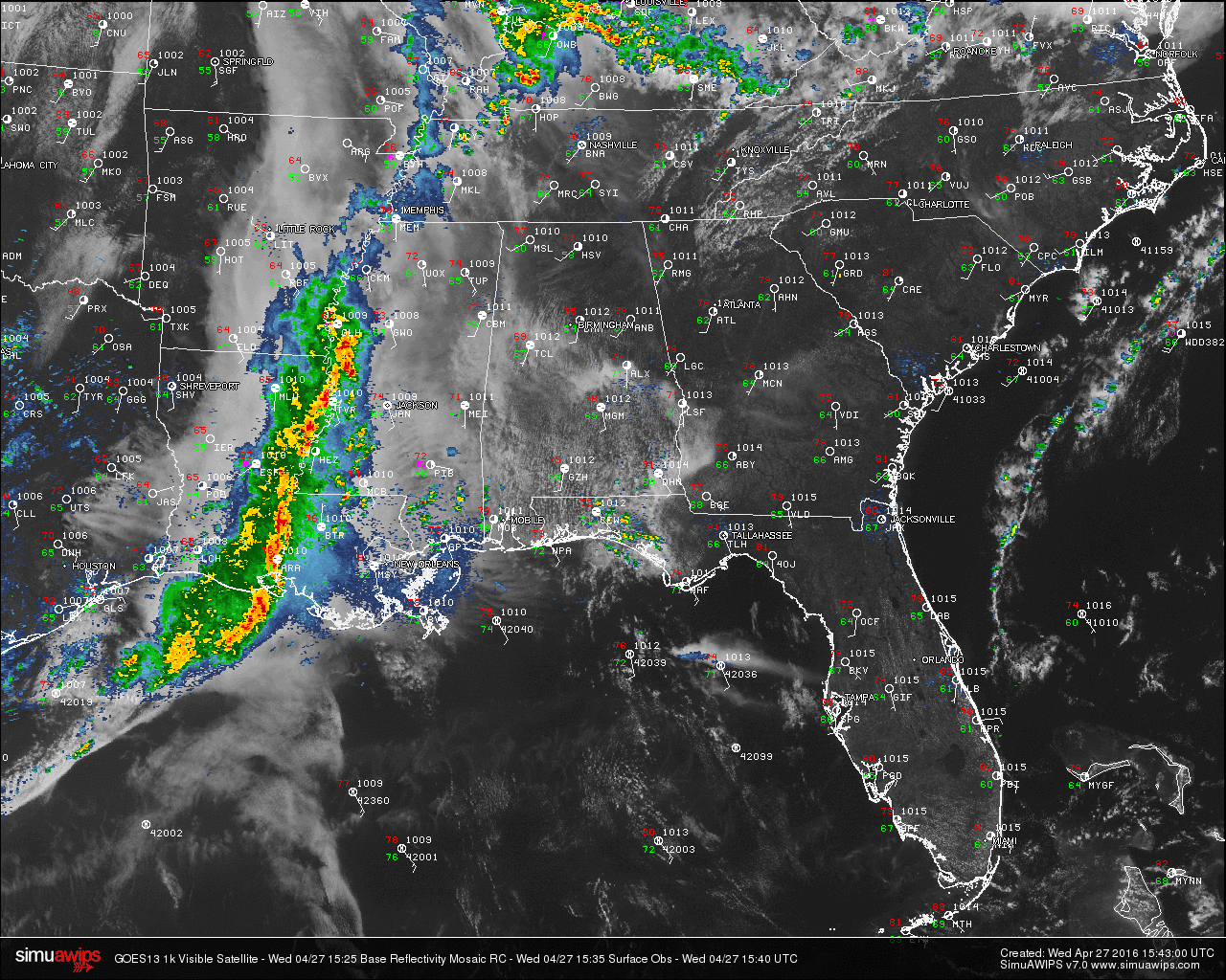
At this hour, radar is quiet and temperatures are in the 70s across North/Central Alabama. Most of the action across the country is located back to the southwest in southeastern Arkansas, central Louisiana, and along the Mississippi River on the Mississippi state line. A Severe Thunderstorm Watch is in effect until 3 PM CDT for much of southwest Mississippi and eastern Louisiana.
ACROSS THE STATE: Skies are mostly clear across much of north Alabama, with more clouds across the central and southern parts of the state. Here is a list of temperature readings from across the state at this time:
Birmingham 75
Tuscaloosa 69
Muscle Shoals 77
Huntsville 77
Anniston 78
Alexander City 73
Montgomery 78
Dothan 71
Mobile 79
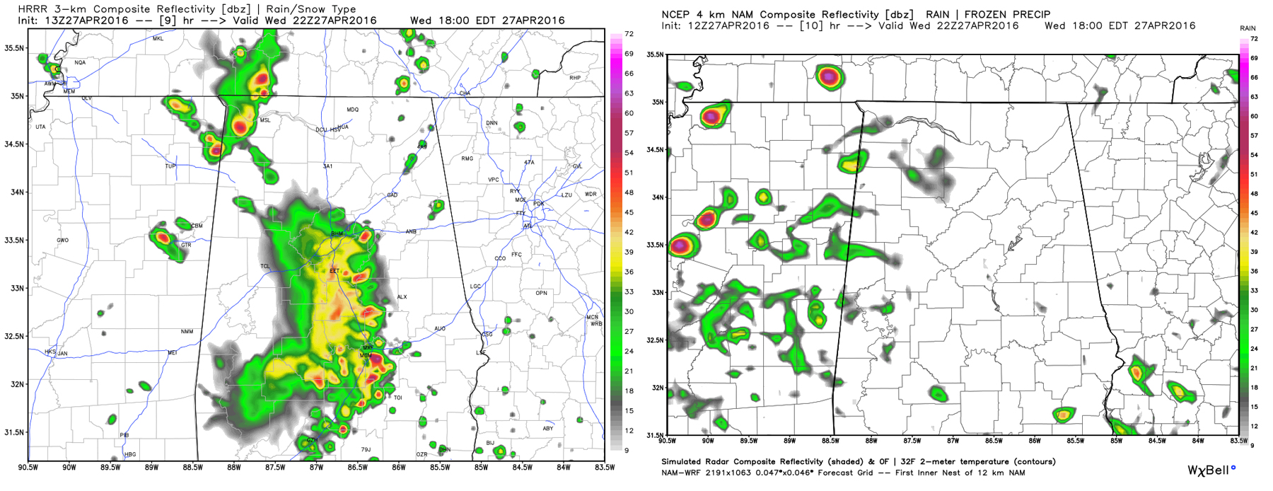
HRRR (left) & NAM4k (right) valid at 5PM CDT.
TODAY & TONIGHT: The latest HRRR model run has organized showers and thunderstorms moving into western Alabama during the early afternoon hours, while the Hi-Res NAM is still showing mostly dry conditions until later tonight. I believe most of the day will be dry, but a chance of showers and thunderstorm are possible this afternoon and tonight.
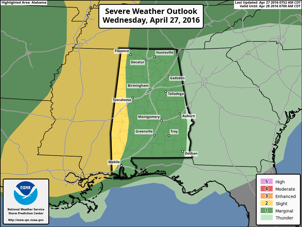
The SPC has the extreme western counties of Alabama under a “Slight Risk” for severe storms, with a “Marginal Risk” for the rest of the state. Stronger storms could produce small hail and gusty winds, but the overall severe threat is low.
TOMORROW: We’ll need to maintain some risk of showers/storms through tomorrow, but drier air begins to flow into North Alabama during the morning, and by afternoon the best coverage of rain will shift down into the southern half of the state. The SPC has a “marginal risk” of severe storms defined for most of Central and South Alabama; again small hail and gusty winds are the main issues. Instability values rise to very high levels tomorrow afternoon ahead of the surface front (CAPE values to 4,000 j/kg), but dynamic support will weaken during the day.
TALADEGA SUPERSPEEDWAY: Friday will be a warm and beautiful day, with sunny skies and afternoon temperatures well up into the 80s. Another warm day is in store for Saturday, but a passing shower or thunderstorm is possible. It won’t rain all day and the Sparks Energy 300 should be completed. Highs on Saturday will be in the mid 80s. Showers and thunderstorms become more widespread on Sunday. It shouldn’t rain all day long and there is a chance that the GEICO 500 will run, just be ready for delays. Highs on Sunday will be close to 80.
APRIL 27 2011 SPECIAL: You can watch our one hour special here. It was on this date five years ago that 62 tornadoes killed 252 people in our state during a generational tornado outbreak.
WEATHERBRAINS: Don’t forget you can listen to our weekly 90 minute netcast anytime on the web, or on iTunes. This is the show all about weather featuring many familiar voices, including our meteorologists here at ABC 33/40. You can find it here.
Category: Alabama's Weather
About the Author (Author Profile)
Scott Martin is an operational meteorologist, professional graphic artist, musician, husband, and father. Not only is Scott a member of the National Weather Association, but he is also the Central Alabama Chapter of the NWA president. Scott is also the co-founder of Racecast Weather, which provides forecasts for many racing series across the USA. He also supplies forecasts for the BassMaster Elite Series events including the BassMaster Classic.Subscribe
If you enjoyed this article, subscribe to receive more just like it.


