

Radar Check at 6:00 PM for North/Central Alabama
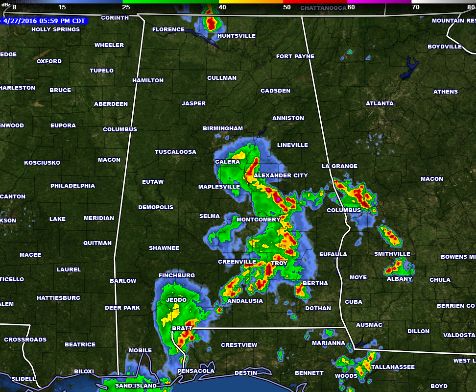
Currently a line of storms are currently located along the I-65 corridor from southern Shelby county down through Baldwin County and out into the gulf, with an arm stretching to the east along the I-85 corridor from Montgomery county all the way into western Georgia. The line is moving to the northeast. Plenty of lightning with these storms, so if you’re in the path it would be advisable that you stay inside until these storms pass.
There is a strong thunderstorm up in Limestone county in northern Alabama. There is plenty of lightning associated with this cell as well. It is moving to the northeast and will move into Tennessee within an hour.
No watches or warnings are currently in effect in Alabama at the moment.
As of now, Instability numbers are still higher in the southern part of the state, with CAPE values in the 2,000-3,500 J/kg range. Shear numbers are starting to rise, especially over southwestern Alabama, but these are increasing well behind the storms.
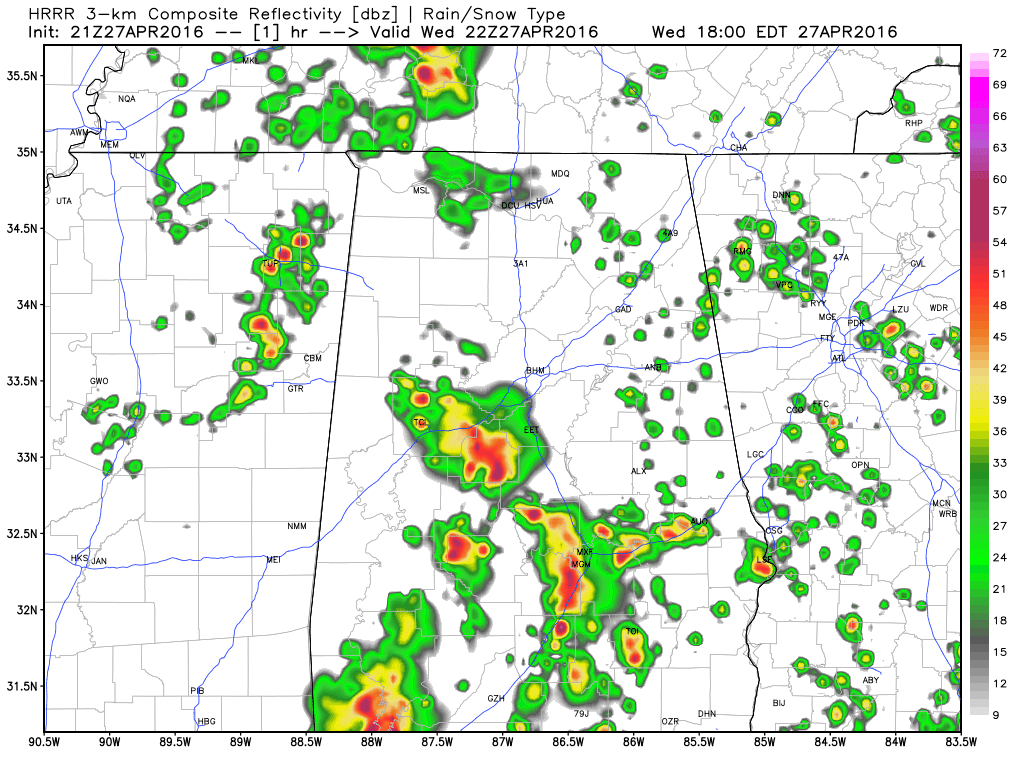
The latest run of the HRRR model shows some storms redeveloping over the northwestern parts of the state around the 7:00 PM time frame, and moving northeast through the counties along and north of the I-20 and I-59 corridors. With that said, we’ll keep a risk for showers and thunderstorms in the forecast for the rest of tonight and into early tomorrow morning. Some storms could be strong, but severe weather risk is minimal.
Category: Alabama's Weather, Severe Weather
About the Author (Author Profile)
Scott Martin is an operational meteorologist, professional graphic artist, musician, husband, and father. Not only is Scott a member of the National Weather Association, but he is also the Central Alabama Chapter of the NWA president. Scott is also the co-founder of Racecast Weather, which provides forecasts for many racing series across the USA. He also supplies forecasts for the BassMaster Elite Series events including the BassMaster Classic.Subscribe
If you enjoyed this article, subscribe to receive more just like it.


