

Friday Midday Nowcast For North/Central Alabama
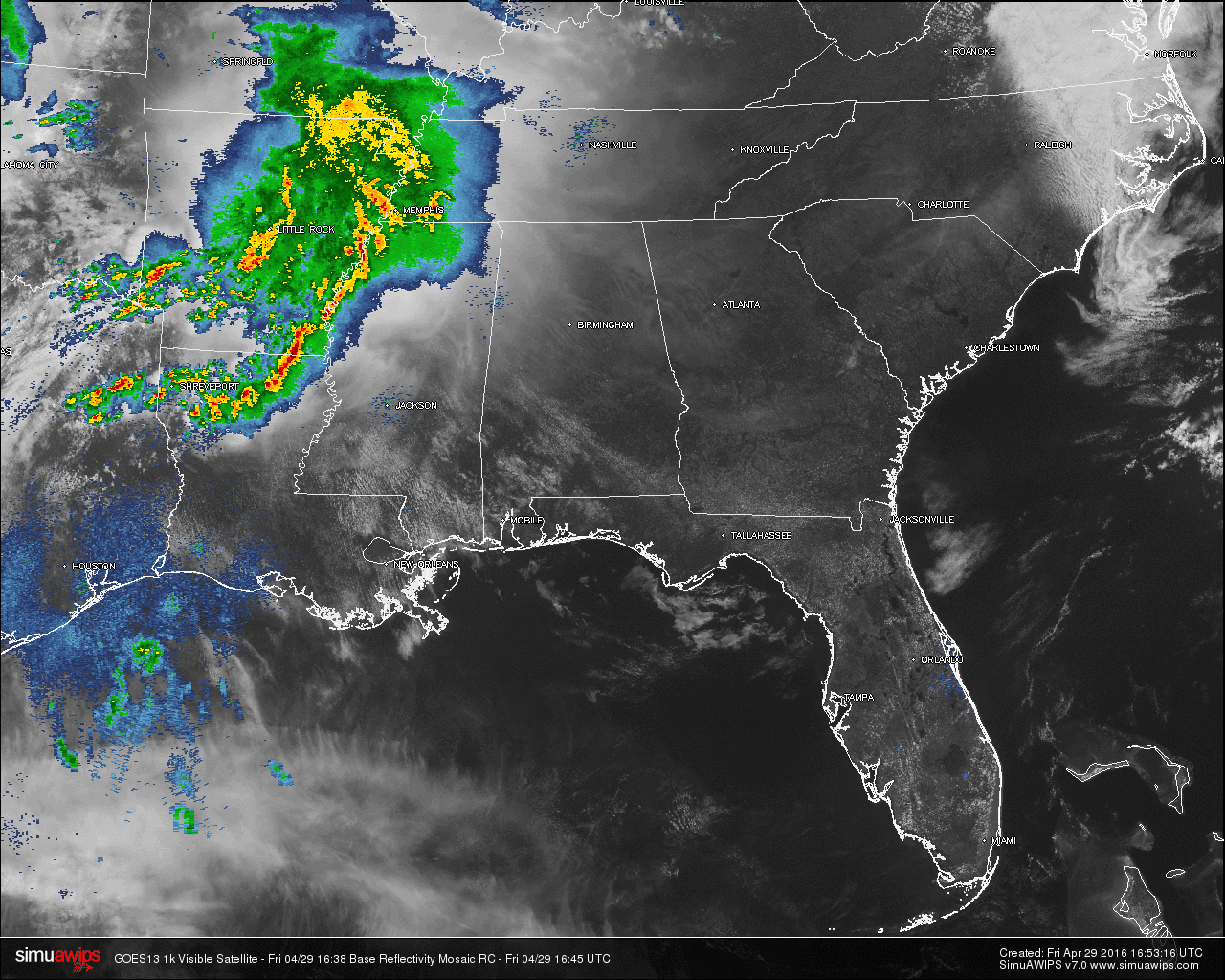
Partly to mostly cloudy skies cover North/Central Alabama at this hour. There are no showers showing up right now, but back to our west, there is a MCS (mesoscale convective system) currently moving its way across Arkansas and Louisiana, and into western Tennessee and Mississippi.
As of now, there are no severe warnings with this system, but Flash Flood Warnings are in effect for several counties in Arkansas. From the NWS in Shreveport, estimates of four to eight inches of rain have already fallen. This system is pushing to the east and may affect North/Central Alabama later this afternoon and evening.
TEMPERATURES AT 12PM: Temperatures are up into the upper 70s to low 80s for most communities across the area. Here is a list of temperature readings from across the state at this time:
Birmingham 81
Tuscaloosa 82
Muscle Shoals 79
Huntsville 79
Anniston 81
Alexander City 79
Montgomery 83
Dothan 83
Mobile 83
TODAY & TONIGHT: For the rest of today, skies will become mostly cloudy in the later afternoon hours for much of North/Central Alabama. Much of the day will be dry. A few scattered showers or thunderstorms are possible late this afternoon, but coverage will be greatest over North Alabama due to the MCS.
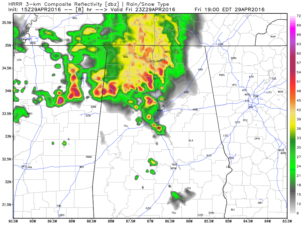
HRRR Valid at 6PM tonight.
The latest HRRR model run has the MCS entering into the northwest corner of the state in the 2PM-4PM timeframe, and possibly reaching Birmingham between 6PM to 8PM, and the Gadsden and Anniston areas between 7PM and 9PM.
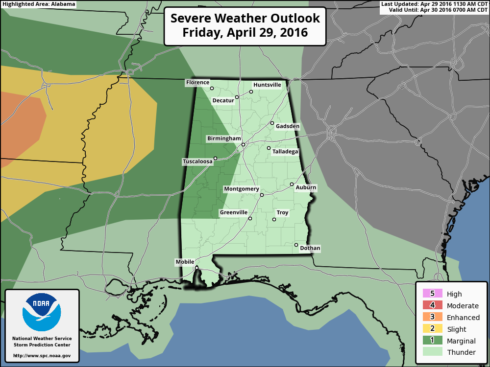
The SPC still has much of west and northwest Alabama under a “Marginal Risk” for severe storms. A few storms could produce gusty winds. Fortunately, the MCS will be weakening, and the overall severe threat is low.
THE WEEKEND: A big upper trough will be lifting out of the western U.S.; the surface low underneath will slowly weaken as it moves east/northeast. Moist air will cover Alabama, and we will need to mention the risk of a few showers and storms both tomorrow and Sunday. Giving specific start/stop times for the rain is almost impossible in this setup, and model guidance is not very consistent.
Bottom line is that you will need to be ready for a few passing showers or storms tomorrow and Sunday, but the rain won’t be continuous and the sun will be out at times. A strong storm or two is possible, but the severe weather threat is very low with weakening upper dynamics. The high tomorrow will be in the mid 80s, with low 80s Sunday afternoon.
TALLADEGA SUPERSPEEDWAY: Partly sunny and very warm today with a high between 84 and 87 degrees. We can’t rule out a shower after 3 p.m., but the day will be generally dry.
For tomorrow and Sunday, expect a mix of sun and clouds both days with the risk of a passing shower or storm from time to time. Unfortunately in this pattern, we aren’t able to give specific times when the rain will pass through, but the good news is that we don’t expect a big rain mass to set in for hours. A very good chance they get the Sparks Energy 300 in on Saturday, and the GEICO 500 in on Sunday, but a delay is very possible both days. Keep an eye on radar.
And, please remember the 8 mile lightning rule. Lightning within 8 miles, you get inside. Car, truck, building, etc. I don’t mess around with it, and you shouldn’t either.
APRIL 27 2011 SPECIAL: You can watch our one hour special here. It was five years ago that 62 tornadoes killed 252 people in our state during a generational tornado outbreak.
WEATHERBRAINS: Don’t forget you can listen to our weekly 90 minute netcast anytime on the web, or on iTunes. This is the show all about weather featuring many familiar voices, including our meteorologists here at ABC 33/40. You can find it here.
Category: Alabama's Weather
About the Author (Author Profile)
Scott Martin is an operational meteorologist, professional graphic artist, musician, husband, and father. Not only is Scott a member of the National Weather Association, but he is also the Central Alabama Chapter of the NWA president. Scott is also the co-founder of Racecast Weather, which provides forecasts for many racing series across the USA. He also supplies forecasts for the BassMaster Elite Series events including the BassMaster Classic.Subscribe
If you enjoyed this article, subscribe to receive more just like it.


