

Radar Check at 5:30 PM
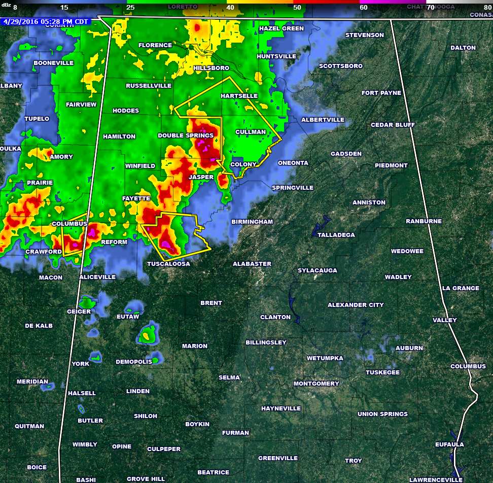
UPDATE: Severe Thunderstorm Warning for Fayette County has been cancelled. Warning is still in effect for Northern Tuscaloosa county. A new severe thunderstorm warning is in effect for Southeastern Lawrence, Southwestern Morgan, and nearly all of Cullman Counties until 6:00 PM CDT.
Storms associated with a MCS (mesocyclone convective system) is pushing its way across much of Northwest Alabama. The heaviest storms on radar at this moment are located in Winston County, stretching back to the southwest through the northwest corner or Walker, much of Fayette, and into northwestern Tuscaloosa counties.
A Severe Thunderstorm Warning remains in effect for Northern Tuscaloosa Counties until 6:00 PM CDT for storms located near Ashcroft Corner and Lake Lurleen State Park. This storm was moving to the east at 20 MPH. Winds in excess of 60 MPH and quarter-size hail could be expected with this storm.
Overall these storms are weaker as the atmosphere over Alabama is not as conducive for severe weather. You can still have gusty winds up to 40 MPH and small hail with this storms. Other than the current severe thunderstorm warning, severe reports should be limited over the next few hours.
Category: Alabama's Weather, Severe Weather
About the Author (Author Profile)
Scott Martin is an operational meteorologist, professional graphic artist, musician, husband, and father. Not only is Scott a member of the National Weather Association, but he is also the Central Alabama Chapter of the NWA president. Scott is also the co-founder of Racecast Weather, which provides forecasts for many racing series across the USA. He also supplies forecasts for the BassMaster Elite Series events including the BassMaster Classic.Subscribe
If you enjoyed this article, subscribe to receive more just like it.


