

Alabama Weather Update at 6:10 PM
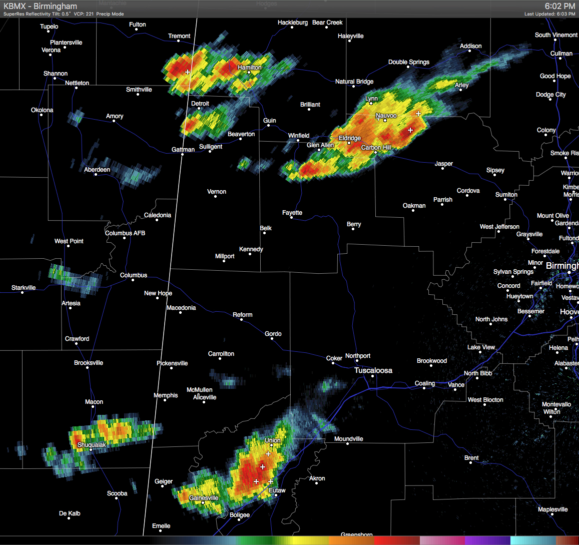
RADAR CHECK: A strong thunderstorm is located over Southwestern Marion, Northwestern Lamar Counties. Another strong thunderstorm is located over Northern Fayette, Southwestern Winston, and Northwestern Walker Counties. These storms are moving to the southeast at 20-25 MPH. Main threat from these storms are dangerous cloud-to-ground lightning, winds in excess of 30 MPH, and small hail.
Another strong thunderstorm is located over Northern Greene and Northwestern Sumter County. This storm is also moving to the southeast at 20-25 MPH, and will soon affect Eutaw and Boligee. Main threat from this storm is dangerous cloud-to-ground lightning, winds in excess of 30 MPH, and small hail.
No severe warning are in effect at this time in Central Alabama. As soon as the sun goes down, the strength in these storms should start to weaken.
Category: Alabama's Weather, Severe Weather
About the Author (Author Profile)
Scott Martin is an operational meteorologist, professional graphic artist, musician, husband, and father. Not only is Scott a member of the National Weather Association, but he is also the Central Alabama Chapter of the NWA president. Scott is also the co-founder of Racecast Weather, which provides forecasts for many racing series across the USA. He also supplies forecasts for the BassMaster Elite Series events including the BassMaster Classic.Subscribe
If you enjoyed this article, subscribe to receive more just like it.


