

Midday Nowcast: Hot, Humid, Storms Later
The heat is on as the upper ridge continues to hold on for one more day. We are seeing plenty of sunshine and temperatures heading well into the 90s this afternoon, and with dew points in the 70s, it is downright miserable and dangerous out there.
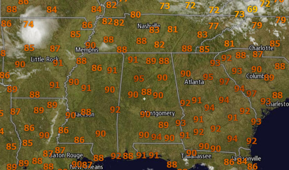
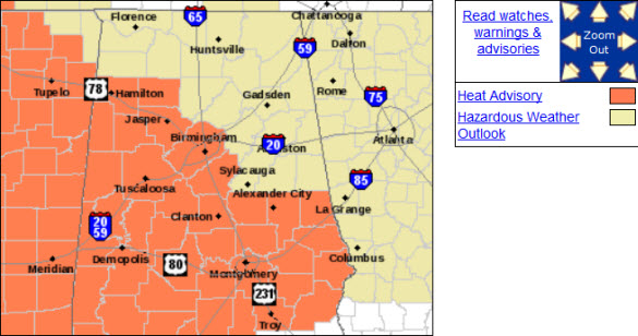
HEAT ADVISORY TODAY: The heat advisory is in effect until 9PM tonight and heat index values are above 100° already late this morning in many locations. For the rest of today and through the evening hours, heat index values will be well over 100° and these could be as high as 110° in some spots. Take it easy out there today!
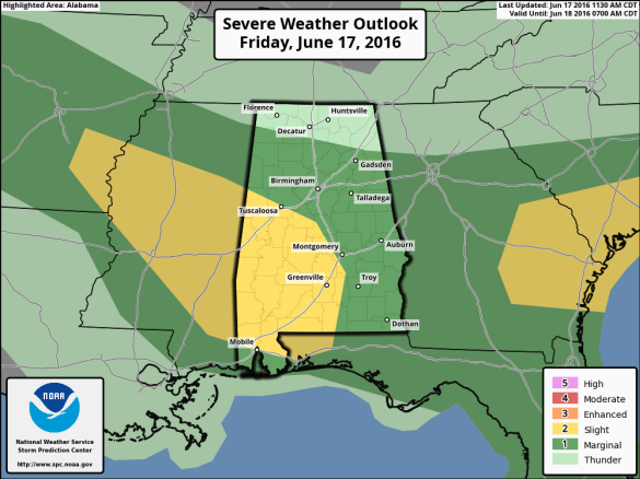
STORMS TODAY TOO: The only heat relief today will come from showers and storms that are expected to develop. A surface boundary is pushing into and through the state, and with the very hot and unstable air mass in place across the state, we are likely to see some strong to severe storms this afternoon and early evening.
The SPC has upgraded portions of the “marginal risk” to a “slight risk” for severe storms today for the state.
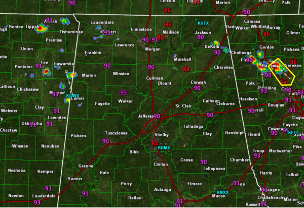
QUICK RADAR CHECK: We are beginning to see the above advertised showers and storms develop and these will continue to expand in coverage and move off towards the south through the state. It will not rain everywhere, just note that where storms develop, they will be packing a punch with lots of lighting, hail, and the greatest concern damaging winds. Main window for stronger storms will come from 2-8PM. As we have seen the past few days, the storms should develop into line as they push south through the state.
WEEKEND HEAT RELIEF: A few lingering showers are possible tomorrow mainly across our southern communities, but through the day a nice surge of drier and cooler air will settle into the state. Temperatures will be cooler, as we are forecasting upper 80s to near 90. The real difference will be noticed in those humidity levels. Lower humidity levels mean more comfortable conditions for the state. Expect mostly sunny weather Saturday and Sunday, with no afternoon showers or storms expected. Nights will be cooler and refreshing with the possibility of cooler spots reaching the 50s early Sunday morning. Enjoy those lower dew points, it could be a while before we see them that low again.
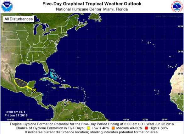
TROPICAL UPDATE: A tropical wave located near the Yucatan Peninsula is producing disorganized cloudiness and thunderstorms from the northwestern Caribbean Sea through southeastern Mexico. Development, if any, of this disturbance should be slow to occur due to proximity to land while it moves west-northwestward at about 10 mph over the Bay of Campeche and southwestern Gulf of Mexico over the next few days.
Category: Alabama's Weather
About the Author (Author Profile)
Macon, Georgia Television Chief Meteorologist, Birmingham native, and long time Contributor on AlabamaWX. Stormchaser. I did not choose Weather, it chose Me. College Football Fanatic. @Ryan_StinnetSubscribe
If you enjoyed this article, subscribe to receive more just like it.


