

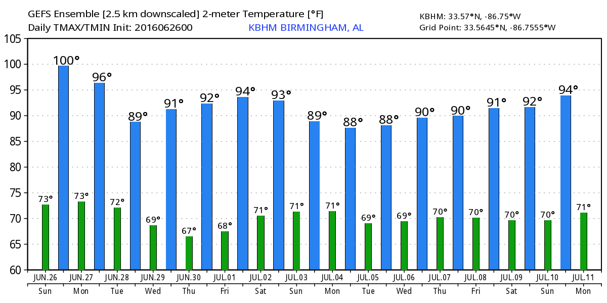
Another Hot One Before a Break
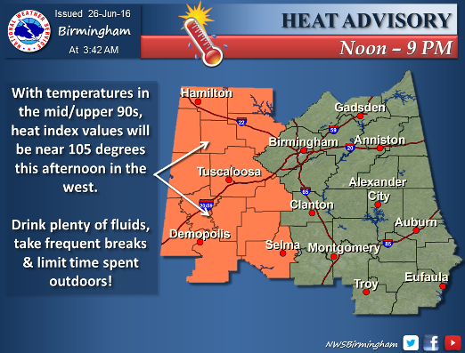
As the upper ridge to our west holds on across mainly the western half of Alabama, the NWS in Birmingham has gone ahead with another heat advisory for today generally west of the I-65 corridor. Look for highs to once again climb into the middle and upper 90s across Central Alabama, and the heat will again generate afternoon thunderstorms. As we saw yesterday, a few of these storms may be severe with damaging wind the greatest threat.
Beautiful weather is in store for beachgoers to the beaches of Alabama and Northwest Florida for the next couple of days. Expect plenty of sunshine, with only an isolated afternoon and evening shower or thunderstorm. Highs will be near 90 degrees each day, while lows will be in the middle 70s. Rain chances go up at midweek, but thunderstorms will not create a complete washout. The sea water temperature at the Dauphin Island Sea Lab was 89 degrees.
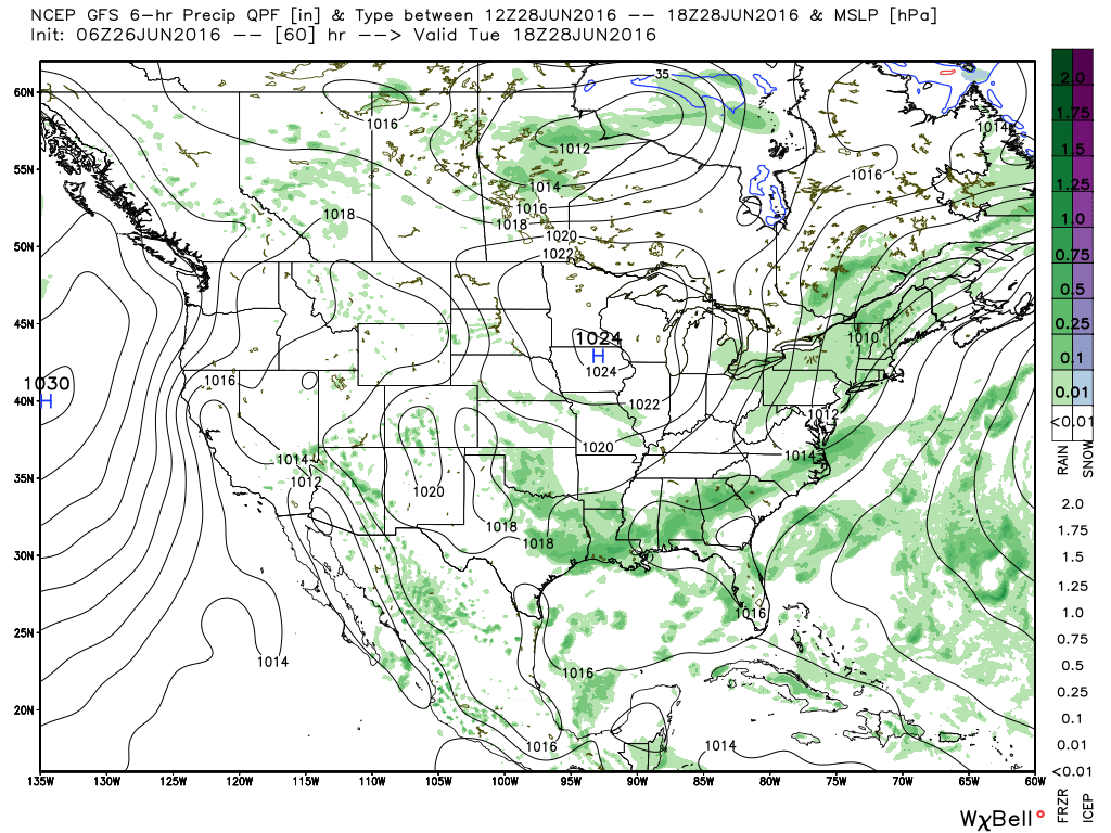
SPC maintains a marginal risk for organized severe storms generally along the front stretching from the eastern Great Lakes area into the Texas Panhandle for today, Day 1. Day 2 and 3 each feature an area of slight risk in western Nebraska and eastern Colorado. And the tropical weather picture remains quiet with no specific areas of concern.
The heat ridge will slowly ebb westward Monday and Tuesday as a large upper closed low traverses southern Canada. This upper low will gradually dig out a trough over the eastern half of the US to complete a pattern shift by the latter half of the week. A surface front will be approach the Southeast US on Monday helping to increase thunderstorm coverage for us. The front moves into South Alabama on Tuesday which should also bring some better rain chances to all of Central Alabama. Rainfall totals of 1 to 2 inches will be possible in parts of Central and South Alabama over the next five days with the best chances coming Monday and Tuesday. With the presence of more thunderstorms as well as clouds, we should see the highs held to the lower 90s.
Wednesday and Thursday we should see dry weather. With dew points forecast to be lower – generally in the lower 60s – highs in the upper 80s are possible and that lower humidity will help make it feel not quite as hot.
The upper air pattern will flatten by Friday as we see moisture levels rise once again. This means a return to those heat-driven afternoon and early evening thunderstorms as we head into the weekend. Highs should climb into the lower 90s again.
While we are under the northwesterly flow during the middle and latter part of the week ahead, we will have to be vigilant for the development of mesoscale convective systems (MCSs) over the Central US. These thunderstorms clusters can travel hundreds of miles and completely bust a forecast, but there is no skill this far in advance to specify the time and location of their occurrence. Knowing that this pattern will exist keeps us alert to their formation and makes us ready to make adjustments to forecasts as needed.
Looking out into voodoo country, the GFS maintains a trough across the eastern US until July 9th. From the 9th to the 11th, the pattern gradually morphs back into a ridge over the Mississippi River Valley. This ridge does not appear to be quite as strong as the one we’re just coming out of, but it does mean a return to warmer than typical temperatures.
James Spann is expected back from his vacation on Monday morning with the next edition of the Weather Xtreme Video. Please be aware of the heat and use common sense to stay hydrated and to not overdo it with your outside activities. Have a great day and Godspeed.
-Brian-
Category: Alabama's Weather
About the Author (Author Profile)
Brian Peters is one of the television meteorologists at ABC3340 in Birmingham and a retired NWS Warning Coordination Meteorologist. He handles the weekend Weather Xtreme Videos and forecast discussion and is the Webmaster for the popular WeatherBrains podcast.Subscribe
If you enjoyed this article, subscribe to receive more just like it.


