

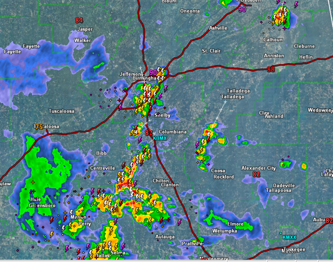
Strong Storms Impacting Birmingham Suburbs
Pulse thunderstorms continue to track towards the east across Central Alabama this Sunday evening. As they pulse up in intensity, they are producing a lot of lightning and torrential tropical downpours. As they pulse down in intensity, they will also be certainly capable of producing some damaging wind gusts due to wet microbursts.
These storms will continue the next several hours, but should begin to wind down once the sun sets and daytime heating is loss. Nevertheless, if you find yourself under one of these storms, use precaution as the rainfall will be intense, where some localized flash flooding is possible, and there will be frequent lightning strikes.
The main thunderstorm activity this evening is along and South of the Interstate 20 corridor, including portions of the Birmingham metro. Additional storms continue to impact portions of Chilton, Bibb, Shelby, Coosa, Perry and Dallas counties. We also note a strong storm tracking through northern Calhoun County.
Click image to enlarge.
Category: Alabama's Weather
About the Author (Author Profile)
Macon, Georgia Television Chief Meteorologist, Birmingham native, and long time Contributor on AlabamaWX. Stormchaser. I did not choose Weather, it chose Me. College Football Fanatic. @Ryan_StinnetSubscribe
If you enjoyed this article, subscribe to receive more just like it.


