

Midday Nowcast: Decent Rain Chances Today Through The Weekend
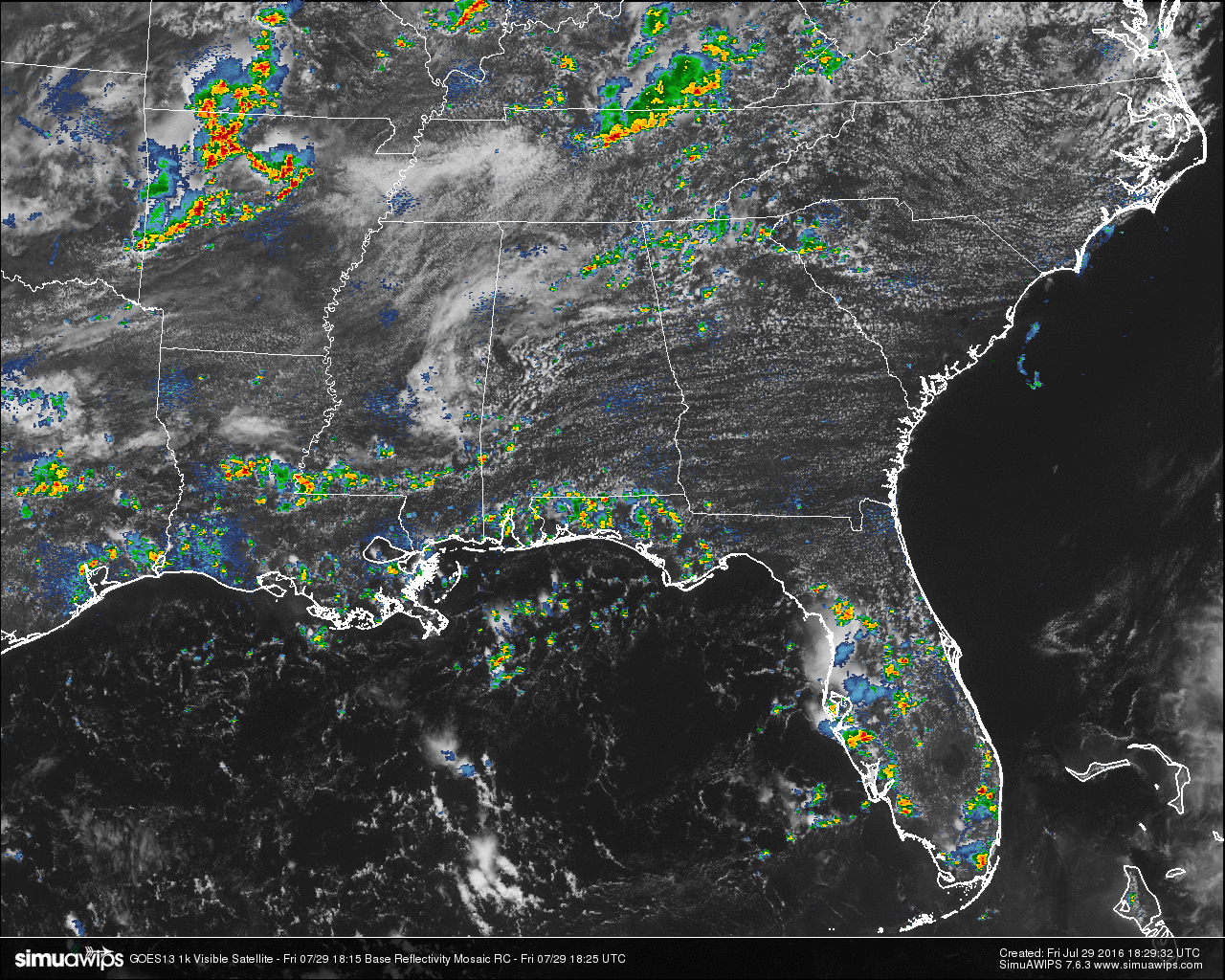
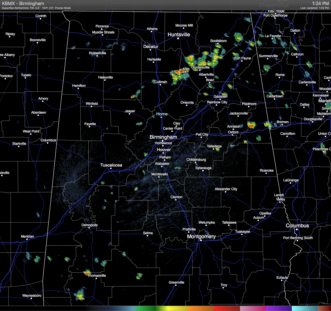
Skies are partly cloudy for the northern parts of Central Alabama at this hour, with the southern part of the area enjoying a little more sunshine with partly to mostly clear skies. On the radar, we do have some scattered showers mainly across the northeastern parts of the area, especially east of I-65 and west of I-59. There are a few more spotty showers out there across the area, but a good bit of the state remains dry at this moment.
TEMPERATURES AT THIS HOUR: You can tell by the list below where the clouds are holding the temperatures back, and where the location is in sunshine. Here is a list of temperature observations from across the area:
Birmingham 86
Tuscaloosa 87
Gadsden 85
Anniston 90
Cullman 83
Hamilton 83
Clanton 89
Alexander City 88
Montgomery 92
WHAT TO EXPECT FOR TODAY: Once again, skies will be partly to mostly cloudy across Central Alabama, and with a weakness in the upper ridge across the deep south, we’ll have a better chance of showers and thunderstorms this afternoon and evening. Afternoon highs will be in the upper 80s to just above 90 degrees. Not everyone will get rainfall, but the odds of any one spot getting rainfall will be around 50/50.
CODE YELLOW AIR QUALITY: The Air Quality Index for the Birmingham Metropolitan Area will be in the “Code Yellow” for ozone and particulate matter 2.5. Unusually sensitive people should consider limiting prolonged outdoor exertion.
TODAY’S CLIMATOLOGY FOR BIRMINGHAM: The normal high for July 28th is 91, while the normal low is 70. The record high for today was set back in 1930 at 107. The record low was set back in 1994 at 60.
WEEKEND OUTLOOK: Not much change for the weekend as the weakness in the upper ridge across the deep south will keep a decent chance of showers and thunderstorms in the forecast throughout the weekend. Odds for any one place getting rainfall will be about 50/50. Otherwise, expect a mix of sun and clouds with afternoon highs in the low to mid 90s. Heat index values will reach the low 100s on both days, so please use common sense while outside.
HEADED TO THE BEACH: Expect scattered showers and storms along the beaches of Alabama and Northwest Florida. Rain chances will ratchet up just a bit by midweek next week. Highs will be around 89 with morning lows in the upper 70s. Waves will generally be running less than one foot, except around thunderstorms, so the rip current threat should be low. See a very detailed Gulf Coast forecast here.
THE TROPICS: The tropical Atlantic has become a bit more active with two disturbances under the watchful eye of the National Hurricane Center. Both are a long way from threatening any land areas, and they will stay that way for several days to come.
THE BLOG IS ON TWITTER: Be sure to follow the Alabama Wx Weather Blog on Twitter. Just click here to start following our feed.
WEATHERBRAINS: This is the show all about weather featuring many familiar voices, including our meteorologists at ABC 33/40. You can listen anytime on the web, or on iTunes. You can find it here.
ADVERTISE WITH US: Deliver your message to a highly engaged audience by advertising on the AlabamaWX.com website. The site enjoyed 10.2 MILLION pageviews in the past 12 months. Don’t miss out! We can customize a creative, flexible and affordable package that will suit your organization’s needs. Contact Bill Murray at (205) 687-0782.
Category: Uncategorized
About the Author (Author Profile)
Scott Martin is an operational meteorologist, professional graphic artist, musician, husband, and father. Not only is Scott a member of the National Weather Association, but he is also the Central Alabama Chapter of the NWA president. Scott is also the co-founder of Racecast Weather, which provides forecasts for many racing series across the USA. He also supplies forecasts for the BassMaster Elite Series events including the BassMaster Classic.Subscribe
If you enjoyed this article, subscribe to receive more just like it.


