Wet Weekend; Drier Monday
Showers and thunderstorms are likely to occur across much of Central and North Alabama this weekend, so the somewhat wet pattern will continue. The highs today and Sunday should be in the upper 80s being held down by a good supply of clouds as well as fairly numerous storms. But that is expected to change on Monday when a front, albeit weak, makes it way through North and Central Alabama pushed southward by a surface high located over Ohio River Valley. While I was holding out some hope that we would see a couple of days with cooler temperatures, it looks like that might not happen, but we should see an air mass change as much drier air is pushed into the Southeast US with dew points dropping into the lower 60s. This should break the long streak of lows in the 70s as lows dip well into the 60s.
For beachgoers, you will see about 7 to 9 hours of sunshine over the weekend and not next week with a few scattered showers and thunderstorms from Gulf Shores to Panama City Beach. Highs on the immediate coast will stay in the 87-90 degree range, with lower 90s inland. Sea water temperatures are mostly in the mid 80s. See a very detailed Gulf Coast forecast here.
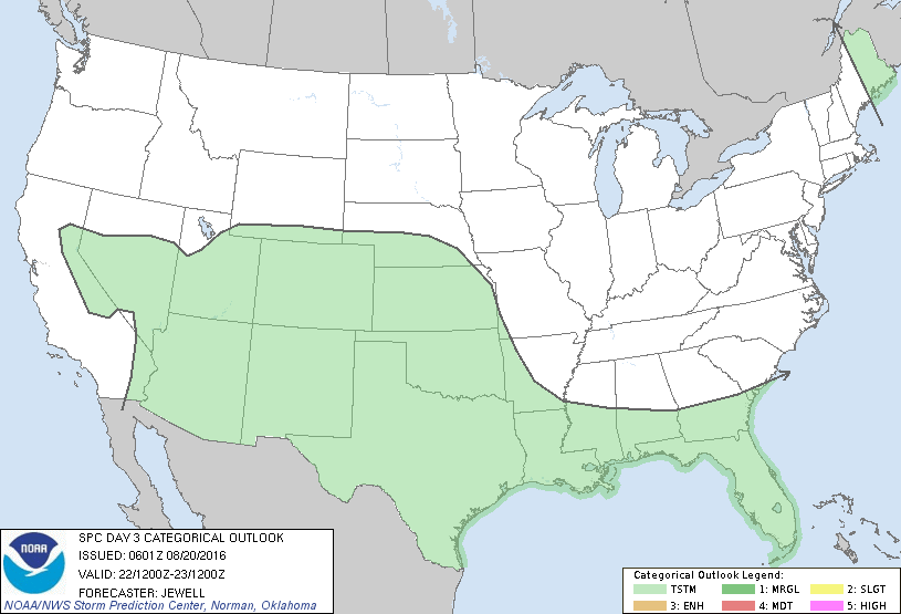
The severe weather threat across the US is down significantly with only a small area in Michigan where there is a slight risk of severe storms. Day 2 that risk area moves into New York and the Mid-Atlantic states but peaks only as marginal. For Day 3, there are no severe weather risk areas outlined.
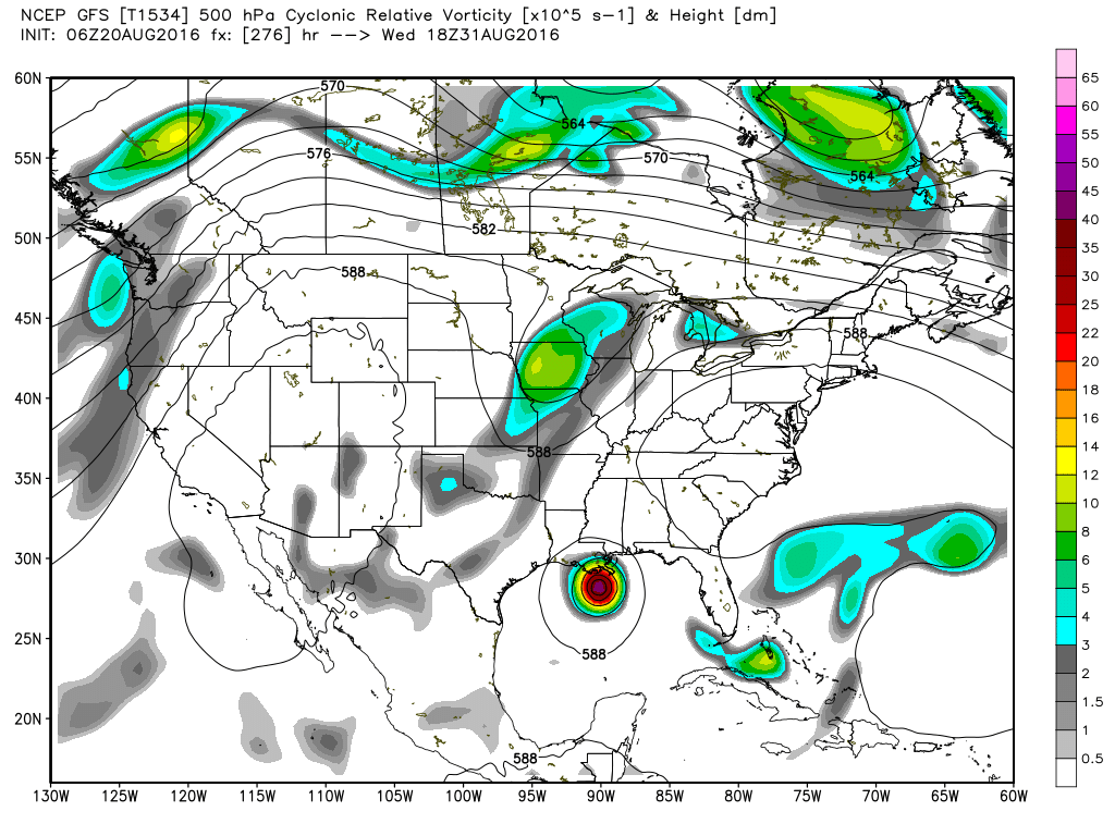
But while severe weather across the continental US is waning, the tropical Atlantic is becoming more active. There are three areas under the watchful eye of meteorologists this morning. Fiona is struggling in the South Central Atlantic and barely hanging on as a tropical storm. The system is very shallow, so it is likely to be downgraded to depression status later today or Sunday. The track keeps it in the Atlantic but moving more westward due to the shallow nature of the storm.
Across the deep South Atlantic we have two disturbances. The first one is about 700 miles west-southwest of the Cape Verde Islands. It is expected to continue moving westward and is expected to gradually increase in strength with fairly good prospects that it will become a depression or tropical storm by the middle of the upcoming week as it gets into the eastern Caribbean. This one even shows up on the long range GFS projections. A second area of disturbed weather is just about to emerge into the South Atlantic from Africa. This disturbance actually presents a little better than the first one and it is expected to gradually develop as conditions become more favorable for storm formation.
Back in Alabama, the weak front is going to bring an air mass change to the area for Monday and Tuesday. Both days should be dry with highs climbing to around 90 as the upper ridge develops over the Gulf of Mexico. But as the surface high shifts eastward into the Atlantic, the wind will come quickly around to the south once again putting showers back in the forecast for Wednesday and the rest of the week. The upper ridge will be the prevalent upper air feature for out weather for the second half of the week and into next weekend. So there will be some chance of showers and thunderstorms each day. I expect highs to dance around the 90-degree mark with some days getting into the lower 90s. Morning lows will rise into the 70s again.
But as we get to next weekend and peek into voodoo country, the GFS has some interesting projections that will surely fuel a great deal of speculation for week 2. The GFS brings a tropical system, the first system discussed above, across the southern tip of Florida and into the Gulf of Mexico. The storm crosses the Gulf into Louisiana. But the ECMWF appears to take the same system east of Florida recurving it into the Atlantic. So, as we see often, there is a great deal of variation on what this system will do. But it’s presence will give weather enthusiasts a great deal of fodder for water cooler discussions.
I expect to produce the next Weather Xtreme Video by 7 am or so on Sunday morning. Stay tuned to the blog for updates on the Alabama weather scene. Stay dry and Godspeed.
-Brian-
Category: Alabama's Weather
About the Author (Author Profile)
Brian Peters is one of the television meteorologists at ABC3340 in Birmingham and a retired NWS Warning Coordination Meteorologist. He handles the weekend Weather Xtreme Videos and forecast discussion and is the Webmaster for the popular WeatherBrains podcast.Subscribe
If you enjoyed this article, subscribe to receive more just like it.


