

Storms Rolling Through North Alabama
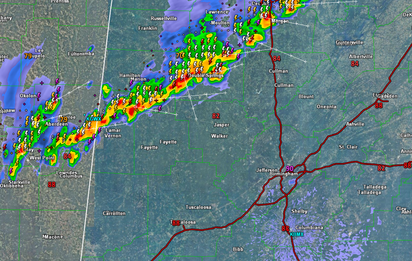
A line of storms ahead of a frontal boundary is tracking southeast through Northwest Alabama. These storms are are heading towards the Birmingham Metro. Before these storms get to the Metro area, they are going to be tracking through cities such as Jasper, Cullman, Fayette, and Vernon.
Storms are producing a lot of lightning, intense rainfall, and gusty winds, but none of these storms are severe, and severe weather is not expected tonight. They are also knocking temperatures down from the mid and upper 80s, into the 70s. These storms are expected to maintain their intensity for the next few hours but should begin to wind down by about 10PM and become more isolated as the better dynamics are north of Alabama, and daytime heating is loss.
These storms are expected to at least make it to the Interstate 20 corridor before they begin to dissipate.
Category: Alabama's Weather
About the Author (Author Profile)
Macon, Georgia Television Chief Meteorologist, Birmingham native, and long time Contributor on AlabamaWX. Stormchaser. I did not choose Weather, it chose Me. College Football Fanatic. @Ryan_StinnetSubscribe
If you enjoyed this article, subscribe to receive more just like it.


