

More Storms Now Pushing Into Northwestern Alabama
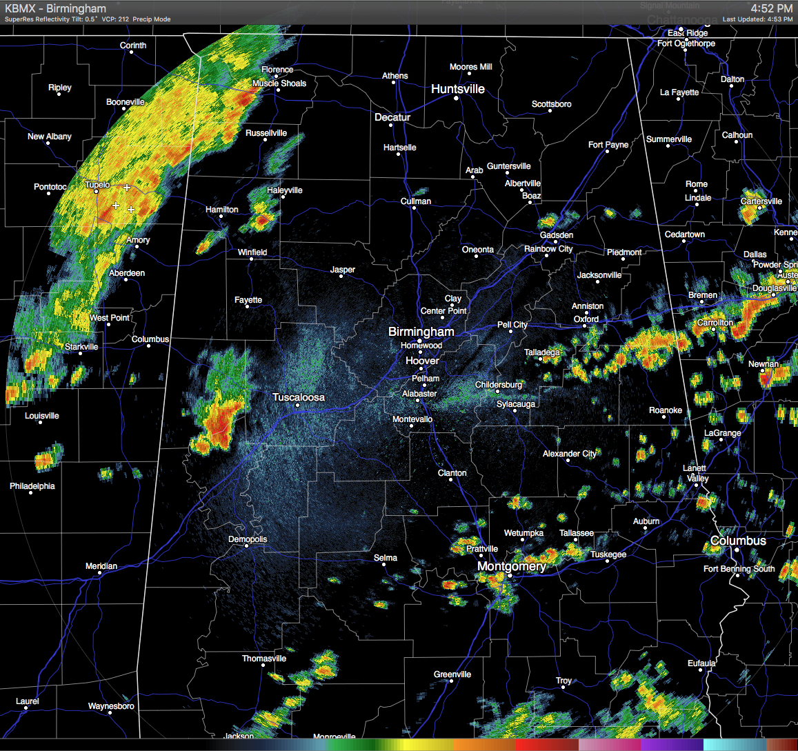
At the 5PM hour, we have storms starting to push their way in from Mississippi, as they are now entering into the northwestern corner of the state. They are moving to the east at about 20-25 MPH.
A stronger storm that has developed ahead of the line of storms has warranted a Significant Weather Advisory for Northern Greene and Northwestern Hale counties until 5:30 PM. A strong thunderstorm was located near Mantua and just southeast of Aliceville, and was moving to the southeast at 25 MPH. Winds in excess of 40 MPH and dangerous cloud-to-ground lightning can be expected. People in Eutaw, Moundville, Akron, Union, Wedgeworth, Evansville, Mantua, Knoxville Walden Quarters, and Sawyerville are in the path of this storm, so take shelter until it passes.
Otherwise across the state, just scattered showers and a few thunderstorms are out there mostly are east of I-65. There are no watches and warnings in effect, and should be that way throughout the remainder of the daylight hours. We’ll take what ever rain we can get.
Category: Alabama's Weather, Severe Weather
About the Author (Author Profile)
Scott Martin is an operational meteorologist, professional graphic artist, musician, husband, and father. Not only is Scott a member of the National Weather Association, but he is also the Central Alabama Chapter of the NWA president. Scott is also the co-founder of Racecast Weather, which provides forecasts for many racing series across the USA. He also supplies forecasts for the BassMaster Elite Series events including the BassMaster Classic.Subscribe
If you enjoyed this article, subscribe to receive more just like it.


