

Midday Nowcast: Fall Is Nearly Here, Can We Start to Feel Like It?
HOW’S YOUR MONDAY, WEATHER-WISE?:
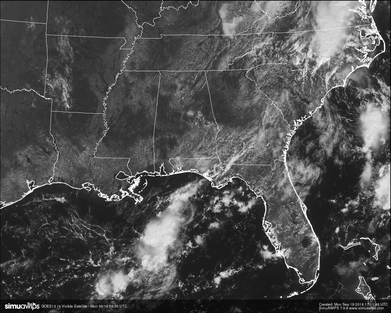
At the noon hour across Central Alabama, skies are mostly clear out there, and not a drop of rain can be found on radar at this point. Skies should remain mostly clear today and afternoon highs will range in the upper 80s to right over 90 degrees today, with only a very small risk of a shower or storm in the southeastern part of the area throughout the afternoon and evening hours. Skies should clear out for the evening and overnight lows will range throughout the 60s to near 70 degrees.
TEMPERATURES ACROSS CENTRAL ALABAMA AT NOON:
Birmingham: 84
Tuscaloosa: 84
Gadsden: 84
Anniston: 84
Cullman: 83
Alabaster: 82
Alexander City: 88
Auburn: 82
Montgomery: 84
Selma: 84
ONLY THREE DAYS AWAY FROM FALL’S ARRIVAL:
Even though we have been in “Meteorological Fall” since the first of the month, the Autumnal Equinox actually does not take place until Thursday morning at 9:21 AM CDT. We’ll have approximately 12 hours of daylight and 12 hours of darkness. Unfortunately that doesn’t mean that we will get any additional rain chances this week, as we have settled back into a hot and dry pattern for the week. Mostly sunny days and fair nights are expected through Friday, with highs at or near 90 degrees and low ranging in the mid 60s to 70 degrees. The good news is that dew points will be a little lower and that will keep those temperatures from being unbearable.
THE WEEKEND OUTLOOK:
A little more moisture is expected to begin to flow into the state for the weekend, but really not enough to make a change to the forecast… mostly sunny and hot, with a very slight risk of an isolated afternoon or evening shower or storm. Highs will be near 90 degrees, with overnight lows in the 60s.
TODAY’S CLIMATOLOGY FOR BIRMINGHAM:
The normal high for September 19th is 84, while the normal low is 62. The record high for today was set back in 1931 at 102. The record low was set back in 1901 at 42.
CODE YELLOW AIR QUALITY ALERT:
Ozone and particulate matter 2.5 level will be high enough to raise the “Code Yellow” Air Quality Alert for the Birmingham metropolitan area today. Unusually sensitive people should consider limiting prolonged outdoor exertion.
HEADED TO THE BEACH:
About 8 to 10 hours of sunshine daily on the coast from Gulf Shores to Panama City Beach this week with only widely scattered storms. Highs in the upper 80s on the immediate coast, with low 90s inland. See a very detailed Gulf Coast forecast here.
TROPICS:
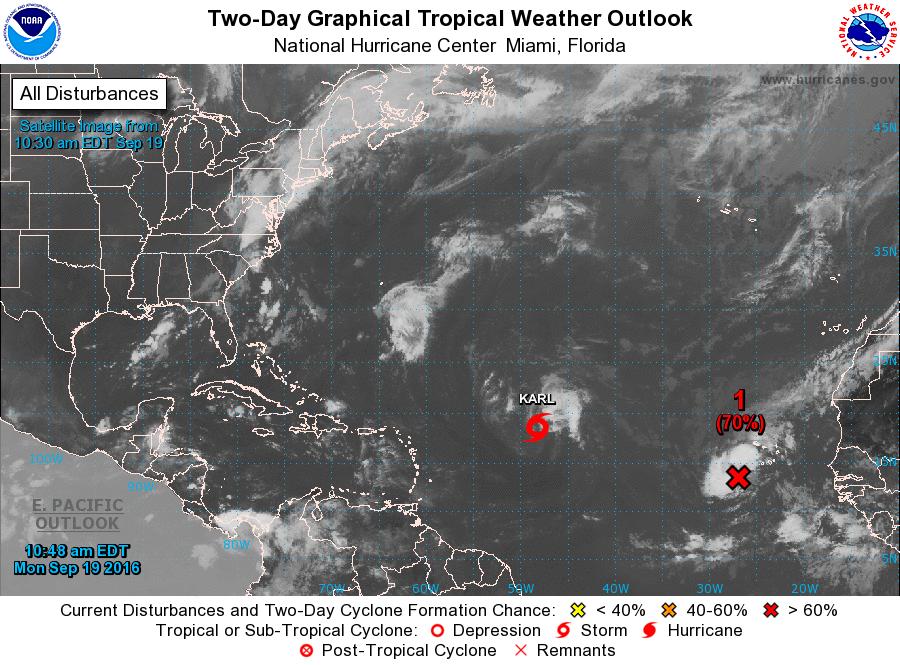
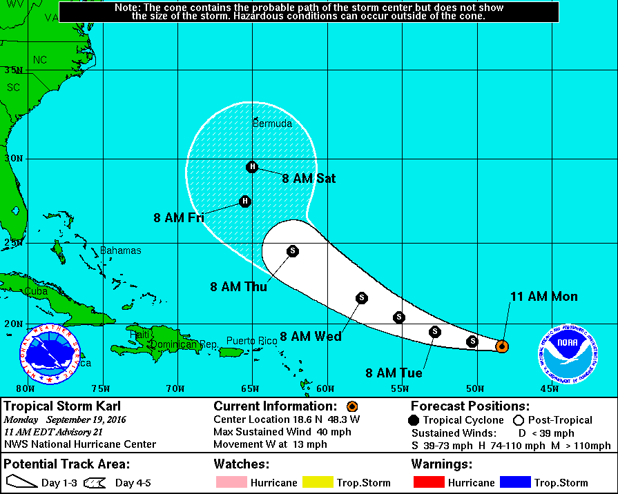
Tropical Storm Karl is poorly organized as it is continuing to struggle with shear and dry air. Slow strengthening is expected to happen over the next five days as should become a hurricane later this week. Karl will start to turn to the northwest by midweek. Karl will not be a threat to the US, but it could be close to the island of Bermuda this weekend.
The last public advisory on Post-Tropical Cyclone Julia was given last night at 10PM as the system has become a remnant low. What’s left of the system will drift into eastern North Carolina tonight and tomorrow.
There is a tropical wave located near the Cabo Verde Islands in the eastern Atlantic that is expected to strengthen into a depression before entering into a zone of less conducive environmental conditions… and is expected to curve to the north and will be no threat to land.
ON THIS DAY IN 1988:
Thunderstorms developing along a fast moving cold front produced severe weather in Wisconsin, Illinois, Indiana and Michigan. Eight tornadoes were reported, including five in Indiana. Thunderstorm winds gusted to 74 mph at Wabash IND. Winds associated with the cold front itself gusted to 69 mph at Kenosha WI.
THE BLOG IS ON TWITTER:
Be sure to follow the Alabama Wx Weather Blog on Twitter. Just click here to start following our feed.
WEATHERBRAINS:
This is the weekly netcast that’s all about weather featuring many familiar voices, including our meteorologists at ABC 33/40. You can listen anytime on the web, or on iTunes. You can find it here.
ADVERTISE WITH US:
Deliver your message to a highly engaged audience by advertising on the AlabamaWX.com website. The site enjoyed 10.2 MILLION pageviews in the past 12 months. Don’t miss out! We can customize a creative, flexible and affordable package that will suit your organization’s needs. Contact Bill Murray at (205) 687-0782.
Category: Alabama's Weather
About the Author (Author Profile)
Scott Martin is an operational meteorologist, professional graphic artist, musician, husband, and father. Not only is Scott a member of the National Weather Association, but he is also the Central Alabama Chapter of the NWA president. Scott is also the co-founder of Racecast Weather, which provides forecasts for many racing series across the USA. He also supplies forecasts for the BassMaster Elite Series events including the BassMaster Classic.Subscribe
If you enjoyed this article, subscribe to receive more just like it.


