

Slowly Warming Up and Dry
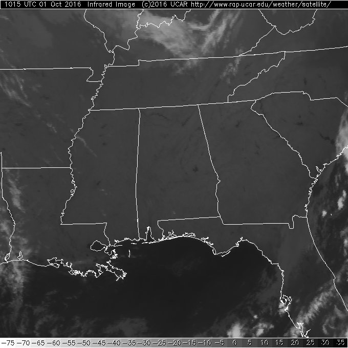
Welcome to October, climatologically Alabama’s driest month. And the satellite image this morning confirms clear skies across the state of Alabama as the infrared images allows us to pick out some of the larger lakes and rivers. Temperatures this morning were in the 50s, some of the lowest values we’ve seen this season. Our Skywatcher at Black Creek in Etowah County reported a low so far of 43 degrees – now that’s jacket weather. But with lots of sunshine in store for the state, we should see highs climb nicely into the upper 70s and lower 80s.
Football weather looks great. Alabama will host Kentucky this evening at Bryant-Denny Stadium. The 6:00 pm CDT kickoff will be clear with temperatures falling from 73 at kickoff into the mid 60s by the fourth quarter. On the Plains, Auburn hosts Louisiana-Monroe this afternoon at Jordan Hare Stadium with a 2:30 pm CDT kickoff. You can expect sunshine with a kickoff temperature of 78 degrees falling into the upper 60s by the final whistle.
For beachgoers, weather along the coast will be mostly sunny days with fair nights. Highs will be in the lower 80s today and drop into the middle 70s for the start of the next week. Lows will be in the 60s. See a very detailed Gulf Coast forecast here.
The Barber Vintage Motorcycle Festival runs from Friday, October 7, through Sunday, October 9, at the Barber Motorsports Park. No real skill in a specific forecast this far out, but October is our driest month of the year, and for now we see nothing to suggest any chance of rain for the event on these three days. Get ticket information right here.
The SPC convective outlooks are shy on much organized severe storms with only a small marginal area for Day 1 in Montana and Day 3 in parts of the Dakotas and Nebraska.
The tropics are active with Matthew currently a major hurricane at Category 4. Matthew is forecast to make a turn toward the north today crossing the eastern side of Jamaica on Monday and plowing into eastern Cuba on Tuesday. After that the storm should lose a little punch as it makes its way through the Bahamas. Beyond that the track is likely to be very close to the East Coast of the US, so all interests from Florida to Maine will need to keep up with the latest information on Matthew.

An area of disturbed weather in the Central Atlantic is not expected to undergo much development during the next several days as it moves northwestward.
The trough that has brought this wonderful taste of Fall to the Southeast will gradually migrate northeastward into New England by Monday. The trough is replaced by an upper ridge that moves to the East Coast by Wednesday as another trough sets up along the eastern slopes of the Rockies by Wednesday. From Wednesday through Friday the trough makes slow progress eastward with a front forecast to approach Central Alabama late Friday. The upper trough and the surface front will make their way across the Southeast US on Saturday, but with very little moisture there will be almost no chance for any showers to develop along or just ahead of the front. Matthew by next Saturday could be churning up the eastern seaboard in the vicinity of the Outer Banks of North Carolina.
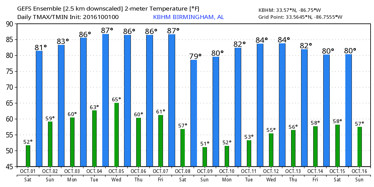
With the weather pattern outlined by the GFS, we should see highs return to the 80s for the week ahead with lows mainly in the 60s after Sunday morning. The front on Saturday will bring slightly cooler and drier air once again dropping temperatures into the upper 70s for highs.
Looking out into voodoo country, the broad trough over the eastern US becomes a good deal sharper around the 12th of October. After that, the GFS has a very complex pattern with an area of low pressure across the Gulf Coast area under a ridge aloft. The problem is that the atmosphere is forecast to stay dry, so it will be difficult to get any rain without a big increase to the precipitable water values.
I expect to have the next Weather Xtreme Video posted here by 7:30 am or so on Sunday. Enjoy another beautiful Fall day for Central Alabama. Godspeed.
-Brian-
Category: Alabama's Weather
About the Author (Author Profile)
Brian Peters is one of the television meteorologists at ABC3340 in Birmingham and a retired NWS Warning Coordination Meteorologist. He handles the weekend Weather Xtreme Videos and forecast discussion and is the Webmaster for the popular WeatherBrains podcast.Subscribe
If you enjoyed this article, subscribe to receive more just like it.


