

Monitoring Strong Storms Over West Central and Northwest Alabama; Severe Threat is Low.
We’re monitoring thunderstorms over Northwest Alabama and East Central Mississippi at this hour. They have continued to increase in coverage and intensity.
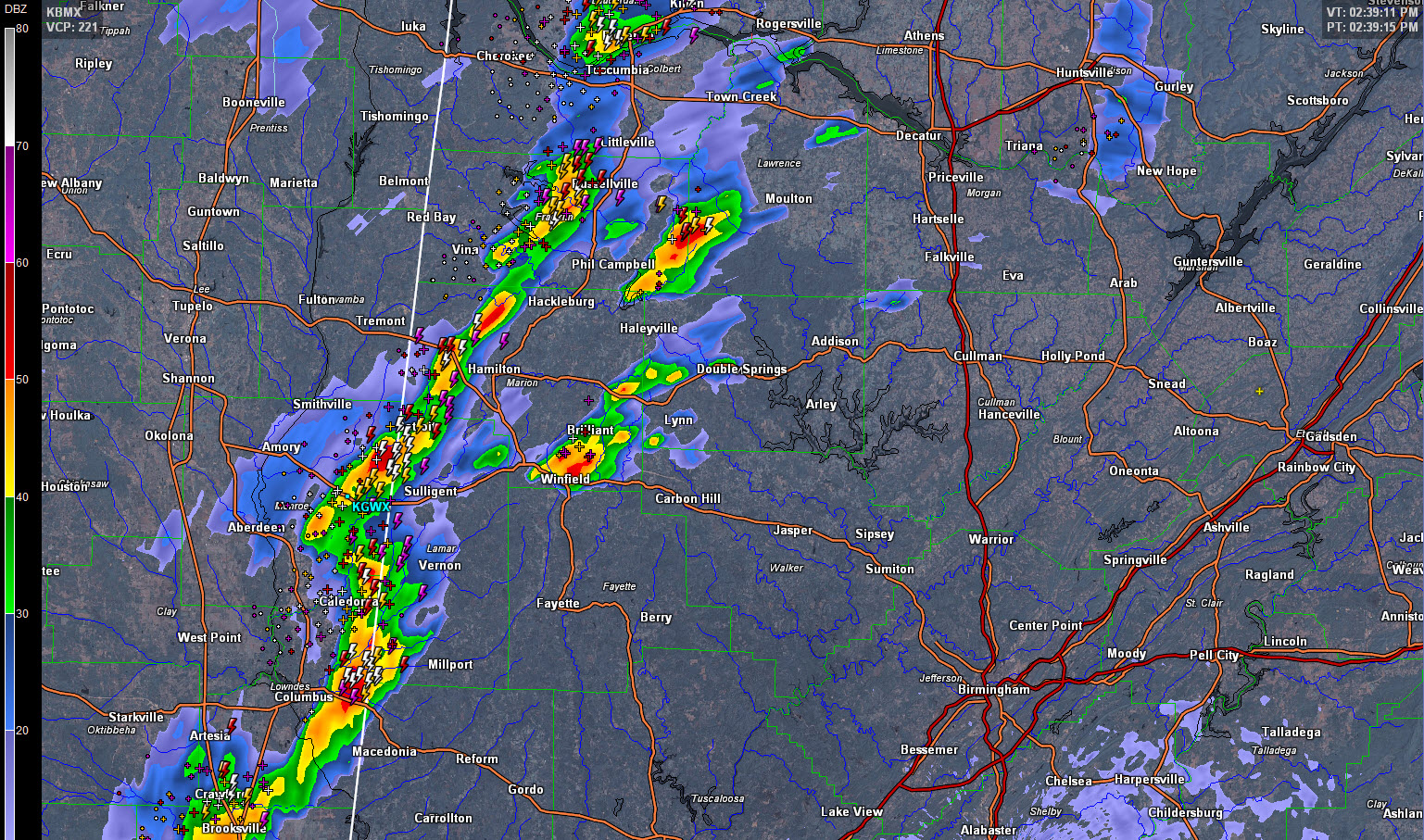
The strongest storms extend from near the Shoals area of Northwest Alabama through Franklin County to the west of Russellville to western Marion County west of Hamilton to east of Columbus MS.
A couple of storms are just ahead of the line east of Phil Campbell and near Winfield in Marion County.
There is a kink in the line of storms just east of Aberdeen MS. This indicates a little extra vorticity and could help this activity be a little stronger as it moves into southwestern Marion County and northern Lamar County.
Instability values are marginal, running up to around 1,000 j/kg in areas northwest of I-20. There are some localized values near 1,500 joules over Northwest Alabama. Shear values are low, with just enough bulk shear to keep the storms organized. Bulk shear numbers are running 20-30 knots. Storm relative helicities are running well less than 50 m2/s2 for now, meaning the threat of severe storms is low.
In keeping with this, so far the storms have been well below severe limits, producing only gusty winds, heavy rain and lots of lightning. There could be isolated severe reports, including a report or two of large hail and damaging winds.
Category: Alabama's Weather
About the Author (Author Profile)
Bill Murray is the President of The Weather Factory. He is the site's official weather historian and a weekend forecaster. He also anchors the site's severe weather coverage. Bill Murray is the proud holder of National Weather Association Digital Seal #0001 @wxhistorianSubscribe
If you enjoyed this article, subscribe to receive more just like it.


