

Good-Looking November Weekend, but Rain Returns
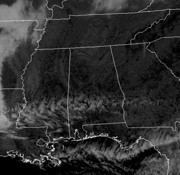
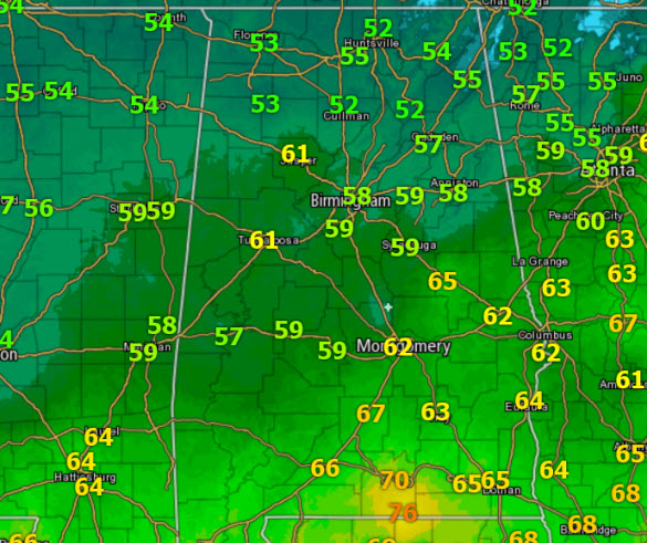
SUN-FILLED SATURDAY: Plenty of sunshine today, but it is cooler for us all. A cool northwest wind continues to blow and that is making it feel cooler as well. Temperatures this afternoon are ranging from the upper 50s to lower 60s.
COLD TONIGHT: The clear sky tonight will allow our temperatures to settle into the upper 20s and lower 30s for all of us in Central Alabama. That means we are expecting a morning freeze throughout North/Central Alabama.
SUNNY SUNDAY: After the morning chill, we will once again see more sun than clouds, and highs will be able to climb a few degrees warmer and we should see mid-60s through out North/Central Alabama tomorrow. Late tomorrow, our winds will begin to shift out of the south and that will start to transport moisture north out of the Gulf.
SEVERAL ROUNDS OF RAIN AHEAD: Finally, the stuff what we have been needing, RAIN, will return in earnest to Alabama. As we start the new work week, we are in store for multiple rounds of rain. A dynamic storm system will be lifting across the Plains Sunday and Monday, and will swing a front into the Southeast. This frontal boundary, along with a secondary area of low pressure that lifts north out of the Gulf will give us best chances of rain we have seen since summer.
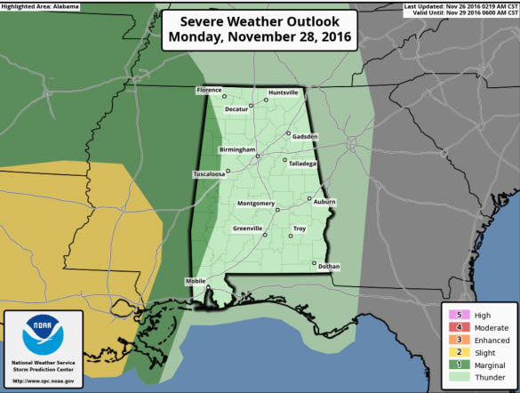
Monday will be a mild/breezy day with rising dew points; the high will be in the low 70s. The first round of rain and storms will push across the Mississippi Valley and be approaching the western portions of the state by mid-afternoon and into Monday night. We will need to monitor this system for severe weather potential, although at the moment it looks like the surface low will be too far north for a classic severe weather event for Alabama, however, a very strong the wind field will be in place, and with the higher dew points returning, we are going to have to watch everything carefully. As of today, no severe weather risk has been issued of Central Alabama, but the SPC has a “marginal risk” into portions of West Alabama, but this is just a small sliver of the state, along and west of U.S. Hwy 43 from Muscle Shoals to Mobile.
As the line of storms moves into the state a few strong storms are possible, but the line will be weakening as it pushes east through the nighttime hours. Damaging winds look to be the main threat with any of the stronger storms. Ahead of this line, a few showers could break out Monday during the day across the state as moisture increases on the back of a strong low level jet stream out of the Gulf of Mexico.
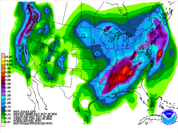
TUESDAY/WEDNESDAY: We should see a lull in the action as the best dynamics lift well north of the state, but the frontal boundary should stall across Central Alabama. At this time, we expect the rain to diminish during the day Tuesday, with only a few scattered showers possible. Late Tuesday night and into Wednesday, a wave of low pressure is expected to form on the front and lift across Alabama. This low is expected to cause rain to surge northward again. Severe weather is not expected, but of course that all depends on the track of the low, and some strong storms look possible for South Alabama, and we will be monitoring this low as well. The best news is that we are going to see rain Monday and Monday night, then perhaps an even better rain event Tuesday night and Wednesday, and by the time the rain begins to wind down Wednesday night, much of North/Central Alabama should have received 2-3 inches of rain, or maybe even more in spots…Just what the doctor ordered…We still need a lot more rain to bust the drought, but this should be a good start.
Category: Alabama's Weather
About the Author (Author Profile)
Macon, Georgia Television Chief Meteorologist, Birmingham native, and long time Contributor on AlabamaWX. Stormchaser. I did not choose Weather, it chose Me. College Football Fanatic. @Ryan_StinnetSubscribe
If you enjoyed this article, subscribe to receive more just like it.


