

A Brief Update For Tonight’s Weather
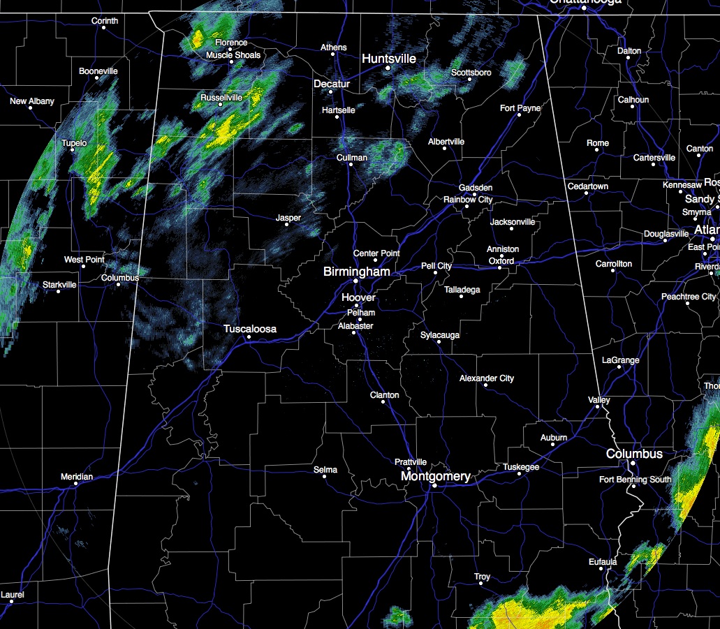
Well there is two bits of good news for tonight’s weather. The first good news is that we will receive even more beneficial rainfall to help bring our deficits down. Even though there is a lull in the rainfall across much of the area at this moment, more rain is expected to move in from the west and southwest.
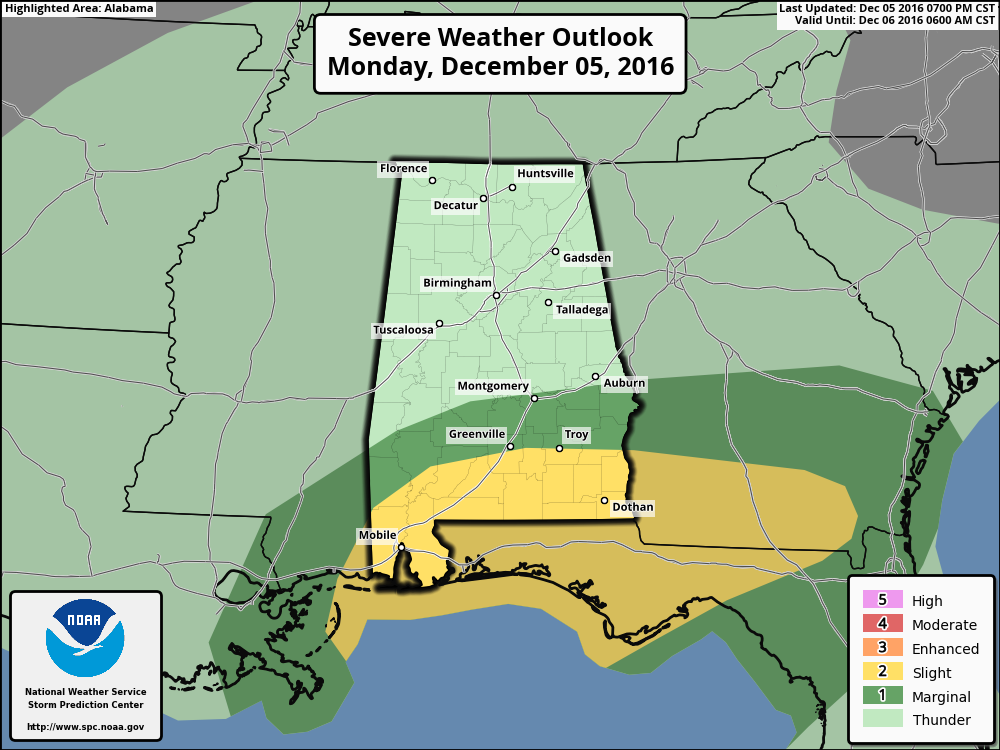
The second bit of good news is that the SPC has cut the risk areas down a bit from earlier today. Only the southern parts of Barbour, Bullock, and Pike Counties in the southeastern corner of the area remain in the “Slight Risk” for severe storms, with locations in our area south of a line from Auburn to Montgomery to just south of Demopolis in the “Marginal Risk.”
The boundary that is expected to move north as a warm front has not started its move as of yet. With that staying in place, that has kept the convection down near the Gulf Coast, and has allowed temperatures and dew points north of that boundary to be way lower than expected, especially with the amount of precipitation that has fallen already in Central Alabama. There still may be a few thunderstorms with moderate to heavy rainfall, but for nearly the entire Central Alabama area, there will be no severe weather threat through the rest of the evening and the overnight hours.
So bring on the rain, and a few claps of thunder. That will only help me sleep better.
Category: Alabama's Weather, Severe Weather
About the Author (Author Profile)
Scott Martin is an operational meteorologist, professional graphic artist, musician, husband, and father. Not only is Scott a member of the National Weather Association, but he is also the Central Alabama Chapter of the NWA president. Scott is also the co-founder of Racecast Weather, which provides forecasts for many racing series across the USA. He also supplies forecasts for the BassMaster Elite Series events including the BassMaster Classic.Subscribe
If you enjoyed this article, subscribe to receive more just like it.


