

Central Alabama Weather Update At 2:00 PM

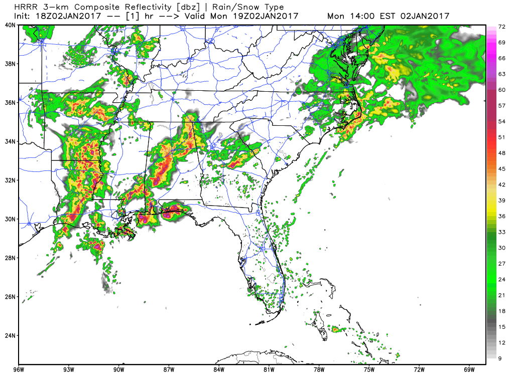
Most of the rain and thunderstorm activity at this time is south of the I-59 and I-20/59 corridors, with the most active storms in our area stretching from Sylacauga to Clanton to Selma. No watches or warnings are in effect for anyone in Central Alabama, as the Tornado Watch that was in effect for Marengo and Sumter counties was cancelled due to the cool and more stable air that is currently in place from the rainfall so far. Tremendous rain continues to fall with the potential for flooding over parts of east, central, and southwest Alabama.
The most active weather at this time is occurring over the southern parts of the state, where a Severe Thunderstorm Warning has been issued for Northeastern Conecuh, Monroe, Southeastern Wilcox, and Butler County until 2:30 PM CST for severe thunderstorms located along a line extending from near Pine Apple to 7 miles southeast of Peterman, moving northeast at 25 mph.
Back to our west and southwest, a line of severe thunderstorms are making their way through the eastern parts of Louisiana and into the southwestern parts of Mississippi. Multiple severe thunderstorm warnings are in effect for the line stretching from Yazoo City to Jackson to McComb to Baton Rouge. The line is moving to the northeast and will probably enter the western counties of the state by the 4-6PM time frame.
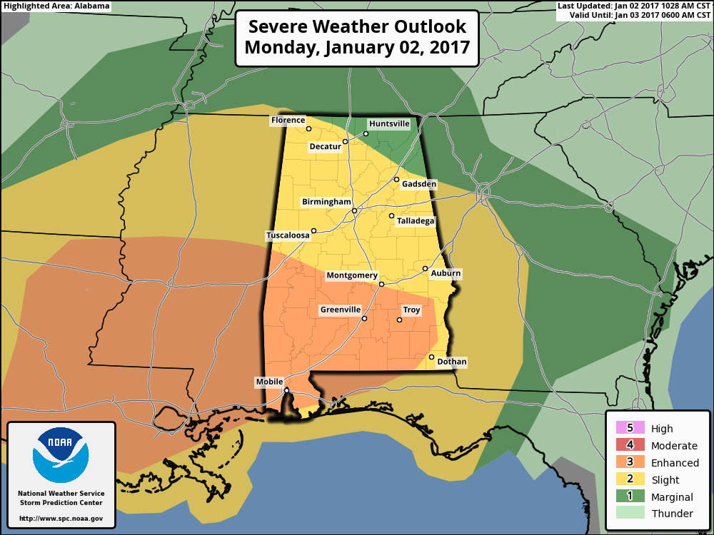
The risk for severe weather for now through the remainder of the afternoon hours will be confined to the southeastern corner of Central Alabama (south of the I-85 corridor). A few strong storms could be possible north of that, but unlikely.
A second wave for severe weather moves in later this evening starting around the 4-6PM time frame and will last until around 3AM. Severe storms are possible throughout the entire Central Alabama area, but the best chance for those will be in the southern parts of the area and extending into South Alabama. Damaging winds, hail, and a few tornadoes are more likely for these areas, but are possible as far north as I-20.
Category: Alabama's Weather, Severe Weather
About the Author (Author Profile)
Scott Martin is an operational meteorologist, professional graphic artist, musician, husband, and father. Not only is Scott a member of the National Weather Association, but he is also the Central Alabama Chapter of the NWA president. Scott is also the co-founder of Racecast Weather, which provides forecasts for many racing series across the USA. He also supplies forecasts for the BassMaster Elite Series events including the BassMaster Classic.Subscribe
If you enjoyed this article, subscribe to receive more just like it.


