

Rain and Storms Pushing East
A band of rain and thunderstorms continues pushing east across Central Alabama this evening.
At 635 p.mm. it extends from Fort Payne to Pell City to west of Talladega to west of Rockford and west of Prattsville this into Southwest Alabama.
The heaviest weather is over southern Talladea County extending into western Coosa County into Autauga County.
Further southwest, a severe thunderstorm warning is in effect for parts of Wilcox County.
So far, no warnings in the NWS Birmingham county warning area, which is great news. There is still a small chance of severe weather ahead of the main line of storms.
Here is the radar reflectivity on the left and rainfall that has fallen on the right.
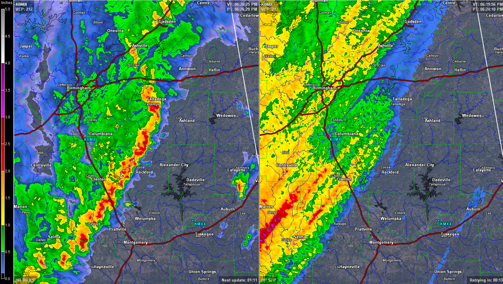
Beneficial rains are falling. I have picked up 1.60 inches here in Vestavia. Only 1.08 inches of ran through 6 p.m. at the Birmingham Airport but it was continuing to rain.
There is an areal flood advisory, less serious than a flood warning, for parts of Chilton County where 1.5-2 inches of rain has fallen with more rain coming. Some minor flooding will occur there.
Rain is continuous back into Mississippi, back the back edge is coming over the border near Meridian.
Rain will end from the southwest over the next 3-4 hours. It should end in Birmingham by 11 p.m.
New forecast data indicates that between 1.5-2.5 inches of rain will fall across much of Central Alabama between now and Monday morning. Lesser amounts are expected along the Alabama/Mississippi border closer to 1-1.25 inches.
Severe weather is still a significant threat for the weekend. Stay tuned.
Category: Alabama's Weather
About the Author (Author Profile)
Bill Murray is the President of The Weather Factory. He is the site's official weather historian and a weekend forecaster. He also anchors the site's severe weather coverage. Bill Murray is the proud holder of National Weather Association Digital Seal #0001 @wxhistorianSubscribe
If you enjoyed this article, subscribe to receive more just like it.


