

PDS Tornado Watch Issued For Southeastern Counties In The Area Until 7:00 PM
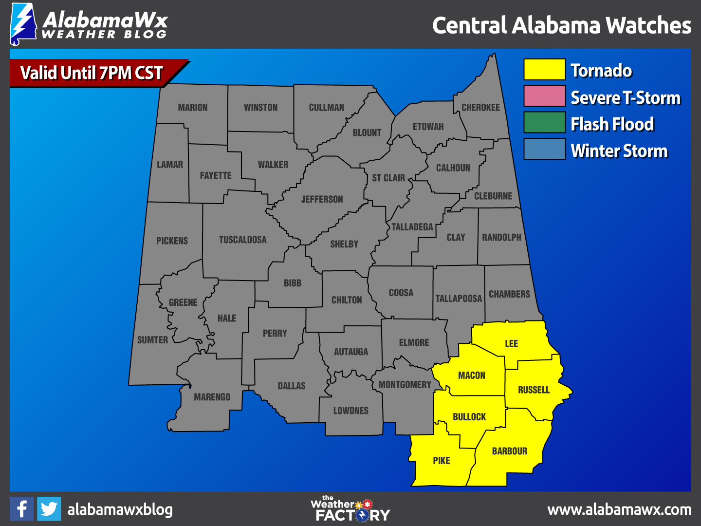
The National Weather Service has issued a PDS Tornado Watch until 7:00 PM CST for Lee, Macon, Russell, Barbour, Bullock, and Pike counties. This includes the cities of Auburn, Eufaula, Opelika, Phenix City, Troy, Tuskegee, and Union Springs.
THIS IS A PARTICULARLY DANGEROUS SITUATION
••• Primary threats include
Several tornadoes and a few intense tornadoes likely.
Widespread damaging winds and scattered significant gusts to 80 MPH likely.
Widespread large hail and scattered very large hail events to 2 inches in diameter likely.
An outbreak of severe storms and tornadoes is expected to unfold over the watch area this afternoon. Storms currently over AL and the FL panhandle will track rapidly northeastward, posing a risk of long-track significant tornadoes and widespread damaging winds.
Category: Alabama's Weather, Current Warnings, Severe Weather
About the Author (Author Profile)
Scott Martin is an operational meteorologist, professional graphic artist, musician, husband, and father. Not only is Scott a member of the National Weather Association, but he is also the Central Alabama Chapter of the NWA president. Scott is also the co-founder of Racecast Weather, which provides forecasts for many racing series across the USA. He also supplies forecasts for the BassMaster Elite Series events including the BassMaster Classic.Subscribe
If you enjoyed this article, subscribe to receive more just like it.


