This Week’s Meteorology 101 from Professor Peters: Wall Clouds
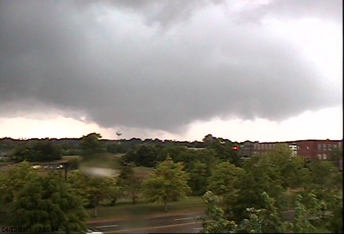
This wall cloud was captured from a Starkville MS skycam on April 20, 2011.
In the Southeast US the tornado season has already begun. Many of the Southeast US states consider March, April, and May to be their primary severe weather season with emphasis on tornadoes. During storm spotter training, weather enthusiasts are introduced to the term wall cloud.
A wall cloud is a fairly large, localized, persistent lowering of the cloud base of a cumulonimbus cloud and this is an area where tornadoes are likely to be seen. Often times, prior to being able to see the actual tornado itself, the wall cloud will show signs of rotation which is often seen in ragged clouds of the wall cloud or in clouds moving into the wall cloud. This rotation within the wall cloud is an indication of the existence of a mesocyclone or the rotation of the updraft.
Wall clouds form as warm, moist air rises into the base of the thunderstorm in the area of the strongest updraft. As the air is entrained the air temperature of the air will drop and the dew point increases resulting in the rapid condensation of clouds and thus this relatively lower base under the primary updraft.
There is a problem, though. Not every wall cloud will result in a tornado, and not every tornado will necessarily have a wall cloud. The wall cloud is one potential indicator of tornado formation that storm spotters are trained to look for.
It’s also important for storm spotters to watch for the telltale rotation of the clouds in the wall cloud. The presence of rotation in the wall cloud does not insure a tornado will occur, but the probability of a tornado is definitely higher when rotation and the mesocyclone are present.
A serious job for storm spotters is identifying rotation within the wall cloud and not simply translation of the clouds. Thunderstorms move so clouds in the cloud base will move with the thunderstorm – this is translation. Rotation is not the simple movement of the thunderstorm but the circular pattern of cloud movement and often hard to identify.
No one ever said that nature would make it easy for meteorologists or storm spotters.
If you have a question about the weather, drop an email to question at weather brains dot com.
Category: ALL POSTS, Met 101/Weather History
About the Author (Author Profile)
Brian Peters is one of the television meteorologists at ABC3340 in Birmingham and a retired NWS Warning Coordination Meteorologist. He handles the weekend Weather Xtreme Videos and forecast discussion and is the Webmaster for the popular WeatherBrains podcast.Subscribe
If you enjoyed this article, subscribe to receive more just like it.


