

Severe T-Storm Warning Issued for Parts of Jackson, Madison, and Limestone Counties Until 6:00PM
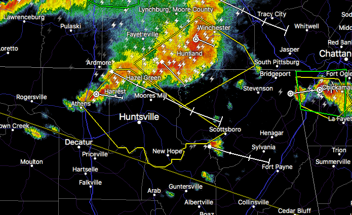
The National Weather Service in Huntsville Alabama has issued a
* Severe Thunderstorm Warning for…
West central Jackson County in northeastern Alabama…
Madison County in north central Alabama…
East central Limestone County in north central Alabama…
* Until 600 PM CDT
* At 516 PM CDT, a severe thunderstorm was located near Harvest, or 8
miles east of Athens, moving southeast at 50 mph.
HAZARD…60 mph wind gusts and quarter size hail.
SOURCE…Radar indicated.
IMPACT…Hail damage to vehicles is expected. Expect wind damage
to roofs, siding, and trees.
* Locations impacted include…
Huntsville, Madison, Athens, Scottsboro, Moores Mill,
Meridianville, Redstone Arsenal, Hazel Green, Owens Cross Roads and
Gurley.
Category: ALL POSTS, Archived Warnings
About the Author (Author Profile)
Scott Martin is an operational meteorologist, professional graphic artist, musician, husband, and father. Not only is Scott a member of the National Weather Association, but he is also the Central Alabama Chapter of the NWA president. Scott is also the co-founder of Racecast Weather, which provides forecasts for many racing series across the USA. He also supplies forecasts for the BassMaster Elite Series events including the BassMaster Classic.Subscribe
If you enjoyed this article, subscribe to receive more just like it.


