

Midday Update: Watching the Radar
Here is the latest convective outlook from the SPC. As you can see, the SPC has trimmed back the severe weather risk areas. The “slight risk” area continues to be confined to areas along and west of Interstate 65, while the “marginal risk” covers much of the rest of the state.
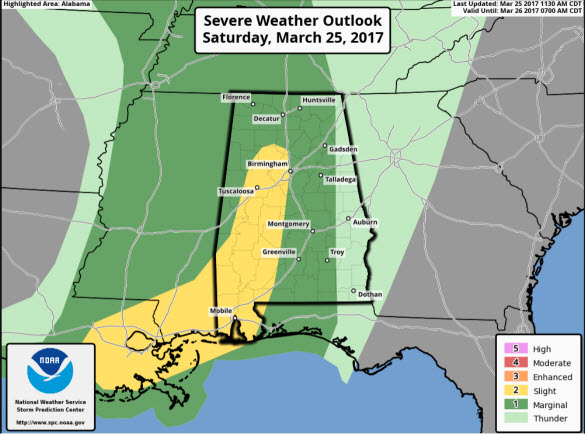
Within these risk areas, the threat of a few strong to severe storms will continue as we move through the afternoon and evening hours. The main threat with some of the stronger storms will be damaging wind gusts, hail, and frequent lightning. The tornado threat is very low, but not zero. Between now and about 6PM this evening, is when if any severe storms will be possible.
The main dynamics are farther north this afternoon, which is going to limit the severe weather threat, but we want to urge everyone to stay weather aware as we continue through our Saturday afternoon, as the threat of a few possible severe storms remains. Of course, when thunder roars, go indoors!
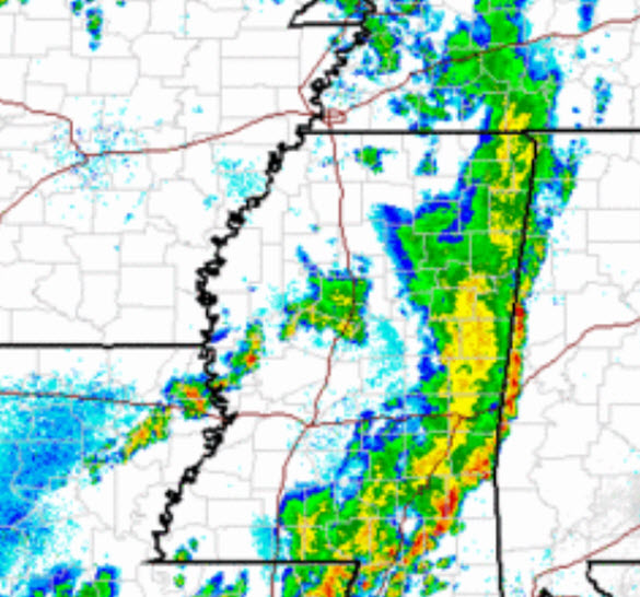
Latest look of the radar shows a thin line of storms moving into and through western portions of the state. This band of storms will continue its eastward track through the state. None of these storms are currently severe, but once again they are producing lightning and brief downpours. As the storms are approaching the clouds are very ominous looking. They should be moving into the Tuscaloosa area within the hour, pushing through the Birmingham Metro between 1-3PM, then towards the Anniston/Gadsden areas later this afternoon.
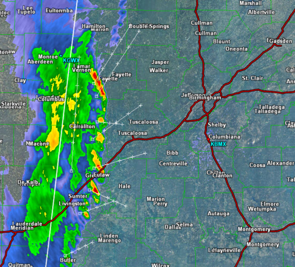
Back to the west, we are watching additional showers and storms developing across Central Mississippi behind this initial line, and we are going to watch these as well, as they remain in a “marginal risk” area. We could see these storms move into Alabama, but for these storms to maintain any threat of severity, the atmosphere will need to recover behind this first line and that does not look to happen.
Category: Alabama's Weather, ALL POSTS
About the Author (Author Profile)
Macon, Georgia Television Chief Meteorologist, Birmingham native, and long time Contributor on AlabamaWX. Stormchaser. I did not choose Weather, it chose Me. College Football Fanatic. @Ryan_StinnetSubscribe
If you enjoyed this article, subscribe to receive more just like it.


