

Strong Storms Approaching Parts Of Shelby, St. Clair, & Talladega Counties
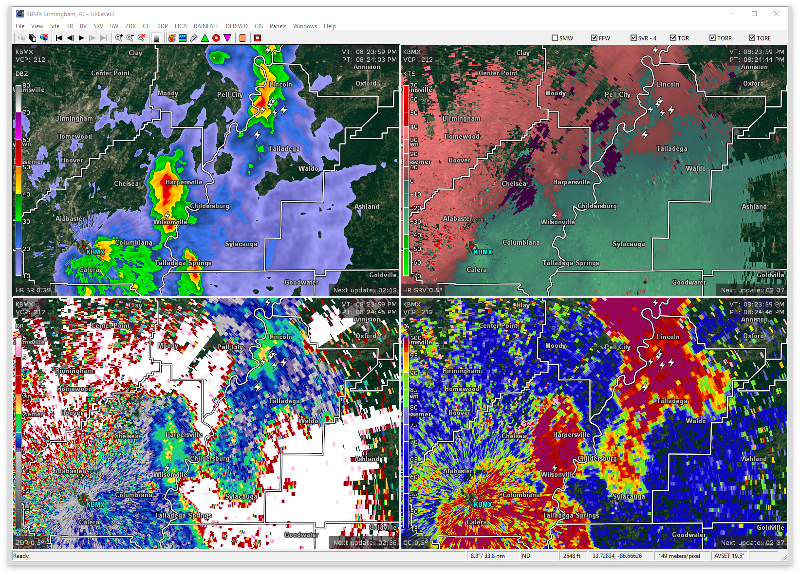
At 822 PM CDT, Doppler radar was tracking a strong thunderstorm over Westover, or 8 miles north of Wilsonville, moving northeast at 50 mph. Wind gusts up to 50 mph will be possible with this storm.
Therefore, a Significant weather Advisory has been issued for West-Central Talladega, Northeastern Shelby, and South-Central St. Clair counties until 9:00PM.
Locations in the path are Talladega, Pell City, Chelsea, Childersburg, Wilsonville, Vincent, Harpersville, Westover, Alpine Bay Resort, Alpine, Logan Martin Lake, Vandiver, Coosa Island, Logan Martin Dam, Country Club Estates, St. Clair County Airport, Sterrett, Gaston Steam Plant, Cropwell and Howells Cove.
Torrential rainfall is also occurring with this storm, and may lead to localized flooding. Do not drive your vehicle through flooded roadways. Frequent cloud to ground lightning is occurring with this storm. Lightning can strike 10 miles away from a thunderstorm. Seek a safe shelter inside a building or vehicle.
Category: ALL POSTS, Severe Weather
About the Author (Author Profile)
Scott Martin is an operational meteorologist, professional graphic artist, musician, husband, and father. Not only is Scott a member of the National Weather Association, but he is also the Central Alabama Chapter of the NWA president. Scott is also the co-founder of Racecast Weather, which provides forecasts for many racing series across the USA. He also supplies forecasts for the BassMaster Elite Series events including the BassMaster Classic.Subscribe
If you enjoyed this article, subscribe to receive more just like it.


