

Severe Thunderstorm Warning Expired For Parts Of Greene County
…THE SEVERE THUNDERSTORM WARNING FOR EAST CENTRAL GREENE COUNTY
WILL EXPIRE AT 115 AM CDT…
The storm which prompted the warning has weakened below severe
limits, and has exited the warned area. Therefore, the warning will
be allowed to expire.
A severe thunderstorm watch remains in effect until 500 AM CDT for
west central Alabama.
Severe Thunderstorm Warning Continues For Parts Of Greene County Until 1:15AM
Apr 27th @ 12:33 am

…A SEVERE THUNDERSTORM WARNING REMAINS IN EFFECT UNTIL 115 AM CDT FOR EAST CENTRAL GREENE COUNTY… At 1255 AM CDT, a severe thunderstorm was located over Eutaw, moving east at 45 mph.
HAZARD…60 mph wind gusts and quarter size hail.
SOURCE…Radar indicated.
IMPACT…Hail damage to vehicles is expected. Expect wind damage to roofs, siding, and trees. Locations impacted include… Eutaw, Walden Quarters, I 20 Rest Area Near Eutaw and Eutaw Municipal Airport.
Severe Thunderstorm Warning Continues For Parts Of Greene County Until 1:15AM
Apr 27th @ 12:33 am

…A SEVERE THUNDERSTORM WARNING REMAINS IN EFFECT UNTIL 115 AM CDT FOR CENTRAL GREENE COUNTY… At 1244 AM CDT, a severe thunderstorm was located over Allison, or near Eutaw, moving east at 50 mph.
HAZARD…60 mph wind gusts and quarter size hail.
SOURCE…Radar indicated.
IMPACT…Hail damage to vehicles is expected. Expect wind damage to roofs, siding, and trees. Locations impacted include… Eutaw, Boligee, Knoxville, Allison, Walden Quarters, Five Points Intersection, New Mount Hebron, I 20 Rest Area Near Eutaw, Eutaw Municipal Airport and Clinton.
Severe Thunderstorm Warning Issued For Parts Of Greene County Until 1:15AM
Apr 27th @ 12:33 am
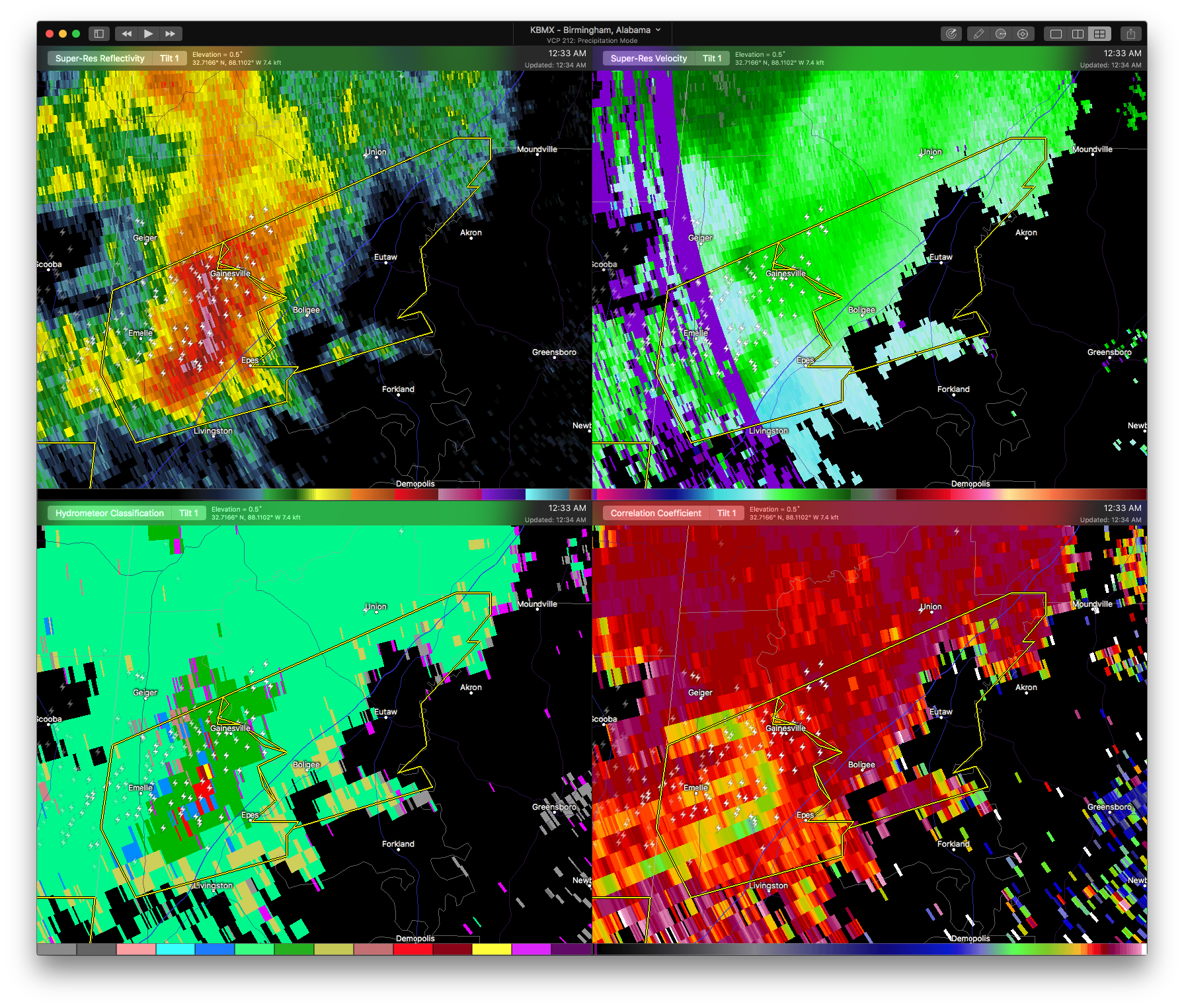

The National Weather Service in Birmingham has issued a
* Severe Thunderstorm Warning for…
Central Greene County in west central Alabama…
* Until 115 AM CDT
* At 1232 AM CDT, a severe thunderstorm was located near Gainesville, or 11 miles north of Livingston, moving east at 50 mph.
HAZARD…60 mph wind gusts and quarter size hail.
SOURCE…Radar indicated.
IMPACT…Hail damage to vehicles is expected. Expect wind damage to roofs, siding, and trees.
* Locations impacted include…
Eutaw, Boligee, Epes, Knoxville, Allison, Walden Quarters, Five
Points Intersection, New Mount Hebron, I 20 Rest Area Near Eutaw, Eutaw Municipal Airport and Clinton.
Category: ALL POSTS, Archived Warnings
About the Author (Author Profile)
Subscribe
If you enjoyed this article, subscribe to receive more just like it.


