

A Quick Check On Alabama’s Weather Situation At 10:45PM
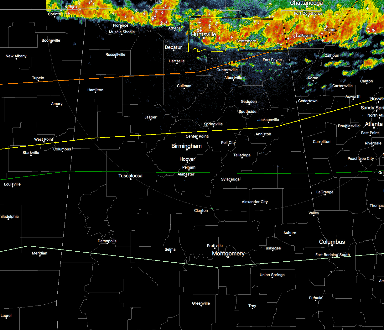
A line of strong to severe storms have already moved into the northern parts of that state at the moment, but an even yet stronger line will be moving in from the northwest later into the overnight and early morning hours. We currently have a severe thunderstorm warning for the northeast corner of the state, including all of Jackson and Madison counties, along with the northeastern part of Dekalb County, until 11:00PM CDT. These storms are pushing to the east-southeast at close to 40 MPH.

There is another smaller line within this whole broken line of storms that is currently pushing across the Mississippi River in Tennessee that will probably be a little bit stronger than this first line moving through now. These will probably make it into the northern part of the state by the 2AM hour or just a little bit earlier. The main threats from this line of storms will be mainly from damaging wind gusts of 60 MPH or more. The tornado threat is low with this line, but not zero, so an isolated spin-up or two could be possible.
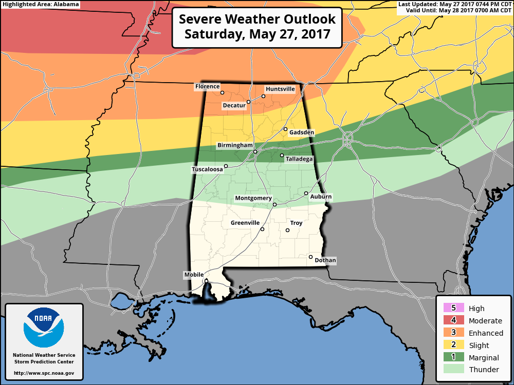
Latest update from the SPC has the northern part of the state north of a line from Hackleburg to Eva to Valley Head in an Enhanced Risk for severe storms, with the area south of there to a line from Belk to Mount Olive to Weaver in a Slight Risk. Just below that, there is a Marginal Risk up to a line from Gordo to Helena to Wedowee.
Category: Alabama's Weather, ALL POSTS
About the Author (Author Profile)
Scott Martin is an operational meteorologist, professional graphic artist, musician, husband, and father. Not only is Scott a member of the National Weather Association, but he is also the Central Alabama Chapter of the NWA president. Scott is also the co-founder of Racecast Weather, which provides forecasts for many racing series across the USA. He also supplies forecasts for the BassMaster Elite Series events including the BassMaster Classic.Subscribe
If you enjoyed this article, subscribe to receive more just like it.


