

Severe Thunderstorm Watch Likely For The Northern Parts of Central Alabama
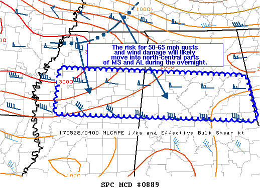
SUMMARY…The risk for scattered 50-65 mph gusts and wind damage will likely move into north-central parts of MS and AL during the overnight. The greatest severe-gust risk will probably concentrate over MS and the adjacent counties of AL.
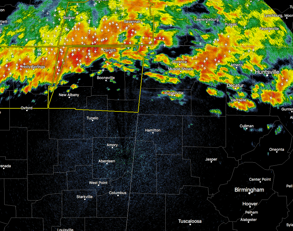
DISCUSSION…A convective line moving southeast at just above 60 MPH along the TN/MS border. A 60 MPH measured gust was observed at Memphis at with passage of the gust front with the more intense line segment oriented in a southwest-northeast direction over the greater Memphis and southwestern TN area. This portion of the convective line is more favorably oriented with the mid-level flow. Farther east over northern AL, a west-northwest to east-southeast cold pool orientation appears less favorable for severe gusts.
Objective analysis indicates mean layer CAPE ranging from 3000 J/kg over northern MS to around 2000 J/kg over north-central AL. Low-level southerlies veering to strong mid-level westerly flow is resulting in 50-60 kt effective shear which will support storm organization as the convective line extending from the Memphis area east through northeast AL moves southeast overnight. As such, it appears the risk for wind damage and isolated to scattered severe gusts will concentrate over the MS portion of the discussion area and perhaps the western-most counties of AL.
Category: Alabama's Weather, ALL POSTS
About the Author (Author Profile)
Scott Martin is an operational meteorologist, professional graphic artist, musician, husband, and father. Not only is Scott a member of the National Weather Association, but he is also the Central Alabama Chapter of the NWA president. Scott is also the co-founder of Racecast Weather, which provides forecasts for many racing series across the USA. He also supplies forecasts for the BassMaster Elite Series events including the BassMaster Classic.Subscribe
If you enjoyed this article, subscribe to receive more just like it.


