

Severe Thunderstorm Warning Expired For Parts Of Calhoun And Cherokee Counties
…THE SEVERE THUNDERSTORM WARNING FOR EASTERN CALHOUN AND
SOUTHEASTERN CHEROKEE COUNTIES WILL EXPIRE AT 415 AM CDT…
The storms which prompted the warning have moved out of the area.
Therefore the warning will be allowed to expire.
Severe Thunderstorm Warning Continues For Parts Of Calhoun And Cherokee Counties Until 4:15AM
May 28th @ 3:19 am

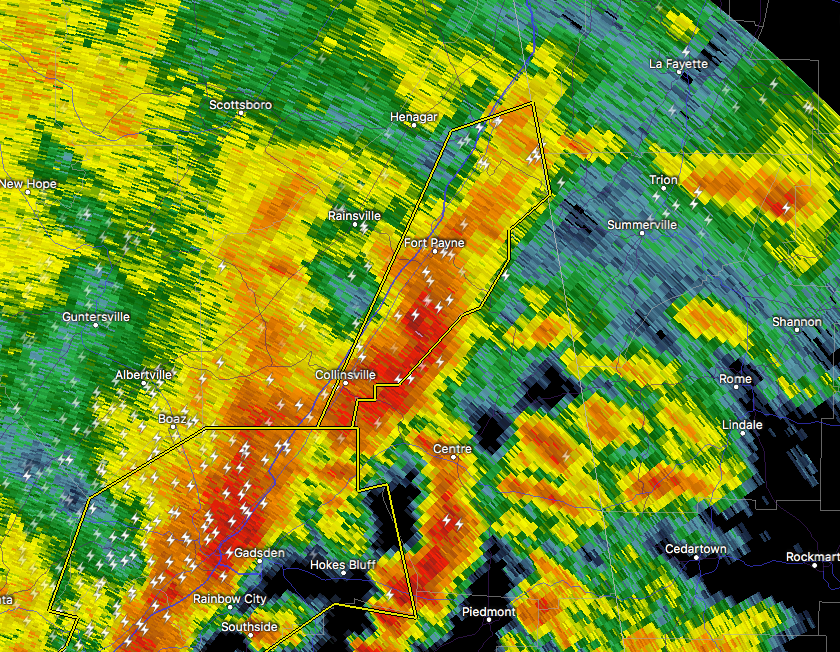
…A SEVERE THUNDERSTORM WARNING REMAINS IN EFFECT UNTIL 415 AM CDT FOR EASTERN CALHOUN AND SOUTHEASTERN CHEROKEE COUNTIES… At 359 AM CDT, severe thunderstorms were located along a line extending from near Oxford to near Cave Spring, moving east at 45 mph.
HAZARD…60 mph wind gusts.
SOURCE…Radar indicated.
IMPACT…Expect damage to roofs, siding, and trees. Locations impacted include… Anniston, Oxford, Forney, Pleasant Gap, Dearmanville, Choccolocco and Spring Garden.
Severe Thunderstorm Warning Continues For Parts Of Calhoun And Cherokee Counties Until 4:15AM
May 28th @ 3:19 am

…A SEVERE THUNDERSTORM WARNING REMAINS IN EFFECT UNTIL 415 AM CDT FOR CALHOUN AND SOUTHEASTERN CHEROKEE COUNTIES… At 343 AM CDT, severe thunderstorms were located along a line extending from near Bynum to Moshat, moving east at 45 mph.
HAZARD…60 mph wind gusts.
SOURCE…Radar indicated.
IMPACT…Expect damage to roofs, siding, and trees. Locations impacted include… Anniston, Oxford, Jacksonville, Piedmont, Centre, Cobb Town, Forney, West End-Cobb Town, Fort McClellan, Centre Municipal Airport, Saks, Weaver, Hobson City, Tennala, Anniston Regional Airport, Pleasant Gap, Blue Mountain, Alexandria, Jacksonville State University and Oxford Lake.
Severe Thunderstorm Warning Issued For Parts Of Calhoun And Cherokee Counties Until 4:15AM
May 28th @ 3:19 am

The National Weather Service in Birmingham has issued a
* Severe Thunderstorm Warning for…
Calhoun County in east central Alabama…
Cherokee County in northeastern Alabama…
* Until 415 AM CDT
* At 319 AM CDT, severe thunderstorms were located along a line extending from 6 miles east of Odenville to Tabor Road, moving east at 45 mph.
HAZARD…60 mph wind gusts.
SOURCE…Radar indicated.
IMPACT…Expect damage to roofs, siding, and trees.
* Locations impacted include…
Anniston, Oxford, Jacksonville, Piedmont, Centre, Cobb Town, Forney, West End-Cobb Town, Fort McClellan, Centre Municipal
Airport, Saks, Glencoe, Weaver, Ohatchee, Leesburg, Hobson City, Tennala, Cherokee Rock Village, Anniston Regional Airport and
Pleasant Gap.
Category: ALL POSTS, Archived Warnings
About the Author (Author Profile)
Subscribe
If you enjoyed this article, subscribe to receive more just like it.


