

Weekend Dry and Warm; Showers Return Next Week
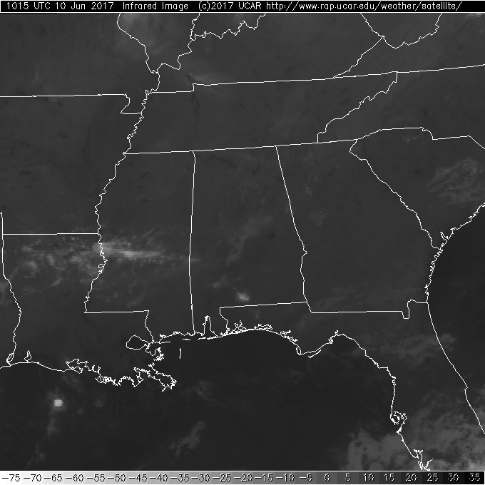
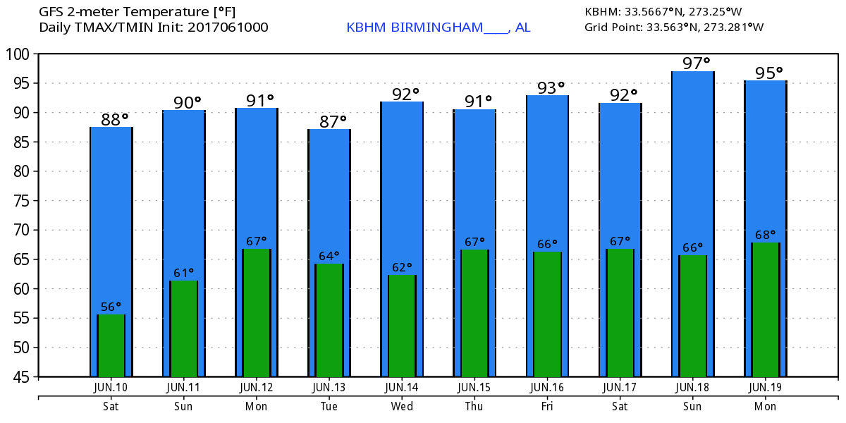
The sky across the Southeast US this morning was mostly clear with just a few patches of mainly mid-level clouds. We can expect to see mostly sunny skies today with highs climbing into the upper 80s for most of us. The upper air pattern for us features a weak upper low over Southeast Texas this morning while weak troughiness over the East Coast will yield to an upper ridge.
Sunday the upper low over the Southeast Texas coast moves ever closer to us, but while moisture levels will be higher on Sunday, I think we will remain essentially rain free with some showers over the Gulf Coast area. Temperatures will hover close to 90 degrees but additional clouds should keep us from the lower 90s.
That pesky upper low weakens even further on Monday, but it is still visible in the upper air pattern, and this upper weakness will assist in bringing fairly widespread showers to the Southeast US for the work week as it slowly migrates eastward. Moisture levels will be high, so the combination of good moisture, afternoon heating, and the upper level weakness should generate a number of showers for the Southeast US for much of the week ahead. So the weather forecast will be somewhat the same each day with scattered showers and highs in the upper 80s.
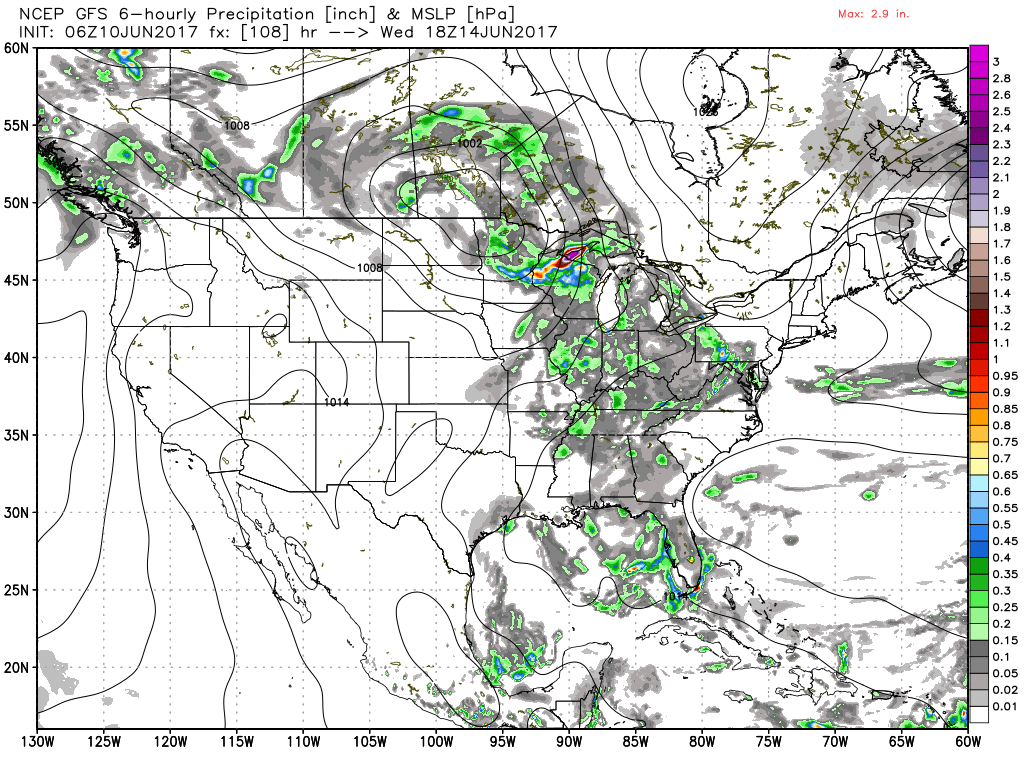
The upper air pattern over the Continental US will consist of a ridge over the eastern US and a strong upper low in the Northwest US on Monday that will move along the US-Canadian border during the week as it rides north of the strong ridging over the eastern US. That ridging breaks down a little toward the end of the week as the upper ridge slides into the Atlantic. So that upper weakness over the Gulf Coast stays in play even into the start of next weekend. As a result of the overall pattern, rainfall amounts are forecast to be around 1 inch. But the rain will come in the form of showers, so unless you are particularly lucky, not everyone will see rain at their location each day.
Severe weather is confined primarily to the western Great Lakes on Day 2 and the western Dakotas on Day 3 and 4. The tropical Atlantic remained quiet while the eastern North Pacific has one small area just offshore from extreme southern Mexico.
Scattered storms are in the forecast along the Gulf Coast, but it won’t be a washout. For a detailed look at the weather from Fort Morgan to Panama City Beach, click here to see the AlabamaWx Beach Forecast Center page. The Beach Forecast is partially underwritten by the support of Brett/Robinson Vacation Rentals in Gulf Shores and Orange Beach. Click here to see Brett/Robinson’s Own Your Summer specials now!
Looking out into voodoo country, the GFS is bullish on the return of the upper ridge around June 19th along with a hint at some Gulf mischief. But the ridge pattern is replaced around the 22nd by a fairly strong trough over the eastern third of the country. This pattern stays with us through the 25th. A pattern like this will mean less heat for us, but the big ridge in the Central US means some heat for that part of the country.
I’ll be heading up to Centre in Cherokee County later this morning to participate in a safety fair there. I’ll also be filling in for Meaghan Thomas on ABC 3340 News at 6 and 10 pm, so be sure to tune in for the latest update on the forecast.
-Brian-
Category: Alabama's Weather, ALL POSTS
About the Author (Author Profile)
Brian Peters is one of the television meteorologists at ABC3340 in Birmingham and a retired NWS Warning Coordination Meteorologist. He handles the weekend Weather Xtreme Videos and forecast discussion and is the Webmaster for the popular WeatherBrains podcast.Subscribe
If you enjoyed this article, subscribe to receive more just like it.


