Cindy Loses Tropical Characteristics, Now Post-Tropical
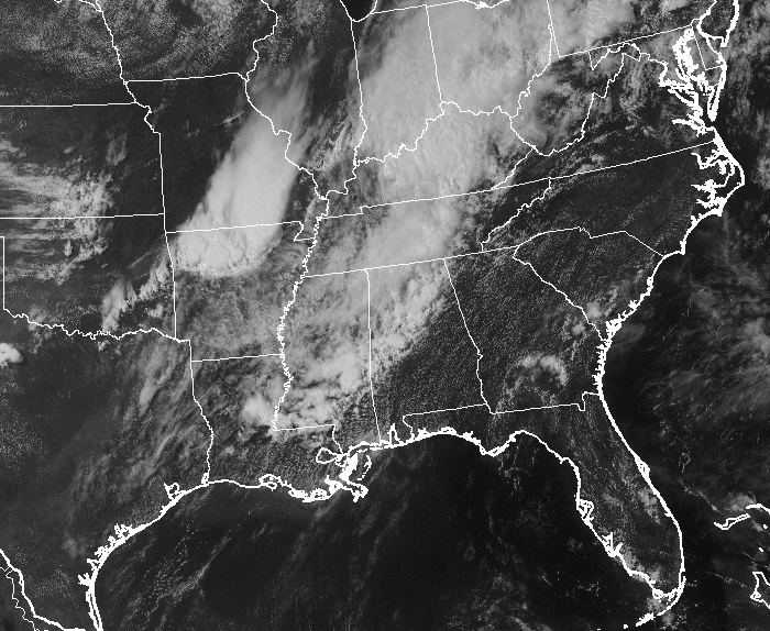
Cindy has completely lost her tropical characteristics and is now classified as Post-Tropical Cyclone Cindy. Even with that being said, the potential for torrential tropical downpours will be spreading east across the Ohio Valley and into Pennsylvania. Severe thunderstorms have produced tornado warnings in Pennsylvania earlier today.
000
Wtnt33 Kwnh 232110
Tcpat3
Post-Tropical Cyclone Cindy Advisory Number 17
NWS Weather Prediction Center College Park Md Al032017
500 Pm Edt Fri Jun 23 2017
…Cindy Loses Tropical Characteristics…Heavy Rain Potential
Spreading Eastward Across The Ohio Valley And Into Western
Pennsylvania As Severe Thunderstorms Form South Of Cindy…
Summary Of 500 Pm Edt…2100 Utc…Information
———————————————–
Location…37.4N 86.1W
About 30 Miles…50 Km…Nnw Of Glasgow Kentucky.
About 90 Miles…150 Km…Wsw Of Lexington/Bluegrass Kentucky.
Maximum Sustained Winds…25 Mph…40 Km/H
Present Movement…Ene Or 75 Degrees At 35 Mph…56 Km/H
Minimum Central Pressure…1002 Mb…29.59 Inches
Watches And Warnings
——————–
Flash Flood Watches Are In Effect For Portions Of The Interior
Southeast…Across The Lower And Mid Mississippi Valleys…And
Into The Tennessee And Ohio Valleys.
Flash Flood Warnings Are In Effect For Portions Of Northern
Alabama…Ohio…And Western Pennsylvania.
For Information Specific To Your Area…Including Possible Watches
And Warnings…Please Monitor Products Issued By Your Local
National Weather Service Office At Www.Weather.Gov.
Discussion And 48-Hour Outlook
——————————
At 500 Pm Edt…2100 Utc…The Center Of Cindy Was Located Near
Latitude 37.4 North…And Longitude 86.1 West. Under Increasing
Vertical Wind Shear…Cindy Has Continued To Lose Tropical
Characteristics This Afternoon And Has Been Declared
Post-Tropical. Surface Observations Indicate That The Low-Level
Center Of Cindy Remains Intact As It Accelerates
East-Northeastward Across Western Kentucky. To The South Of
Cindy…Thunderstorms Continue To Organize Into A Squall Line
Which Extends Down Into Louisiana. Meanwhile…A Cold Front From
The Mid-Section Of The Country Is Quickly Approaching The Eastern
U.S. Post-Tropical Cyclone Cindy Is Expected To Become
Extratropical By Early Saturday As The Fast-Moving Front Merges
With The Remnant Circulation Over The Mid-Atlantic Region. The
Primary Threat With This Storm Will Be Moderate To Heavy
Rain…With Embedded Severe Weather…Moving East Of The Lower And
Mississippi Valley Into The Tennessee And Ohio Valleys Followed By
The Central Appalachians Through Tonight…Before Rapidly Moving
Off The East Coast On Saturday.
Maximum Sustained Winds Are Near 25 Mph…40 Km/H…With Higher
Gusts.
Minimum Central Pressure Is 1002 Mb…29.59 Inches.
Hazards
——-
Rainfall…Tropical Depression Cindy Is Expected To Produce An
Additional 1 To 2 Inches Of Rain…With Locally Higher Amounts Of
3 Inches Possible…From Eastern Kentucky Eastward Into West
Virginia Through Tonight. These Rains Will Continue To Enhance
The Flash Flood Threat Across These Regions. Thunderstorms That
Form To The Southwest Of The Remnants Of Cindy And Ahead Of The
Cold Front Could Trigger More Flooding In The Lower Mississippi
Valley Tonight.
Rainfall Totals
—————
Selected Storm Total Rainfall In Inches Through 2 Pm Edt
…Alabama…
Saraland 6.8 Nnw 8.97
Northport 8.90
Mobile 4.5 Wsw 8.29
Foley 4.5 Se 8.14
Prattville 1 N 6.80
Evergreen 5.97
Greenville 2 Wsw 4.40
Tuscaloosa Muni Arpt 4.35
Excel 3 Ese 4.30
Repton 6 S 4.00
Uriah 8 W 3.90
Pollard 2 N 3.70
Dannelly Field 1 W 3.70
Montgomery Country 2 E 3.60
Montgomery/Dannelly 3.53
Bay Minette 11 N 3.50
…Arkansas…
De Witt 0.2 N 4.86
Camden 8.9 Nne 4.85
Marvell 4.1 W 4.75
White Hall 0.8 Se 4.14
Monticello Airport 3.69
…Florida…
Navarre 2.1 Wnw 10.70
Gonzalez 2.5 Nnw 10.68
Gulf Breeze 7.2 Ene 9.99
Navarre 6.2 E 9.95
Gonzalez 2.1 E 9.60
Pensacola 13.5 Wnw 9.47
Navarre 8.30
Pensacola Rgnl Arpt 8.28
Panama City Beach 0.3 Sw 8.14
Johnsons Beach 3 Nne 8.00
Milton/Whiting Field Nas 6.36
Apalachicola Muni Arpt 5.34
Valparaiso/Eglin Afb 5.16
Crestview/Bob Sikes 5.08
Destin Airport 4.95
Hurlburt Field Aws 4.66
Tyndall Afb/Panama City 4.49
Gonzalez 3 Nnw 3.50
Niceville 2 Se 3.30
Elgin Afb 6 Ne 3.30
…Georgia…
Stephens 4.2 Wsw 7.15
Bishop 3.0 Wnw 7.10
Greensboro 6.2 Wsw 6.96
Starrsville 6.85
Loganville 4.5 Sw 6.41
North Decatur 3.0 Nne 5.99
…Louisiana…
New Orleans 3.6 Sw 10.49
St. Bernard 2.7 E 6.50
Slidell 4.4 E 6.38
Minden 2.2 Ne 6.20
Meraux 0.8 Wnw 5.04
Baton Rouge 3.5 E 4.63
Contraband Bayou 4.52
Sulphur 2 E 4.30
Westlake 4.22
Boothville 4.21
Houma 4 Se 4.10
Lake Charles 1.8 S 4.00
Timberlane 3.80
Chauvin 3 Nne 3.80
Belle Chasse 2 Nne 3.50
Denham Springs 4 Ne 2.60
Baton Rouge 4 E 2.40
Ragley 5 Se 2.10
Ponchatoula 1 Sw 1.70
…Mississippi…
Ocean Springs 3.6 Ese 18.74
Gulfport 2.0 Ne 14.40
Ocean Springs 2 E 12.30
Vancleave 9.5 Wsw 11.34
Biloxi 13.1 Nnw 10.02
Pass Christian 5.0 N 9.84
Gautier 4.9 N 9.78
Long Beach 0.8 Sse 9.59
Waynesboro 5.4 Wnw 9.39
Keesler Afb/Biloxi 8.71
Wiggins 8.50
Pascagoula 5.38
Waynesboro 5 Wnw 4.00
Hattiesburg/Chain Muni Arpt 3.80
Purvis 14 Ese 3.40
Diamondhead 1 E 3.40
Biloxi 13 Nnw 3.40
Ackerman 5 W 3.40
Columbia 3 Nne 3.30
…Tennessee…
Pulaski 8 Ene 1.20
Fayetteville 1 Ssw 1.10
Cornersville 11 Sse 1.00
…Texas…
Mahaw Bayou 5.36
Star Lake 4.76
Sea Rim State Park 4 Wnw 3.96
Sabine Ranch 3.35
Kirbyville 2 Se 2.90
Galveston 6 Ne 2.90
League City 3 Ne 2.50
Broaddus 15 Se 2.50
Kemah 0.2 Wnw 2.30
Beaumont 5 S 2.30
Lumberton 1 Wnw 2.20
Buna 1 N 2.10
Nassau Bay 2 Nnw 1.90
Bafliff 1 Sse 1.90
Next Advisory
————-
Next Advisory Issued At 1100 Pm Edt. Please Refer To Your Local
National Weather Service Office For Further Information On This
Storm.
Category: Alabama's Weather, ALL POSTS
About the Author (Author Profile)
Scott Martin is an operational meteorologist, professional graphic artist, musician, husband, and father. Not only is Scott a member of the National Weather Association, but he is also the Central Alabama Chapter of the NWA president. Scott is also the co-founder of Racecast Weather, which provides forecasts for many racing series across the USA. He also supplies forecasts for the BassMaster Elite Series events including the BassMaster Classic.Subscribe
If you enjoyed this article, subscribe to receive more just like it.


