

A Great Midday Across Central Alabama, But What’s That Up North?
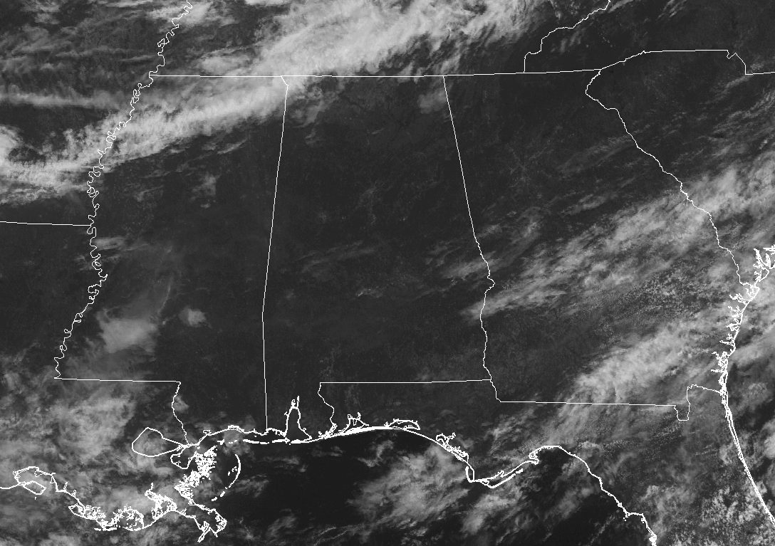
As we approach the midday hour across Central Alabama, we have generally clear skies out there and temperatures are feeling really comfortable at this point. There is a little surprise as we look up towards the northwest corner of the state.
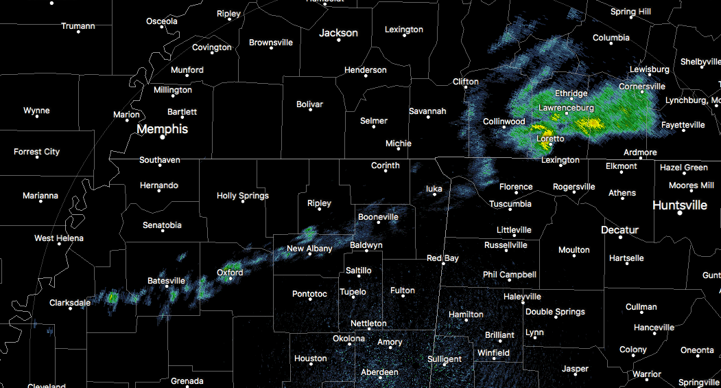
A small, broken line of very light showers are stretching from back in Clarksdale in northwestern Mississippi, through the northwestern tip of the state in Colbert and Lauderdale counties, then exits the state into Tennessee through Iron City to Cornersville. These will continue to dissipate through the next hour or so.
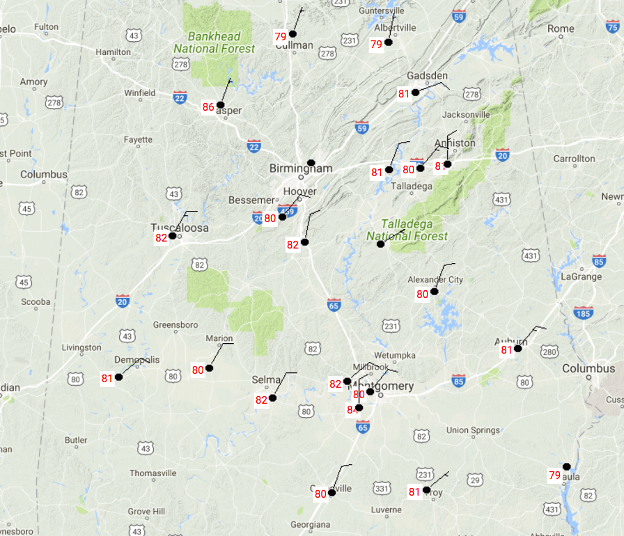
Temperatures from around Central Alabama at this point were running in the upper 70s to the lower 80s. The warm spot is currently at Montgomery at 84 degrees, while Cullman and Eufaula are both tied as the coolest spot at 79 degrees. The good news is that dewpoints are currently in the mid to upper 50s, and along with a northeasterly wind when it blows, makes it actually feel a few degrees cooler.
Skies will generally stay sunny throughout the remainder of the daylight hours, and afternoon highs will get up into the mid to upper 80s. Tonight will be a nice and cool evening for late June in Central Alabama… Skies will be clear with the overnight lows falling into the lower to mid 60s.
Tuesday will be another fantastic day across Central Alabama. Mostly sunny skies with lower humidity levels will make the afternoon highs feel cooler than the mid to upper 80s that will be reached throughout the area.
HEADING TO THE BEACH
A typical week ahead at the beach… About 4-6 hours of sunshine each day, with a chance of showers and thunderstorms. Highs in the lower to mid 80s throughout the week till Saturday. For a detailed look at the weather from Fort Morgan over to Panama City Beach, click here to see the AlabamaWx Beach Forecast Center page.
The Beach Forecast is partially underwritten by the support of Brett/Robinson Vacation Rentals in Gulf Shores and Orange Beach. Click here to see Brett/Robinson’s “Own Your Summer” specials now!
A LOOK AT THE TROPICS
As far as tropical cyclone activity across the Atlantic, Caribbean, and the Gulf of Mexico, all is quiet as of now. No new cyclone development is expected throughout the next 5 days.
TODAY IN WEATHER HISTORY
June 26, 1989 – Thunderstorms produced severe weather from the Central Plains to the Middle Mississippi Valley. There were 129 reports of severe weather during the day and night. Thunderstorms in Kansas produced wind gusts to 90 mph at Liberal, and hail four inches in diameter at Quinter. Thunderstorms in Wisconsin spawned a tornado at Lake Delton injuring four persons. Lightning struck and killed a woman at Junction City, KS, who had gotten out of her car to photograph the lightning.
WEATHERBRAINS
Don’t forget you can listen to our weekly 90 minute netcast anytime on the web, or on iTunes. This is the show all about weather featuring many familiar voices, including our meteorologists here at ABC 33/40. you can watch it live here on Monday nights at 8:30PM CDT.
Category: Alabama's Weather, ALL POSTS
About the Author (Author Profile)
Scott Martin is an operational meteorologist, professional graphic artist, musician, husband, and father. Not only is Scott a member of the National Weather Association, but he is also the Central Alabama Chapter of the NWA president. Scott is also the co-founder of Racecast Weather, which provides forecasts for many racing series across the USA. He also supplies forecasts for the BassMaster Elite Series events including the BassMaster Classic.Subscribe
If you enjoyed this article, subscribe to receive more just like it.


