

Strong Storms Affecting Parts Of The Area At 3:45PM
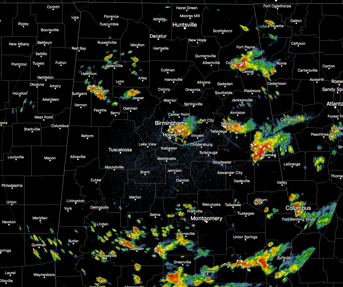
Strong storms are currently occuring across Central Alabama at this time, with the strongest located in the southeastern parts of Jefferson County about to move into Shelby County. NWS Birmingham continues to have a Severe Thunderstorm Warning for this storm as it continues to move to the south-southwest at 5 MPH. The main threat from this storm will be from damaging wind gusts up to 60 MPH, but very heavy rainfall, and dangerous cloud-to-ground lightning is occurring as well. Some pea size hail has been reported falling from this storm as it passed over Mountain Brook.
Other storms have warranted Significant Weather Advisories, especially for the ones over Randolph and Tallapoosa Counties, Dekalb County, and Cherokee County. All of these are moving very slowly at around 5 MPH as well. Once again, torrential downpours and dangerous lightning can be expected with these storms.
Category: Alabama's Weather, ALL POSTS
About the Author (Author Profile)
Scott Martin is an operational meteorologist, professional graphic artist, musician, husband, and father. Not only is Scott a member of the National Weather Association, but he is also the Central Alabama Chapter of the NWA president. Scott is also the co-founder of Racecast Weather, which provides forecasts for many racing series across the USA. He also supplies forecasts for the BassMaster Elite Series events including the BassMaster Classic.Subscribe
If you enjoyed this article, subscribe to receive more just like it.


