

A Few Strong Afternoon Storms
Intense scattered storms continue to impact portions of North and Central Alabama this Alabama with tons of lightning and intense tropical downpours. We’ve had flash flood issues in and around the southern suburbs of the Birmingham Metro and a Flash Flood Warning remains in effect for northwestern Shelby County and South central Jefferson County in Alabama until 415 PM CDT.
Some locations that will experience flooding include Hoover, Vestavia Hills, Bessemer, Homewood, Pelham, Mountain Brook, Helena, Indian Springs Village, Cahaba Heights, Riverchase, Patton Creek, Regions Park Or Hoover Met, Ross Bridge, Bluff Park, The Summit, Riverchase Galleria, Samford University, Meadowbrook and Shannon.
Any storm out there will be capable of producing flash flooding…Never drive through flood waters…TURN AROUND, DON’T DROWN!
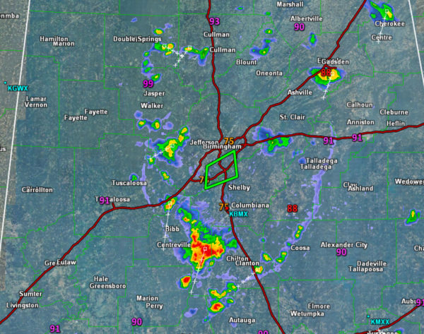
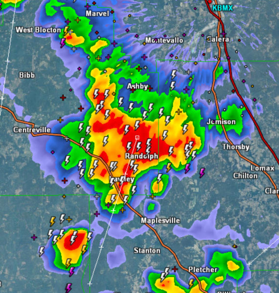
The strongest storm at this time is impacting portions of Bibb and Chilton counties, and is tracking down to the southwest and will be impacting Perry County. Travel along U.S. 82 is not advised at this time as the storm passes by.
Category: Alabama's Weather, ALL POSTS
About the Author (Author Profile)
Macon, Georgia Television Chief Meteorologist, Birmingham native, and long time Contributor on AlabamaWX. Stormchaser. I did not choose Weather, it chose Me. College Football Fanatic. @Ryan_StinnetSubscribe
If you enjoyed this article, subscribe to receive more just like it.


