

A Few Clouds, A Few Showers, And Hot At Midday
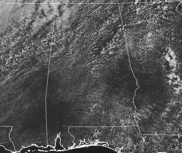
For the northern half of Central Alabama, the day has started off with more clouds than sun, and it continues to be that way at midday. For the southern half of the area, it ranges from mostly clear to partly cloudy.
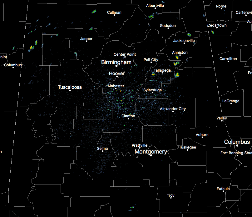
We do have some isolated showers out there across the northern half of the area at this point, while the radar is clear for the southern half of the area. Activity is expected to increase some, but we’re in a more typical summertime pattern for Central Alabama in mid-August, so the risk of any flash flooding will be very low.
Even with the cloud cover over the northern half of Central Alabama, the temperatures at 12:20 PM are not being held back all that much. Mid to upper 80s can be found throughout much of the area at this point, with a few lower 90s in the extreme southern parts of the area. Eufaula is at 92 degrees, while Selma, Troy, and Montgomery are at 90 degrees. The coolest part of the area at this point is up in Haleyville where it is only 82 degrees. Birmingham is currently at 88 degrees.
WEATHER FOR THE REMAINDER OF THE DAY
For the rest of today, we’ll continue to have partly cloudy skies, and scattered showers and thunderstorms will continue to develop during the afternoon hours, with the better chances coming in the northwestern parts of the area. Highs will top out in the lower to mid-90s. Not everyone will see rain, and chances are only in the 30% range for much of Central Alabama, with 40% chance in the northwest.
Later this evening, we’ll have numerous showers and storms move into the western parts of the state at or just before rush hour and will start to weaken and diminish as they progress eastward through Central Alabama. The HRRR has the rain diminished completely by midnight, while the NAM continues to have a few storms progress through the area during the overnight and into the early morning hours on Friday. So I’ll go with scattered showers and thunderstorms will be possible tonight with the better chances in the northern half of the area. Overnight lows will be in the lower to mid-70s.
TOMORROW’S WEATHER
Hot and humid with more sun than clouds, with scattered afternoon and evening showers and thunderstorms. As with summertime convective thunderstorms, a few of these could feature gusty winds and very dangerous cloud-to-ground lightning. I do not believe that we’ll have any flash flooding issues but some heavier storms could cause localized ponding on some surfaces. The better chances will be in the southern half of the area. Friday’s highs will be in the lower to mid-90s.
BEACH FORECAST
For a detailed look at the weather from Fort Morgan over to Panama City Beach, click here to see the AlabamaWx Beach Forecast Center page. The Beach Forecast is partially underwritten by the support of Brett/Robinson Vacation Rentals in Gulf Shores and Orange Beach. Click here to see Brett/Robinson’s Hot Deals now!
ACTIVE TROPICS
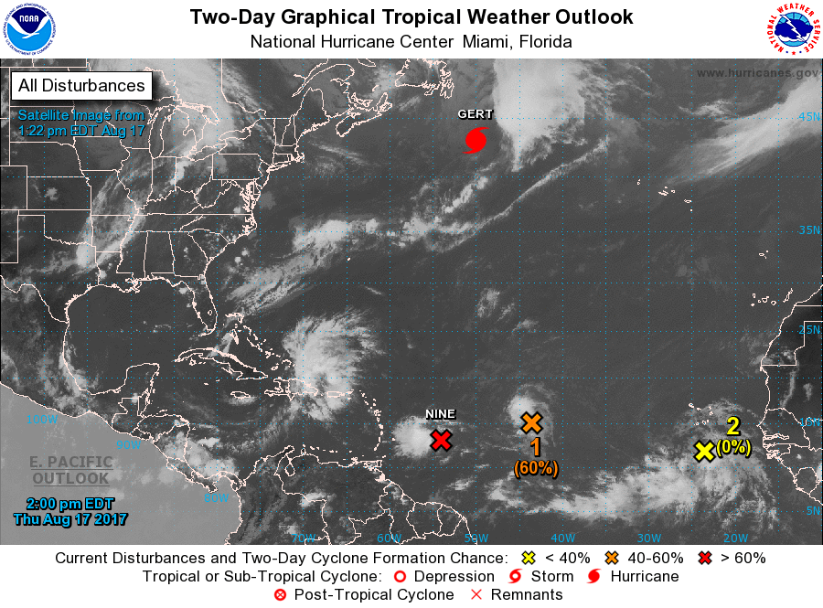
As Hurricane Gert is waving goodbye as she is racing to the northeast, she will become post-tropical later today. We have three more active disturbances making their way across the Atlantic.
The lead disturbance has been designated Potential Tropical Cyclone Nine and should become either a depression or Tropical Storm Harvey later today. Current projections have this one staying well south of the US Mainland and making landfall in Belize on Tuesday as a hurricane.
The second disturbance (Invest 92L) is midway between the African Coast and the Lesser Antilles. It has a 60% of developing into a depression or storm within the next 5 days. We’ll need to keep our eyes on this one as most of the models in the spaghetti plot have this one approaching South Florida and possibly moving into the Gulf Of Mexico early next week.
The third disturbance has a while to go before it becomes a threat to any landmass. It is forecast to gradually strengthen and become a little better organized but only has a 40% chance of developing into a depression or storm within the next 5 days.
Stay up-to-date with the latest posts in the Tropical Weather category on the AlabamaWx Weather Blog home page.
WEATHERBRAINS
Check out the show at www.WeatherBrains.com. You can also subscribe on iTunes. You can watch the show live at live.bigbrainsmedia.com on Monday nights starting at 8:30 PM CDT. You will be able to see the show on the James Spann 24×7 weather channel on cable or directly over the air on the dot 2 feed.
Category: Alabama's Weather, ALL POSTS
About the Author (Author Profile)
Scott Martin is an operational meteorologist, professional graphic artist, musician, husband, and father. Not only is Scott a member of the National Weather Association, but he is also the Central Alabama Chapter of the NWA president. Scott is also the co-founder of Racecast Weather, which provides forecasts for many racing series across the USA. He also supplies forecasts for the BassMaster Elite Series events including the BassMaster Classic.Subscribe
If you enjoyed this article, subscribe to receive more just like it.


