

Severe Weather Risk for Sunday
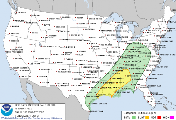
The Storm Prediction Center has continued to keep much of the Deep South under a risk for severe weather tomorrow. A strong storm system will be ejecting out of the Desert Southwest, into the Southern Plains and will be working its way east tomorrow. This a very dynamic system and will be the main reason for the expected severe weather tomorrow. Birmingham, Huntsville, Gadsden, Anniston, Montgomery, Clanton, Cullman, Tuscaloosa, Jasper and Demopolis are all included in the outlined risk.
The last few models runs have come into better agreement on the timing of the event. Showers and thunderstorms are expected to be impacting the region in the morning. Some may be strong but the real threat looks as though it will be impacting Alabama into the overnight hours on Sunday and into Monday. Initial thunderstorms will develop along the Texas and Louisiana Coast tomorrow, this activity will be moving our direction during the day. Depending on the amount of instability that builds in we should be looking at mostly a damaging winds event. Isolated tornadoes will be possible, especially with the development of supercells. We will be watching this situation carefully and will be updating it as soon as additional weather data becomes available.
Category: Alabama's Weather
About the Author (Author Profile)
Macon, Georgia Television Chief Meteorologist, Birmingham native, and long time Contributor on AlabamaWX. Stormchaser. I did not choose Weather, it chose Me. College Football Fanatic. @Ryan_StinnetSubscribe
If you enjoyed this article, subscribe to receive more just like it.


