

Evening Update: A Few Light Showers For Now
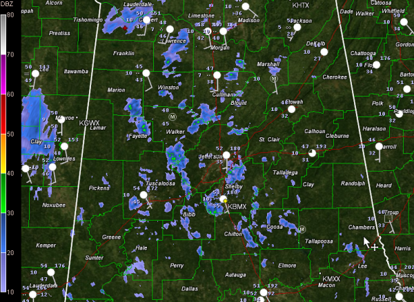
Scattered light rain showers are occurring across mainly the northwestern third of Alabama this evening, generally northwest of a line from Butler to Rockford to Huntsviile.
They are moving east northeast at about 40 mph.
The showers are in response to a moist airmass that is being lifted as it moves from west southwest to east northeast in the flow over the Deep South. The atmosphere has been too dry for much of the day for more than sprinkles to reach the ground, but that is beginning to change.
Light rain was being reported at Hamilton and Huntsvlle. Light drizzle was falling at Cullman. Light rain has been reported within the hour at Tuscaloosa.
Temperatures were in the 50s south of US-78, with 40s over the northwestern, northern and eastern sections of the state. A few breaks in the clouds allowed readings at Anniston to fall back to 45F.
Highs today included 55F at Birmingham and Anniston, 56F at Calera and 57F at Tuscaloosa.
Lows tonight will fall back into the lower 40s in the east and north and upper 40s elsewhere.
We continue to headline a significant threat of severe weather across Alabama for Christmas Day as a rapidly strengthening low pressure system passes just to our northwest tomorrow night. Damaging winds and tornadoes look to be a good possibility, so please dust off those severe weather safety plans and pay close attention to the weather, especially Tuesday afternoon and Tuesday night.
We also want to point out that a significant winter storm will develop Christmas Day across Oklahoma and spread east and northeast across much of Arkansas, southeastern Missouri then into Illinois and Indiana. Winter storm watches are posted for these areas. Significant snowfall accumulations are expected in this region, which will cause travel problems for folks trying to return home.
Amounts in the winter storm watch areas will generally be 2-6 inches, with locally higher amounts over the Ozarks of Arkansas and Missouri.
Lesser accumulations will occur from western Kentucky back through western Tennessee, southern Arkansas and northeastern Texas. Light snow accumulations (generally one inch or less are expected in western Tennessee and northern Mississippi.
Leftover rain will change to a few snowflakes Wednesday morning over the Tnessee Valley of North Alabama as well, but no accumulations are expected. Central Alabama shouldn’t see any snowflakes. Darn!
Category: Alabama's Weather, Severe Weather
About the Author (Author Profile)
Bill Murray is the President of The Weather Factory. He is the site's official weather historian and a weekend forecaster. He also anchors the site's severe weather coverage. Bill Murray is the proud holder of National Weather Association Digital Seal #0001 @wxhistorianSubscribe
If you enjoyed this article, subscribe to receive more just like it.


