

Rain Continues this Afternoon
You will be hard-pressed to find a dry spot across the state today. Rain moved into Central Alabama this morning and it has stuck around all day. It will last several more hours as an area of low pressure off to our south continues to send moisture northward.
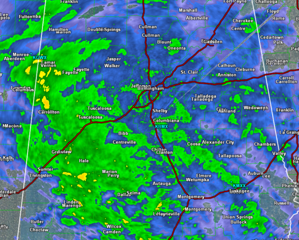
A look at the radar out of Birmingham for Central Alabama, there is rain everywhere. Heaviest rain currently is affecting portions of West Alabama along the Highway 82 corridor from Pickens County down to Montgomery County. Heavier rain is also falling across Lamar, Fayette, Marengo, Hale, and Perry Counties as well.
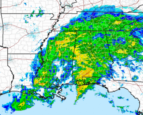
As we expand the radar view for the entire region, rain continues to be the main story. All of Alabama will continue to see a soaking rain and rainfall totals will range from one half inch to an inch northwest of Interstate 59, while location south of 59 will see one to two inches. There will also be some heavier rain bands that develop and will produce heavier amounts of rain in some areas. I would not be surprised to see a few locations receiving in excess of 3 inches before this system moves out of the state overnight.
The rain will last into the overnight hours, but should begin to taper off by Sunday morning. The rain still extends to the west along the Mississippi River. The back edge of the rain is slowly creeping east and will make it into Alabama late tonight.
Category: Alabama's Weather
About the Author (Author Profile)
Macon, Georgia Television Chief Meteorologist, Birmingham native, and long time Contributor on AlabamaWX. Stormchaser. I did not choose Weather, it chose Me. College Football Fanatic. @Ryan_StinnetSubscribe
If you enjoyed this article, subscribe to receive more just like it.


