

Winter Weather Update
The weather continues to be a serious problem for many locations across Central Alabama. A lot to talk about so lets get straight to it. Current radar continues to show the back edge of the snow just north of the Interstate 59 corridor. It continues to ever so slowly creep towards the southeast.
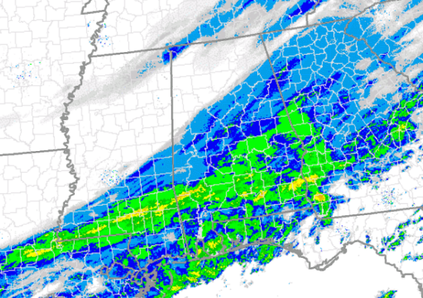
North and west of this line, the weather is not half bad. The snow has ended, and it just remains very cold. Areas around Fayette, Jasper, Hamilton, and Cullman are finished with a majority of the snow for today. There could still be a few flurries, but no additional accumulations expected.
South and east of the snow’s edge, snow continues to fall and will do so through the afternoon. It will continue to make a mess of things. A few inches of snow will be possible. The main snow area will continue to move east today and we should begin to see a majority of the snow begin to taper off later this evening.
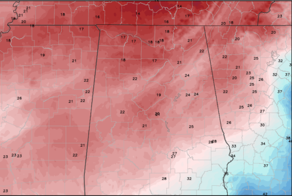
Temps are hovering in the upper teens and lower 20s across Central Alabama, and that means the snow that has fallen is not going anywhere. The snow is accumulating on any and all surfaces. That means the roads will continue to be treacherous, but many of them are not impassable. Take it very slow, and expect a very long commute. If you are at a place where it is warm, please stay there. There is complete gridlock on all roadways.
Category: Alabama's Weather, Winter Weather
About the Author (Author Profile)
Macon, Georgia Television Chief Meteorologist, Birmingham native, and long time Contributor on AlabamaWX. Stormchaser. I did not choose Weather, it chose Me. College Football Fanatic. @Ryan_StinnetSubscribe
If you enjoyed this article, subscribe to receive more just like it.


