

Warm-Up Continues For Alabama
An all new edition of the ABC 33/40 Weather Xtreme video is available in the player on the right sidebar of the blog. You can subscribe to the Weather Xtreme video on iTunes by clicking here.
LET THE WARM-UP BEGIN: Temperatures are in the 40s across Alabama this afternoon under a deep blue sky. Road conditions have improved greatly, but some icy spots remain on side roads in shaded areas.
TONIGHT: Cold, but not as cold as last night. The models are suggesting a low in the low 20s, but clearly the colder places will reach the teens. The valleys in Northeast Alabama might even make a run for the single digits. The sky will remain clear, and the wind light.
INTO THE 50s TOMORROW: We will project a high in the low 50s tomorrow with a partly sunny sky.
THE WEEKEND: Looks like any showers Saturday will be pretty widely spaced, otherwise the day will be mostly cloudy with a high between 55 and 60 degrees. Showers are more likely Sunday ahead of a cold front. Rain amounts of around 1/2 inch look likely Sunday.
TO THE NORTH: Global models hint at some precipitation in the colder air over parts of Tennessee, and the 12Z ECMWF (European model) tries to put a little snow down up that way Sunday night.
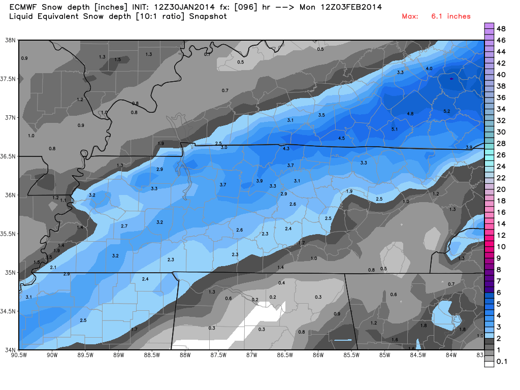
We do NOT expect snow in North-Central Alabama Sunday night; there is no global model solution that supports that idea.
NEXT WEEK: A touch of light rain is not out of the question Monday with a high in the 50s. Southerly winds increase Tuesday ahead of a robust storm system over the Southern Plains with temperatures rising into the mid 60s, and we will have a good chance of showers and storms by Tuesday night into Wednesday morning. A strong storm is not out of the question, but for now the severe weather parameters look very marginal. Colder air moves back into Alabama Thursday, but nothing like the cold air we have now. Again, there is no evidence on any global model of significant snow for North-Central Alabama Wednesday night as the cold air moves in.
LONG RANGE: Rumors are also swirling about the snow shown on the European model for North Alabama on February 7, but long time blog readers understand that is nothing more than voodoo right now.
Take some time to watch the Weather Xtreme video for the maps, graphics, and details.
WEATHER BRAINS: Don’t forget you can listen to our weekly 90 minute netcast anytime on the web, or on iTunes. This is the show all about weather featuring many familiar voices, including our meteorologists here at ABC 33/40.
CONNECT: You can find me on all of the major social networks…
Facebook
Twitter
Google Plus
Instagram
Look for the next Weather Xtreme video here by 7:00 a.m. tomorrow….
Category: Alabama's Weather
About the Author (Author Profile)
James Spann is one of the most recognized and trusted television meteorologists in the industry. He holds the AMS CCM designation and television seals from the AMS and NWA. He is a past winner of the Broadcast Meteorologist of the Year from both professional organizations.Subscribe
If you enjoyed this article, subscribe to receive more just like it.


