

Heading through the Overnight
It has been a terrific day of weather across much of the state as many areas saw more sunshine than clouds. We have also had southerly flow increase and that is bringing in a new air mass across the state. Most locations were able to climb well into the 60s today, with even some 70s across southern portions of the state.
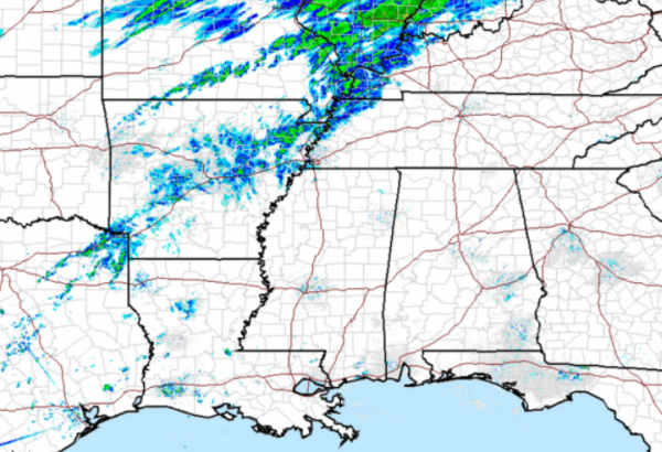
All of Alabama remained dry today and we should remain dry heading into the overnight hours, with only an isolated shower or two across the northwestern portions of the state. After midnight we should begin to see some showers trying to work their way into the state from the northwest. We will watching the radar to our northwest as a cold front in the Mississippi River Valley will be diving southeastward tomorrow. It will bring showers and perhaps a few thunderstorms for Sunday.
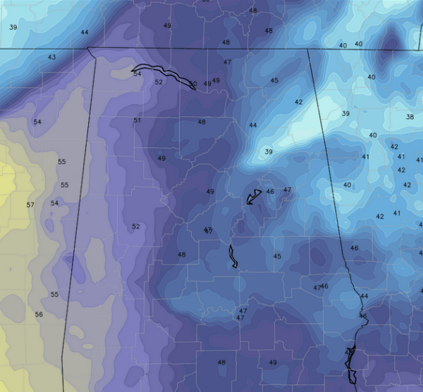
Through the overnight hours our temperatures will not drop much. As we look at the forecast model output for 6AM in the morning, we will see a range in temperatures from 50s across western and southern portions of the state, 40s along the Interstate 65 corridor, and even some 30s creeping into portions of East Alabama. These are a far cry from the single digits we had earlier this week.
Category: Alabama's Weather
About the Author (Author Profile)
Macon, Georgia Television Chief Meteorologist, Birmingham native, and long time Contributor on AlabamaWX. Stormchaser. I did not choose Weather, it chose Me. College Football Fanatic. @Ryan_StinnetSubscribe
If you enjoyed this article, subscribe to receive more just like it.


