

Midday Update
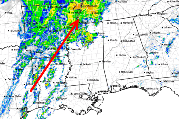
Showers and a few thunderstorms continue off to our west. The individual cells are lifting northeast as the whole system slowly shifts east today. We are starting to see a few showers enter into northwestern Alabama in Lamar and Marion Counties, while the rest of the state remains cloudy, misty and cool.
We are seeing southerly flow develop over the state and that will continue to allow is to warm-up and will bring in a lot of moisture. As we head into the afternoon hours we will see showers develop over the area and also see all activity to our west move into the state. This evening and overnight will be very wet and there will be a few thunderstorms as the system moves through. Some storms could produce gusty winds and heavy rainfall, but at this time severe weather is not expected.
This system will be very similar to the system we had Sunday night. Expect a soaking rain across much of Central Alabama overnight and we should begin to dry out by late morning tomorrow.
Category: Alabama's Weather
About the Author (Author Profile)
Macon, Georgia Television Chief Meteorologist, Birmingham native, and long time Contributor on AlabamaWX. Stormchaser. I did not choose Weather, it chose Me. College Football Fanatic. @Ryan_StinnetSubscribe
If you enjoyed this article, subscribe to receive more just like it.


